Thursday, November 17, 2016

If this is Thursday it must be postcards, 273


The Sunken Gardens, Butchart Gardens, Victoria, B.C., Canada, ca 1971

In 1904 Robert Pim Butchart and his wife, Jennie moved from eastern Canada to western Canada where they settled on Vancouver Island.  Mr. Butchart manufactured Portland cement using the rich limestone deposits he found in his quarry on Tod Inlet on the island.  By 1909 the limestone quarry was no longer producing and Jennie decided to turn it into a sunken garden.  She saw potential in ordinary work objects and used the mine carts as planter boxes.   The Sunken Garden was completed in 1921 and they began receiving visitors to their gardens about the same time.  About this same time the Butcharts named their home “Benvenuto” or Welcome.  Approximately one million people visit the gardens each year.

As the postcard, one of a set of 12 cards, above shows the Sunken Garden.  Her beautification efforts were very successful.  The cards were published as a "postcard pack" by DAD-SON Trading Ltd., Vancouver, B.C. and printed in the United States.  The number on the reverse of this card is found at the lower center, ICS-106369.  Mrs. Butchart didn’t stop with a sunken garden, however, and moved on expanding the gardens to include different themes in the various sections.  In among the plants and pathways visitors also find streams, fountains, statues, a vintage carousel, birds and birdhouses.  There are also places to eat, a gift shop, an information center, and a conservatory with windows that open to allow visitors to see orchids and other more tropical plants in bloom.  The gardens have continued to remain in the family and are now owned by a great grand daughter.  These gardens are a National Historic Site of Canada.  


We visited the gardens recently and were amazed at how large and beautiful they are.  Even at this time of year when many flowers are through blooming for the season the gardens have been arranged and planted with things that bloom throughout the year.  In the autumn there are mostly asters, begonias, chrysanthemums, a few roses, cyclamen, dahlias, hydrangeas and several others things we could not identify.  The gardens are lit at night and during July and August there are fireworks displays on weekends.  During the Christmas season the gardens are decorated with colored lights.  Perhaps these photos below will be a temptation to visit?


Originally part of the Butchart's home this building now houses the conservatory, eating places, an art gallery, and an information center.  


We never did find out what some of the flowers were including these large yellow hanging blossoms Bob is examining above or the blue and white ones below.


 Begonias in hanging baskets


Two-toned Hydrangea


Bed of Begonias


 Two views looking down into the Sunken Gardens, 2016


Zinias


 The Ross Fountain developed for the 60th anniversary of the gardens


The Rose Carousel and Children's Pavilion


 Dragon fountain


Rose


Dahlias


 Star Pond


 Italian Garden


Border plants in the Italian Garden


The Butchart Boar, Tacca, is a replica of a boar at the Straw Market in Florence, Italy. 


The entrance/exit gates with flags from around the world


For additional information, see:


https://en.wikipedia.org/wiki/Butchart_Gardens
"The Butchart Gardens" published by the Butchart Gardens, 2015

Sunday, November 13, 2016

Dock Butte & Blue Lake


 Mt. Baker and Black Buttes


One of the places we had not been on a hike was the Blue Lake Trail that also goes to Dock Butte.  This trail is located near Mt. Baker and has beautiful views of the mountain, Black Buttes, Glacier Peak, Mt. Shuksan, and the Twin Sisters Range.  Toward the beginning of the trail it separates with one section going to Blue Lake and the longer route heading up to Dock Butte.  The drive was far enough from home to encourage us to hike to both so we did Dock Butte first and then on the way down took the trail to the lake.  The round trip was 4.7 miles with a 1200-foot vertical gain.  


 A closer view of Black Buttes, an old giant volcano crater on the west side of Mt. Baker.  It blew out the side similar to Mt. St. Helen's.  It was believed to have been higher than the current Mt. Baker.
 

Mt. Shuksan


 Twin Sisters


 Glacier Peak


Picket Range

We did this hike in mid-September when there was a little autumn color and a few plants had berries such as the Mountain Ash, Twisted Stalk, and Elder Berry.  The trail to Dock Butte is quite steep with the very last portion a hand and foot scramble that we decided not try.  Instead we had our lunch at the false summit and enjoyed the views.  We were very glad we took the effort to visit Blue Lake also as it is a beautiful small mountain lake well worth seeing. 


Red Elder Berries


 Fall color


 Twisted Stalk berries


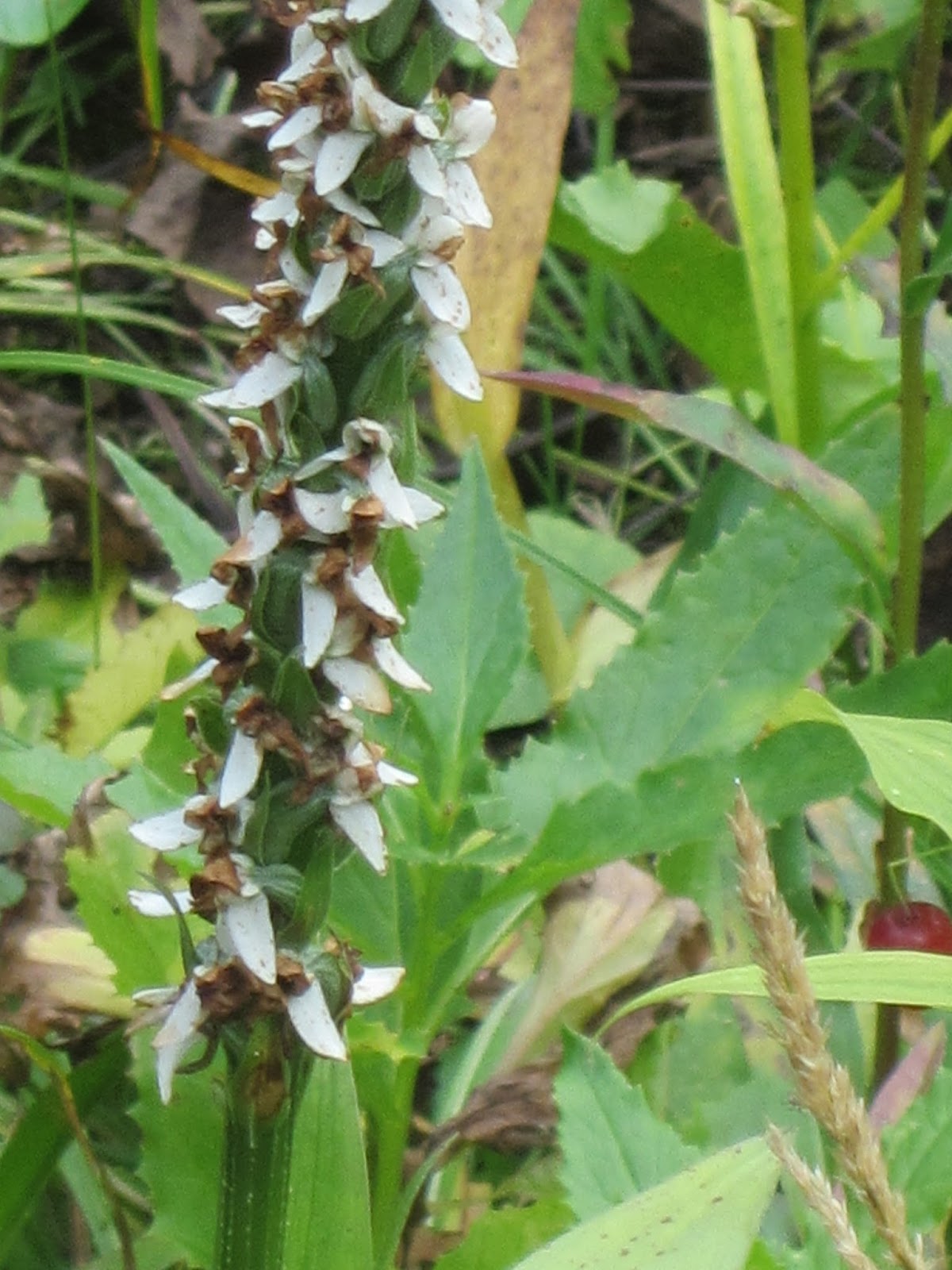
 Bog Orchid still in bloom


Mountain Ash berries


Fall colors 


 Small mountain tarn


Panoramas of Mt. Baker and the trail near where we stopped for lunch


Blue Lake

Thursday, November 10, 2016

If this is Thursday it must be postcards, 272


Castlebay, Isle of Barra, Scotland

The picture on this travel postcard shows Castlebay, the main village on Isle Barra one of the Outer Hebrides.  The card dates from approximately 1950s-1960s and has the number 6710 at the lower right front corner.  It is a “Hail Caledonia” product published by Whiteholme Ltd of Dundee, Scotland.   The latest population census lists the number of inhabitants as 1,174 with 761 or 62% Gaelic speakers.  Fishing and tourism are the main sources of income with a future Distillery planned.

The village takes it name from Kisimul Castle featured on the card below published and produced by the same company as the card above.  The number at the lower right is 6709. 


Kisimul Castle, Isle of Barra, Scotland

Considered more or less impregnable because the castle has its own fresh water wells and was built just off shore on a rocky islet that can only be reached by boat.   It has been the stronghold of the Clan MacNeil since the 11th century.  When the island was sold in 1838 the castle was abandoned and left to deteriorate.  Some of the stones were used as ballast for fishing boats and some ended up as paving in Glasgow.  Almost one hundred years later in 1937 the then clan chief, Robert Lister MacNeil who made some restorations, purchased the castle and most of the island of Barra.  In 2001 the Clan leased the castle to Historic Scotland for 1000 years for the annual sum of £1 and a bottle of whiskey.  There is an ongoing archaeological investigation of the castle to help determine the age of the castle and to see if anything else had been built there earlier.  Several items such as rubble and shells, pottery and animal bones have been unearthed thus far.  A small gold object in almost mint condition was also found and is currently being looked at by specialists to determine its age and purpose.


Thanks to J and K for sharing these two cards.

For additional information, see:

https://en.wikipedia.org/wiki/Kisimul_Castle
https://en.wikipedia.org/wiki/Barra

Friday, November 4, 2016

Hurricane Hill


Parking area and visitor center


Sign pointing the way

On the return trip from Victoria, B.C., Canada in September we stopped on the Olympic Peninsula and took a hike at Hurricane Hill.  I had never been here before and it had been several years since Bob had done this one.  This is a very popular area with convenient parking.  The trail is wider than some in the woods and most of it is paved, wheel chair friendly, although it would be a lot of work to roll or push up parts of it.  On the way down we did meet a young man in a wheel chair who was propelling himself but also had a friend with him to help where necessary.


The day was sunny with fluffy clouds and cool enough to be a great day for hiking.  We saw deer, chipmunks, birds, butterflies, and a few flowers still in bloom.  


 Blue Bell of Scotland also known as Harebell


 Pearly Everlasting


Lots of people hiking on this nice wide open trail


 View along the way


 Autumn colors down below


 There it is not too far ahead, the summit


 We made it to the top!  Thanks to a couple we met from Arlington, Virginia we have this photo to prove it.  Turn about was fair play and we took pictures of them too.  We have met many nice people on hikes (and even some nice dogs--but no dogs are allowed on trails at this park). 


We found the marker at the top


Port Angeles is below in the center, Victoria, B.C. is across the water


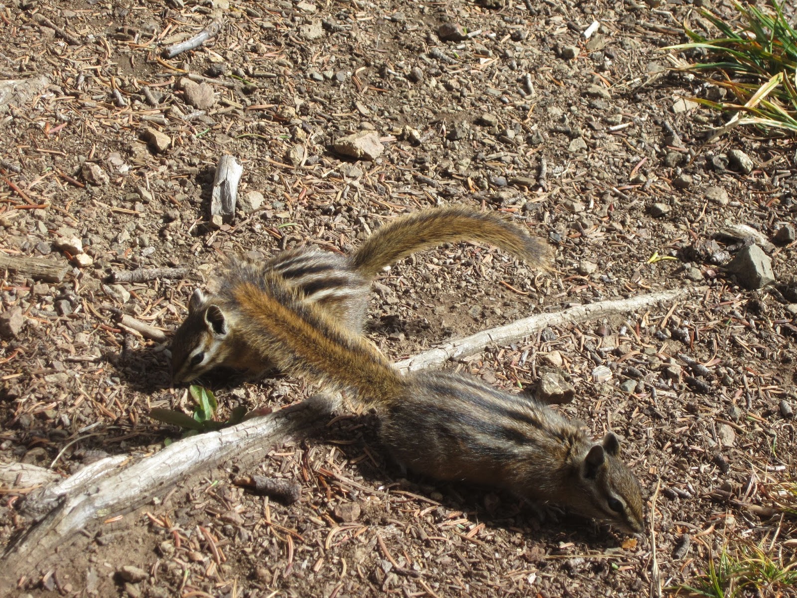
There were lots of these little guys foraging for food


and finding something to eat


Butterfly in the grass


 Gray Jay posing on the sign


 There were several deer also finding things to eat.  They seemed almost oblivious to hikers and would cross the trail right in front of people.


Another beautiful day outdoors . . .

Thursday, November 3, 2016

If this is Thursday it must be postcards, 271


Painted Hills, John Day Fossil Beds National Monument, Oregon

Are these the Merry-Go-Round Mountains from L. Frank Baum’s Land of Oz books?  No, although I thought of those imaginary mountains as soon as I saw the Painted Hills on this postcard published by Discover Your Northwest, John Day Fossil Beds National Monument, Kimberly, Oregon.  The card has the alphanumeric code JODANM-P017-DYNW2013 but no photography credits.

Ancient soils called Paleosols that were built up from volcanic ash coupled with the climate through the ages have produced the bands of color on these hills.  The Painted Hills cover 3,132 acres of the John Day Fossil Beds National Monument and represent one of three units in the monument.  The black bands are lignite a soil made up of vegetative matter that grew along the floodplain.  Siltstone, mudstone and shale make the grey colors.  The red bands are laterite soil from deposits in the floodplain when the climate was warm and humid.  


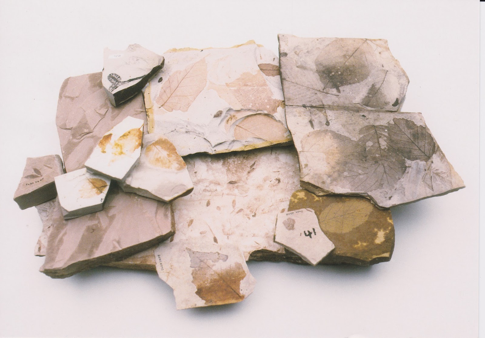
Lake deposit fossils of plant material

This second postcard shows lake deposit fossils of plant material from the John Day area from about 33 million years ago.  It was published by the Northwest Interpretive Association and has the alphanumeric code JODANM-P009-NWI2006 with photo credit to Natural Light Photography.
 
The fossils found here are not dinosaurs but mammals such as early horses, camels and rhinoceroses and plants.   Fossils were discovered here in 1864 when a company of soldiers was sent to protect mining camps from raids by Northern Paiutes.  Samples were given to Thomas Condon, a missionary and amateur geologist who recognized the scientific value and importance of the fossils.  He returned with the soldiers and he found rich fossil beds near Sheep Rock in 1865.  


 Thomas Condon Visitor Center

Even though the area and river are named for John Day who arrived in 1812 with a group heading overland to the Pacific Fur Company in Astoria, the new visitor center is named for Thomas Condon in recognition of his scientific contribution preserving the fossils.  The center opened in 2005 and has many exhibits and fossil samples well worth stopping to see.   Entrance to the park and the visitor center are free.  There are a number of trails, overlooks and picnic tables that are open year-round during daylight hours.  There are also restrooms, a bookstore, classroom, and drinking fountains in the visitor center.  Rangers give indoor and outdoor talks.  There is a short film and places to hike or take walking tours.  The Park Service has installed some solar panels to provide electricity not only for some of the buildings but also for an electric vehicle used by the Rangers and hopes to make the entire park carbon-neutral in the future.


 Above is an example of one of the displays in the visitor center where the artifacts are shown and an artist rendition of what it must have looked like at the time the animals lived there.


A window into the area where the work is done preserving the fossils for display

The area was named for John Day because of an incident that occurred and was retold enough times to become folklore.  He and a companion were robbed of all their belongings including their clothing as they traveled through the area and had to be rescued by trappers heading to Astoria.  Whenever people passed by the place where Day had been robbed the story was related and eventually what had been called the Mah-hah River was changed to the John Day River.  


John Day River

The visitor center is located approximately 20 miles east of the Painted Hills.  It was blazing hot the day we visited however we decided to walk up to the Painted Hills viewpoint to take a few pictures.  It is hard to describe and I don’t think the photos capture the intensity of the colors but it is truly an amazingly stunning and beautiful place.


Sheep Rock


Views of the Painted Hills


For additional information, see:

https://en.wikipedia.org/wiki/Painted_Hills
https://en.wikipedia.org/wiki/John_Day_Fossil_Beds_National_Monument