Showing posts with label waterfalls. Show all posts

Thursday, May 15, 2014

If this is Thursday it must be postcards, 142


 Multnomah Falls, Oregon

Here are a couple more postcards from the recent trip to the Columbia Gorge in Oregon.  We stopped at several waterfalls including the impressive Multnomah Falls featured on these cards.


Both cards are Impact photographics postcards designed in the United States and printed in Korea.  The photographers for the lower card are listed as Craig Tuttle, Steve Terrill and Virginia Swartzendruber.  The photographers for the upper card are Adam Jones/Donita Delmont, agent.   

The upper falls drop 542 feet and the lower falls come down 69 feet for a total of 621 feet making Multnomah Falls among the top waterfalls in the United States for distance down.  They are very impressive and the water noise is loud.  There is a trail up to the Benson Footbridge but it was closed due to a rock slide that occurred in January of this year and damaged the bridge walkway.  The bridge was named for Simon Benson who financed the construction in 1914.  Benson donated the land with most of Multnomah Falls and also gave Portland land that included another waterfall, Wahkeena Falls.  The year round source of the water for Multnomah Falls is underground springs from Larch Mountain, Spring runoff from the mountain snow pack and rainfall. 


The Oregon-Washington Railroad and Navigation Company donated the land at the foot of the falls with a stipulation that a lodge be built there.  The lodge was designed by A. E. Doyle and built in 1925 of local stone and today has an information center, restaurant, gift shop and a snack bar.  We did go into the gift shop where I purchased the cards but we did not go into the restaurant located on the upper floor of the lodge that is supposed to have spectacular views of the falls.  There is a viewing area just outside the building that also has wonderful views.  The falls are so long that it was difficult to get a good picture with my small camera but here above is one. The lodge itself has been entered in the National Register of Historic Places. 


There is a Native American story involving the falls called the “Princess Legend.”  The tale tells of a terrible sickness that threatened the Multnomah people.  An old medicine man told the people that the sickness would only leave if a maiden threw herself from a high cliff on the Big River to the rocks below.  When the daughter of the Chief saw that her lover had become ill with the disease she went to the cliff and jumped to her death.  The story continues by saying that today when the breeze blows through the water and a stream separates from the upper falls then the mist takes the form of the maiden in token of the Great Spirit’s acceptance of her sacrifice.

For more information see:
http://en.wikipedia.org/wiki/Multnomah_Falls

Wednesday, May 14, 2014

West Fork Foss River -- Trout Lake


What a difference a few miles can make.  The trail to Trout Lake along the West Fork of the Foss River, near Stevens Pass, Washington in the Alpine Lakes Area was nothing like the East Fork Foss River Trail.  


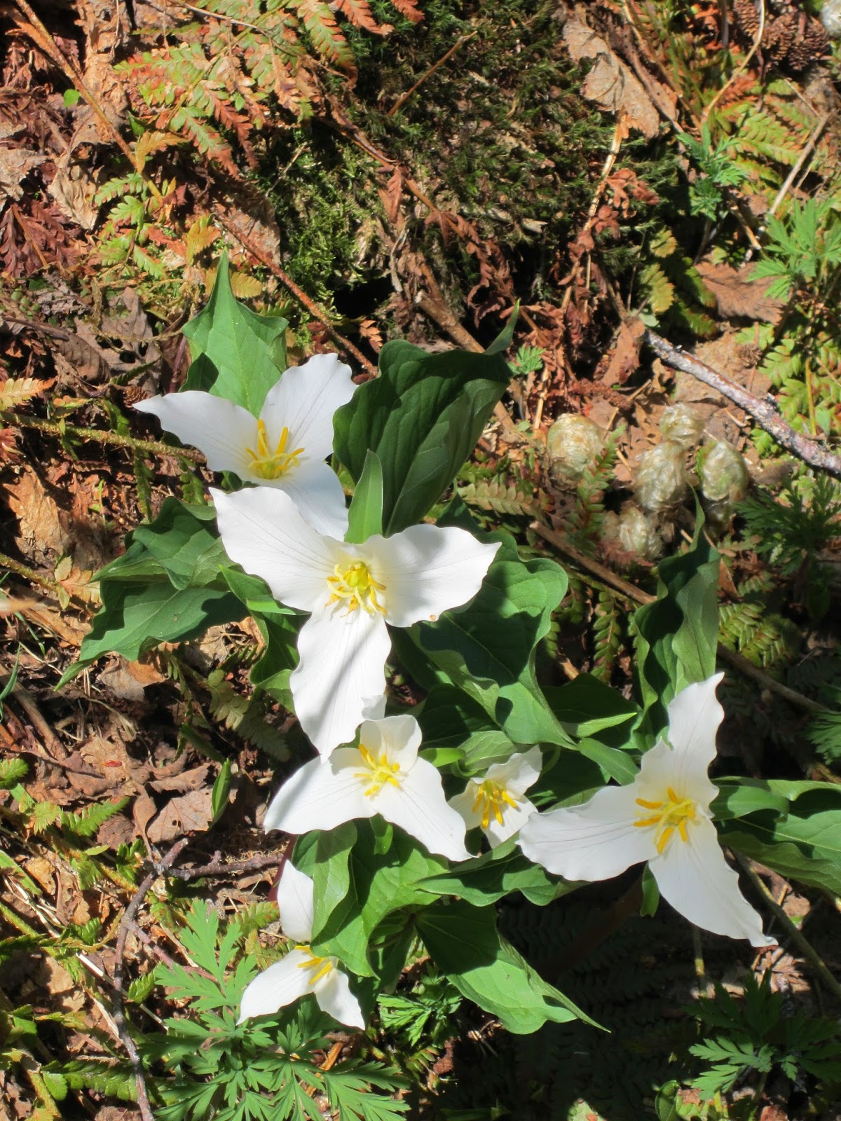
Even though it was a warm, sunny day there were still a few small patches of snow and not nearly as many wildflowers blooming yet however we saw hundreds of Trilliums again, yellow stream violets, Coltsfoot, and Bleeding Heart but not much else.  No Calypso orchids at all.  The trail composition is entirely different also.  This trail was rocky composed of small gravel to fairly large stones that made walking more challenging.  As the photo above shows it was more open terrain with less undergrowth between the trees.  The elevation gain was approximately the same; about 500 feet, starting at 1600 feet and ending at 2100 feet, with the first section of the trail relatively level then a steep incline going up to Trout Lake.  It is classified as an easy hike with a round trip distance of 3 miles. 


We noticed this long waterfall on the hillside some distance away and zoomed in for photo.


There were a few trees down and one very large tree that had fallen directly across the trail so we had to climb around it.  The space beneath was not big enough to crawl under and the log was too large to try and climb over.  Fortunately others had done the same thing so there were footholds on one side of the bank.  I think we were too busy trying to navigate our way around it to remember to take a photo.  At another spot we looked up to see where more than one avalanche had started and come down bringing rocks and trees with it along with the snow.


This extremely large tree Bob is standing next to must be ancient.  There are not many old growth trees like this one anymore. We estimated that the tree is about 10 to 12 feet in diameter and about 200 feet tall.

While the East Fork trail had probably 10 or 11 streams to cross the West Fork trail only had two wide but shallow ones to walk through and one new bridge over the main river.  At one of the shallow water crossings we saw a little brown spotted frog that we tentatively identified as a Pacific Treefrog.  The frog was so well camouflaged it was hard to see. 
We also saw a chipmunk and several different butterflies.


Can you find the frog?

Trout Lake is like a picture book mountain tarn.  As we sat on a log to have our lunch it was so quiet we could hear birdcalls, rushing water, even the wind blowing on the water made little sounds as it rippled.  We only saw two other people all day. 


Trout Lake


Large groupings of Trilliums were common along this trail.


Narrow but non-scary new bridge


Views of the river from the bridge


Mourning Cloak butterfly

Saturday, April 12, 2014

Wallace Falls


Wallace Falls

Even though we have taken a few hikes since January most of the outdoor activities have been skiing instead of hiking until now.  This week we went to Wallace Falls State Park near Gold Bar, Washington.  Bob classifies this as an “easy” hike but the signs and the books say “moderate” difficulty.  The round trip was about 5.2 miles with approximately 800 feet elevation gain.   We saw the Small Falls, the Lower Falls, and the Middle Falls, but did not climb up to the top of the Upper Falls.  The long waterfall cascades down in three sections with the upper falls dropping about 265 feet and can be seen from the valley below. 


Small Falls


 Lower Falls


View from Middle Falls

It would have been another climb of 500 feet up and about ¼ mile distance to reach the top.  Then we would have been looking down on the falls although Bob told me that there is still another set of waterfalls up higher that cannot be seen until one gets to the Upper Falls.  As it turns out most people stop at the Middle Falls viewing area with only a few going all the rest of the way up to the Upper Falls.  There are viewing platforms along the trail and our original destination for the day was the picnic shelter at Lower Falls but it was a beautiful day and I was willing to try more so we were able to get to the Middle Falls.  The sound of the rushing water is loud and pleasant; every so often a light mist of spray wafts upward.  It makes the long falls quite pretty to look at with the clouds of mist.


 The trees were moss covered


Someone had built this small cairn along side the trail


 This odd looking tree growing out of another tree caught our eyes


There were a few wooden bridges crossing the river


 The river as seen from the bridge


One of several viewing platforms along the way

The three trail systems that wind through the forest are the Woody Trail, the old railroad grade, and the Greg Ball trail.  We went up the Woody Trail and returned via the old railroad grade trail, which was longer but less steep.  The railroad bed is open to mountain bikes but we only saw 3 bikers and one skateboarder.  

The trails are popular and there were lots of people due to the lovely weather and some schools being out for Spring Break.  There were families with small children, lots of people with dogs, and lots of teens and what looked like college students too. 


Black tailed deer on the Railroad Grade

Some wildflowers were just beginning to put forth buds and blooms.  As per usual we stopped frequently to take photos and rest so it took us longer than most to make the round trip.  We did see two black tailed deer and a few birds. 


 Skunk Cabbage


 Salmon Berry


 Yellow Wood or Stream Violets


 Trillium


Wild Strawberry

Friday, July 26, 2013

Paradise, Mt. Rainier National Park


Mt. Rainier from Reflection Lake

 Last week we went to the Sunrise side of Mt. Rainier National Park, the weather did stay nice so this week we went to the Paradise side.  The picture above was taken at Reflection Lake.  There were small fish in the lake that we later identified as Brook Trout.    There were almost no clouds in the sky and it was bright sunshine.  The temperature got to 86℉ and was really too hot for strenuous hiking. 

First we stopped at waterfalls along the way.

Christine Falls


Narada Falls

If one is lucky and happens upon Narada Falls (see the Thursday postcard, #52 from 16 August 2012) like we did this day, at the right time with the right amount of sunlight the water acts like a prism and forms a rainbow. 


Sunshine Creek Falls


Lower Myrtle Falls
There was still snow at this waterfall.  The stream flowed under the snow and ice and reappeared some distance below.


Unnamed falls by small bridge

We stopped at a little bridge and walked down a bit to see these beautiful falls.  There was a series of falls above and below this point and a trail that led down but we just stopped to enjoy this one.  A small snow bank offered a chance to do a balancing act.


Our main hike of the day was supposed to be to Bench Lake and Snow Lake for a total of about 2.5 to 3 miles round trip.  We did make it to Bench Lake but the combination of heat, up and down steps, and thousands of pesky bugs proved to be too much to go the entire distance to Snow Lake.  I think I had a sign pinned to me that said “Dinner” just for bugs.  One other lady hiker who passed us said she thought her sign said “Blood Bank.”  Bob and I were each using a natural bug repellent and not Deet (a poison).  Mine was a liquid roll-on his was a lotion.  His seemed to work a bit better than mine so I will try it next time. 


Bench Lake
This trail has a sandy surface and is fairly easy to walk on but there are lots of the stairs and I find them difficult and tiring.  They look nice and give the illusion of being helpful to the hiker but in reality they are very hard on the knees and upper legs.  Trekking poles are necessary especially on the down stairs. 

We saw lots and lots of wildflowers, some we had not seen before, and a variety of wildlife.  The bear we saw was too far away for a picture but clearly recognizable as bear.  We also saw deer, elk, a Douglas squirrel—red not gray, birds, fish and a marmot. 


Avalanche lilies, 1

Avalanche lilies, 2
We were excited to see a couple of Avalanche lilies then happened upon an entire hillside covered in hundred of them.   They are another of the flowers that appear shortly after the snow melts.


Tiger lily
Pink Monkey flower
Baneberry

Cow Parsnip, 1

Cow Parsnip, 2

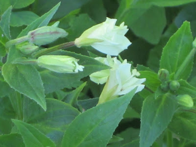
Broadleaf Montia, buds

Broadleaf Montia, open flower 

Shooting stars
Hummingbird and Fireweed
Just as I was taking a photo of the Fireweed a hummingbird zoomed in for a taste of nectar and the result was this photo.  

Rosy Spirea


Daisy – Heartleaf Arnica


Bog Orchid


Pearly Everlasting


Thimbleberry


Dinner at the Longmire lodge completed the day, or so I thought.  As we drove away the setting sun caught the mountain and it turned pink.  Looking back at Mt. Rainier from Elbe, Washngton most of the pink had faded but this was the first good stopping place after leaving the park.