Friday, August 31, 2018

Chain Lakes, Mt. Baker Wilderness, 2018


Mt. Shuksan over Picture Lake

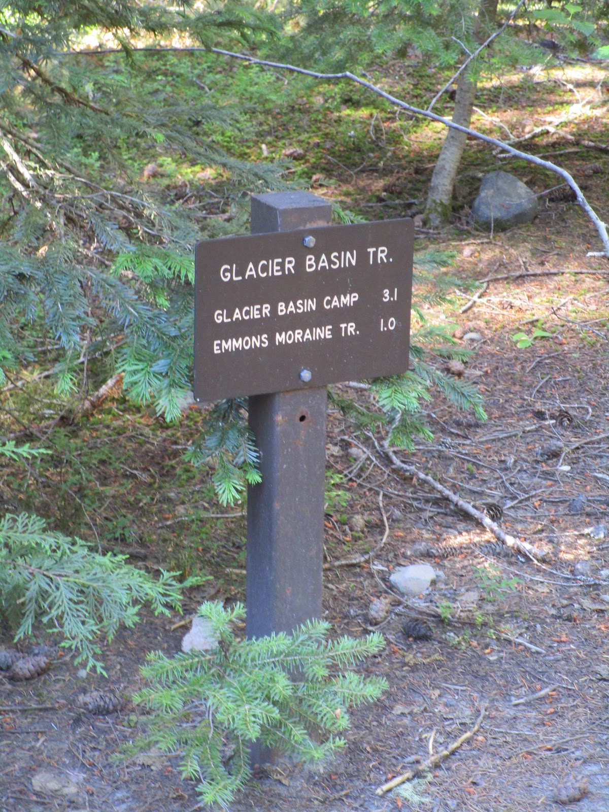
This week we joined with 10 of our friends in the Happy Hikers group and went to the Mt. Baker Wilderness.  We met at the upper parking area at Artist Point and divided into groups to hike different routes.   After taking one car to the lower parking area, one group did the Chain Lakes loop ending at the lower parking area which is about a 7 mile hike, 3 people chose to go to Ptarmigan Ridge, about a 7 to 9 mile hike, and Bob and I did a round trip of 5 miles on the Chain Lakes trail.  The third trail that takes off from this upper parking area is to Table Mountain.  Below the lower lot is another trail to Lake Ann and still further down a trail to the Galena Lakes.  There were several snow patches but the Chain Lakes trail was clear; however, the Ptarmigan Ridge group encountered snow on the trail that had to be crossed.


Lake Mazama and a smaller pond


 Ice Berg Lake with sparkling water and snow patches on the hillsides


Lake Hayes


There are fish, probably trout, in all of these lakes and we met several folks with poles and gear.  One girl, about 12 years old, told us she had caught two fish in Lake Hayes but released them since they were small.  

The elevation gain was about 600 feet for us but most of that was on the return trip when feet and legs were getting a bit tired.  There is not much cover or trees on this trail and the sun was out. Although I thought I had used enough sunscreen I had not gotten the back of my neck, hence sunburn was detected when we got home.  


Note the blue bag dispenser

There is a very nice newer outhouse at the Artist Point parking area.  At the trail sign there were blue plastic bags and instructions for packing out human waste with a note that there were no toilets on the trail.  Following the theory “if ye are prepared, ye need not fear,” we took blue bags just in case but Bob was pretty sure there was a backcountry toilet near at least one of the lakes.  Even though we didn’t need it, or the blue bags, we found a sign pointing to a toilet near Lake Hayes.  


This section was a rocky scree, slippery walking on loose rocks


Most of the trail was more like this, packed dirt

The Chain Lakes trail has a few long stretches of rocky scree.  At one point we heard some noise up above us on the hillside and glanced up in time to see rocks tumbling down.  We watched for a few seconds and then stepped back away when we realized we might get hit.  A man coming along behind us had also stopped and asked us if we had seen any goats as usually the falling rocks were caused by goats up above.  Even though all three of us looked we did not see any so we couldn’t tell if goats started the rock fall or not.  


A view of Mt. Baker from the trail

After several days of wildfire smoke drifting down from British Columbia, Canada it was really wonderful to have a day that had cleared out a bit.  There was still a little haze but not nearly as much.  The temperature was lower and the cool breezes kept us comfortable.   
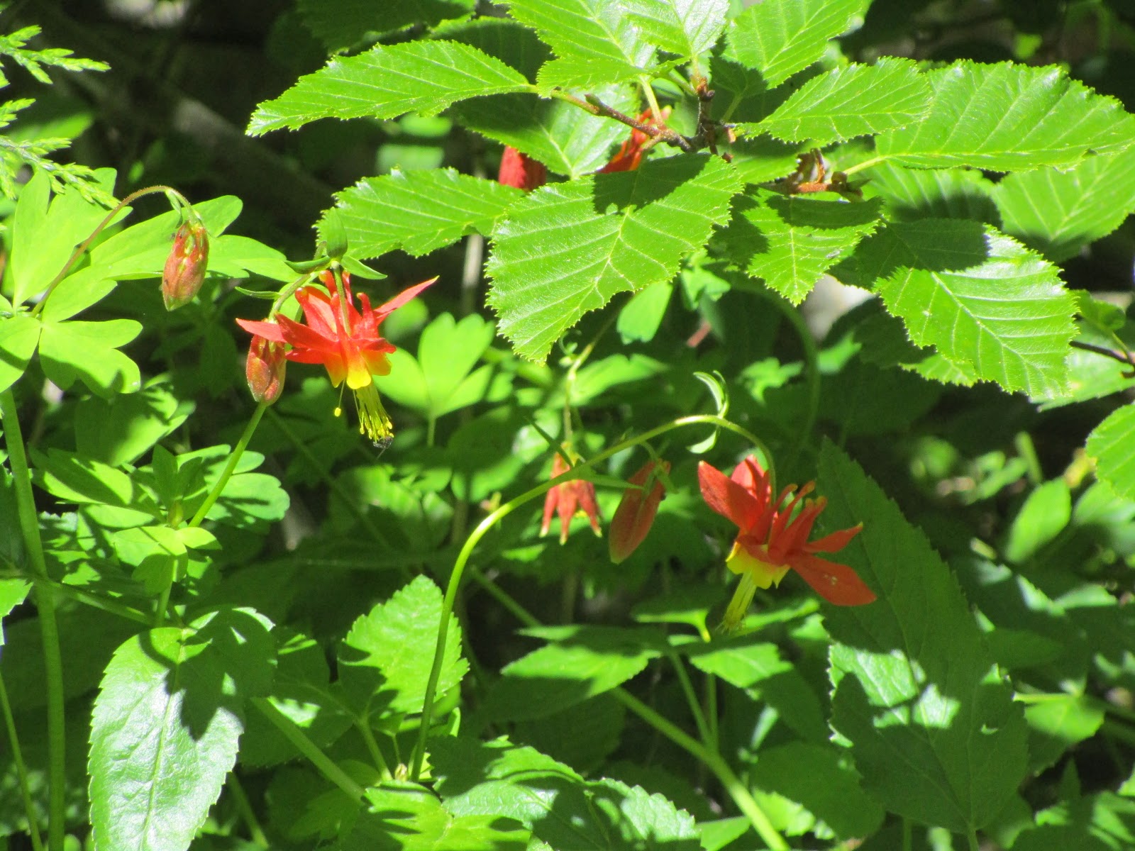


Monkey flower


 White paintbrush


Daisies


Hillside of fireweed


 Fireweed


Asters


 Spirea


 Partridge foot


Lupine


Ripe huckleberries


Mountain ash with berries


 Natural garden of monkey flowers, daisies and, I think, groundsel


Blue butterfly

There were tons of flowers and lots of ripe huckleberries!  That was a surprise and the bonus for the day.  By the end of the day my companion had blue lips and a purple tongue and maybe I did too.  An entire hillside of fireweed in one place and a vast meadow of lupine, monkey flowers and marsh marigolds growing all the way up the hill alongside little streamlets.  The lakes, Mazama, Ice Berg, and Hayes were jewels of blue green with sparkles from the sun and reflections of the surroundings.  We did not see any wild animals and only a few birds.  


Happy dog cooling off in the snow


This man had a Great Dane and a very small dog in tow

This is a popular area and even though it was a weekday we stopped counting people pretty quickly when it became apparent the daily total would be well over 100.  There were probably the most dogs on the trail to date and we stopped counting them as well but estimated the total at least 24 to 30.  All kinds of dogs from Great Danes to tiny little Chihuahuas and one funny golden lab who rolled around in the snow patches at every opportunity.


Two Happy Hikers, near Ice Berg Lake and a hillside of lupine

We met a woman at Ice Berg Lake and talked with her for a while, then she offered to take our picture.  She took 4 shots.  Bob used one in his trip report and it was suggested that I use a different one.  The one he used was perhaps a bit more flattering but this one is okay too.

Thursday, August 30, 2018

If this is Thursday it must be postcards, 366


The Alhambra, Granada, Spain
[photo:  Jesus Gomez]


An unused postcard with the photograph by Jesus Gomez, published and printed in Spain.  The number 1004 appears in the box designated for the stamp.  It came with several others from the trip my son and his wife took earlier this year to Portugal and Spain.  This aerial view card shows the sprawling complex mentioned in last week's postcard Thursday.

Although the name means “The Red One,” for the red clay the fort was made of, at one time the Alhambra was white washed and known as the “pearl set in emeralds” referring to the white walls surrounded by the lush green woods around it.  As mentioned in the previous postcard Thursday, the Alhambra is a sprawling complex of palaces, forts, and gardens completed during the end of Muslim rule of Spain by the Sultan of Granada, Muhammed V.  Originally it was a small fortress built around 889 AD on the remains of Roman fortifications.  It had gone to ruins and was rebuilt, enlarged, and improved by Yusuf I who ruled from 1333 to 1353.  He converted it into a royal palace and Mohammed V who was Sultan from 1353 to 1391 continued to add to it .  In 1492 following the Christian Reconquista the site became the Royal Court of Ferdinand and Isabella and is where Christopher Columbus received permission and endorsement for his expedition. 

The Alhambra fell into disrepair and was occupied by squatters for a period of time before being rediscovered following the defeat of Napoleon.  Today it is one of Spain’s major tourist attractions.  It contains significant and well-known Islamic architecture and later Christian gardens.  The Alhambra is recognized as an UNESCO Heritage Site. 

Famous for intricate and delicate carvings and geometric patterns there are also inscriptions on the walls.  Poems mostly by Ibn Zamrak praise the palace.  The ornamentation is found carved into stucco and also on tile mosaics.  The postcard below has a photograph by Miguela Gomez and shows a pattern in tile containing an inscription in Arabic.  


Mosaic tile patterns, Alhambra
[photo:  Miguela Gomez]

The palace/fort complex evolved over a period of several centuries.  Construction materials included granular aggregate held together by a medium of red clay providing a layered brick and stone exterior while the interior contains alabaster and white stuccowork.  There is a system of water conduits and water tanks that create an inter-play of light, sound and surface. 

For additional information, see:

https://en.wikipedia.org/wiki/Alhambra

Monday, August 27, 2018

Hoypus Point, 2018


Entry sign

Among the other hikes we have taken recently was one to a place we had not gone to before, Hoypus Point, a natural forest area within the Deception Pass State Park.  The Discover Pass is required.  It has a network of trails that wind in and out of the forest.  Located on the water the parking lot is large, has a boat ramp and a newer restroom with flush toilets and warm water in the sink.  There is a small marina there as well.  


Beginning of the trail system


View from the bench

The trail starts out as part of an old road, now closed to motorized traffic. The branch we took ended at a beach with a bench where we sat and enjoyed the water view for a few moments before getting back into the woods.  


 There are signs at each junction to mark the way

All the joining paths are well marked and Bob had printed out a map so we could choose which way we wanted to go.  We elected to do a modified 5-mile round trip loop but could have just as easily meandered around on several different branches before heading back to the parking area.


 Big trees


"Hurry, take the picture, I can't hold this thing up much longer."


Giant Horse tails made us feel like we were in a prehistoric forest

There are large trees, horse tails as tall or taller than a person, and a downed tree across the trail that Bob stood under looking like he was holding it up.  There were not many flowers and we did not take many pictures.  In one section the trail parallels a private road with waterfront homes; however, most of the trails are far away from homes and noise.  One section had a very steep rise that would have been nicer as switchbacks.  The total vertical gain was approximately 600 ft.  This rated easy on our new scale.  Except for the very steep hill, and that could be avoided by taking another branch of the trail system, this would work with young children.


The count:  8 hikers, 3 dogs. 

Thursday, August 23, 2018

If this is Thursday it must be postcards, 365


The Court of the Lions, Alhambra, Granada, Spain


This beautiful postcard of the Court of the Lions in the Alhambra, a Moorish citadel, in Granada, Spain was also among those in the packet sent by my son and his wife this summer when they were in visiting Portugal and Spain.  The Alhambra is a sprawling complex of palaces, gardens and forts.  The Court of the Lions is found in the main courtyard of the Nasrid dynasty Palace of the Lions.  The postcard was issued by GOMEZ, has the number 66 in the place for a stamp, but does not have an informational blurb or other publishing or printing information.

Commissioned by the Nasrid sultan Muhammad V of the Emirate of Granada in Al-Andalus (Andalusa), construction started around 1362 to 1391.  Today it is on the UNESCO World Heritage list and appears on a limited edition 2 Euro commemorative coin.  Identified as in the Nasrid style it reflects both Moorish and Christian influences.  The courtyard is 35 meters or about 115 feet long by 20 meters or almost 66 feet wide.  There are 124 white marble columns and filigree walls. 

The fountain dates from the 11th century and is believed to come from the house of the Jewish vizier Yusuf ibn Nagrela who died in 1066.  The twelve white marble lions surrounding the alabaster basin represent the twelve tribes of Israel, two with triangles on the forehead for the tribes of Judah and Levi.  The lions were removed in 2007 for restoration and replaced in 2012 after reconstruction of the water flow system.  It functions as a clock with water running out of the mouth of the appropriate lion depending on the time of day and into a channel in the floor.  The running water cools the courtyard as well as beautifies it.  A poem written in Arabic by poet and minister Ibn Zamrak was carved into the rim of the basin.

For additional information, see:

https://en.wikipedia.org/wiki/Court_of_the_Lions

Tuesday, August 21, 2018

Dege Peak, Glacier Basin & Sourdough Gap, 2018


Panorama view from Dege Peak

We have taken three great hikes in the Mt. Rainier area in July and August.  This has been a hot, dry summer requiring the selection of hiking days and places based on how comfortable we can hope to be.  For instance, we visited the air-conditioned Museum of Flight on one day that was simply too hot to consider hiking outdoors. 

We have been to Dege Peak three times now and both Glacier Basin and Sourdough Gap twice.  This year we tried for wildflowers and saw plenty.  The flowers at Glacier Basin and Sourdough Gap were different from each other but each took the prizes for the most splendid displays and varieties.  I’m grouping these three hikes together since they are all in the Mt. Rainier area and putting up just a selection of some of the best flowers, animals and a couple of scenic views.


Goats near Dege Peak getting cool in the snow and dirt


It was a little warmer than we like for hiking the day we went to Dege Peak and there were bugs so we got some bites but the views were beautiful and the flowers outstanding.  We saw mountain goats!  We have seen goats near Frozen Lake on the trails to Mt. Fremont and Burroughs but never on the Dege side before.  They were burrowing down in the snow or digging in the dirt to get cool.  The goats were still there after we had lunch at the top and were heading back to the parking area by the lodge.  That gave us the opportunity and pleasure of pointing them out to some folks who had never seen them before.  


Western Anemone or mophead in flower


Transitioning to mophead


 Mophead or seed stage of the Western Anemone


 Aster


 Magenta paintbrush


 False Hellebore or corn lily flower


Jacob's ladder


Yellow lousewort

We generally don’t count people at Mt. Rainier because there are so many it ends up being over 100.  The trails are in good condition and very popular.  There are no dogs allowed on the Dege Peak trail.  It is about 4 miles round trip with a 700 foot vertical gain with the last small section of the trail switch-backed and steep. There were lots of people but lots of space too.  We even had the top spot to ourselves for lunch before a group of six arrived and shortly after them another couple.  By then we were finished and ready to start back down.  Flowers included acres of mopheads, the seed stage of the western anemone, with a couple in flower that had not yet turned to mophead; phlox, asters, yellow lousewort, corn lilies, paintbrush and others.  The bonuses for the day besides the goats were Parnassus, Fritillary and White Pine butterflies.


Parnassus butterfly also called Mountain Apollo
[This is Bob's photo. The sun was so bright I couldn't tell what I was pointing at with the camera.  All I got was the rock!] 

  
 Fritillary butterfly


 White Pine butterfly


View from the trail on the way back to the parking area


The parking area at Chinook Pass has trails going south to Naches Loop or north to Sheep Lake and Sourdough Gap.  The day we hiked to Sourdough Gap via Sheep Lake it was cool and delightful.  I had my jacket on most of the day.  This is about a 7 mile round trip with a vertical gain of 1100 ft.  Not too many bugs and tons of flowers mostly corn lilies and asters with accents of larkspur, tiger lily, monkey flower, elephant head lousewort, paintbrush, fireweed, purple penstemon, spirea, pussytoes, beargrass, mopheads, yarrow and more. 


 Sheep Lake--Sourdough Gap is the V between the hills


We were above the clouds most of the day and walking through the clouds for the rest of the day.  This was taken from just below Sourdough Gap looking toward the invisible lake.


Fireweed along the trail

This trail is part of the Pacific Crest Trail (PCT) and we met 5 pairs of through hikers either coming from the south heading toward Canada or having started at the Canadian border and heading south toward Mexico.   We counted that day and ended up with 59 hikers and 2 dogs.  There are some camping spots near Sheep Lake and we saw at least one group that had set up a tent; however, there is no outhouse or backwoods toilet.  Bonuses for the day, grouse unseen by our feet that we flushed when we walked by, a marmot, and golden-mantled ground squirrels.  


Elephant head lousewort


Pink Wintergreen


 Pink pussypaws


Pink aster


 Orange paintbrush


 Tiger lilies


Larkspur


Harebells or Blue Bells of Scotland


Golden-mantled ground squirrel


Glacier Basin is a stretch for me at about 6.5 miles round trip and 1650 ft vertical gain.  There were bugs and we got bit.  Since I carry the “free lunch” sign for bugs, I have a bug shirt and always wear a long sleeved t-shirt and/or my Gortex jacket, plus use plenty of herbal bug spray.  It was warm but I didn’t dare uncover too much for fear of more insect bites.  It is such a beautiful place; even if was a lot of work to get there it was worth it.  


 Trail sign


 There was a little snow along the way but the trail was mostly clear


 Penstemon


 Monkey flower


 Columbine


Glacier lily


 Western Anemone


Glacier Basin


 One of several frogs in the small pond


Shooting stars 


Marsh marigolds


Bob has adjusted the Mountaineers difficulty scale to reflect our age and physical limitations so Glacier Basin and Sourdough Gap are both moderate hikes on our new scale.  Glacier Basin had vast arrays of penstemon and monkey flowers.  There were also columbine, shooting stars, sedum, marsh marigold, a few trillium still in bloom, western anemone in flower and glacier lilies.  Bonuses for the day were frogs and tadpoles in the small lake and a golden-mantled ground squirrel that posed for a picture.  We counted 44 mountain climbers heading for Camp Sherman on the north side of Mt. Rainier, and 24 hikers. No dogs allowed in the park.  There are camping spaces at Glacier Basin and also a backwoods toilet.