Thursday, November 30, 2023

Cougar Mountain Regional Park, 2023


Entrance sign to the Cougar Mountain Regional Park, Harvey Manning Trailhead


 We made two stops here.  The first stop was at the Anti-Aircraft Radar Park where there is a sign announcing a million dollar view.  There was lowland fog when we were there but we still could see Mt. Baker in the distance.


Fog bank with Mt. Baker


After admiring the view we got back in the car and headed over to the rest of the regional park area.


 Historical information about how the park came to be and a picture of Harvey Manning.


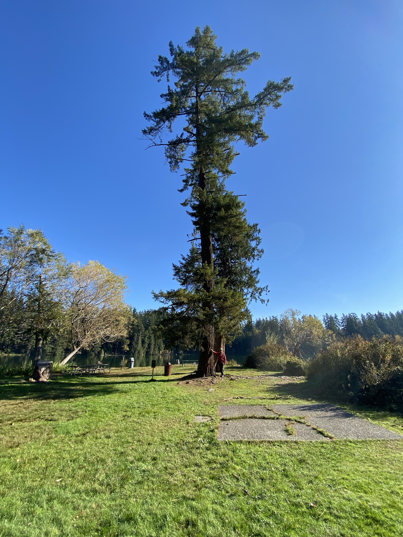
The Cougar Mountain Regional Park has many interconnecting trails.  We decided to do a short loop this time.  A person could probably spend more than one day just exploring all the different options.  This is an old coal mining area that still has underground tunnels.  This warning sign at the trailhead advises hikers to stay on the designated trails and not wander off them because of possible hidden mine openings or cave-ins.  


We saw one large mine opening that had a low wooden fence around it but did not go over close enough to see what was there, or take any pictures.  The trail surface is packed dirt and, at this time of year, fallen leaves.  There are a few tree roots but mostly this is an easy walking trail. 


These two photos show views of trail sections.  The wide mining road on the Red Town portion of the trail above and the narrower, steeper, Wildside trail we took to make a loop back to the trailhead, below.


All the various trails have names and numbers, there are signs pointing the way to go depending on which trail you want to try.  We started out on the Red Town trail and switched over to the Wildside trail to make an approximately 2-mile loop.  We did not take trekking poles, but could have maybe used them on a couple of steep down hills on the Wildside trail.  There are port-a-potties at the trailhead.  The elevation here is about 1500 feet.  The sky was blue with bright sun, crispy and cold, in the 30s F, with frost in places. 
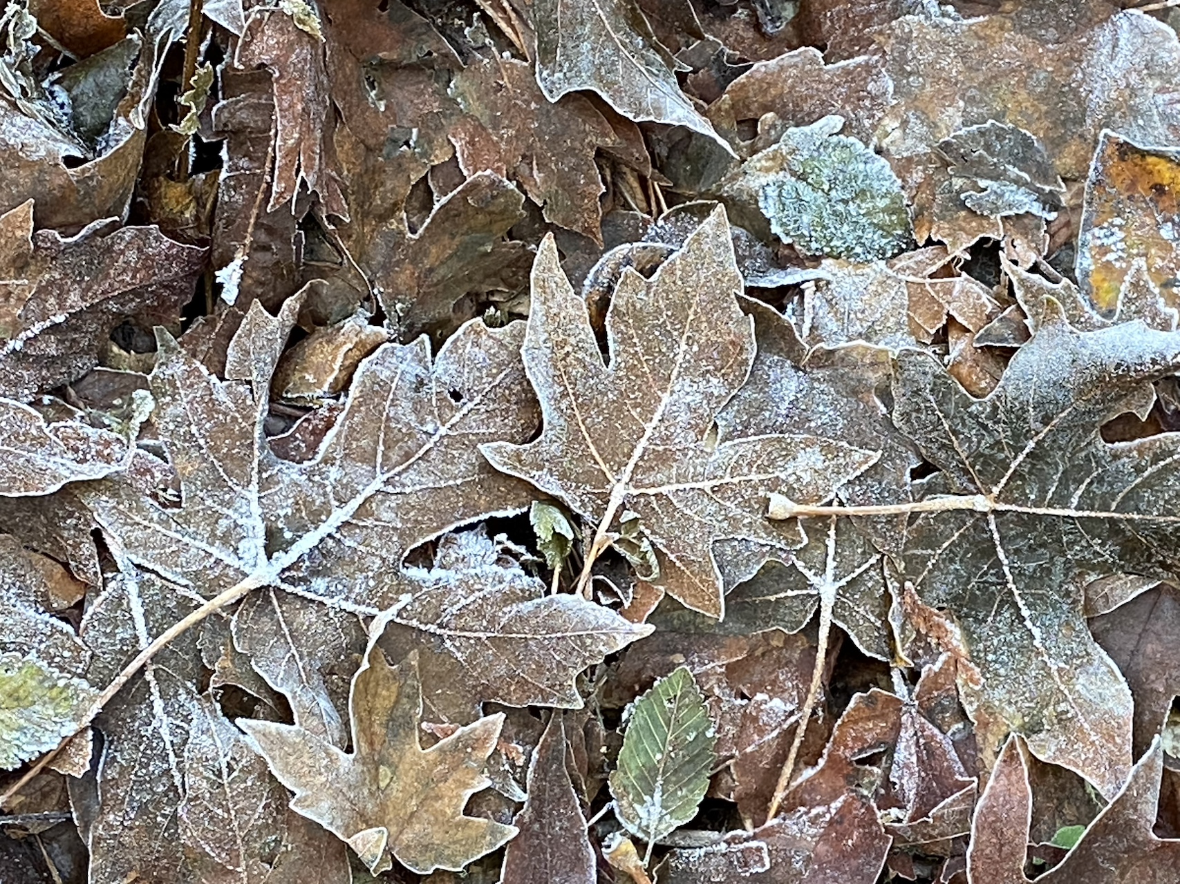


Frosty leaves


Two rocks tipped together made an interesting arch.


Fungi, toadstools? mushrooms?


Licorice ferns


No flowers at this time of year but we saw pretty white fungi growing on one tree and licorice ferns growing on another one.


Count for the day:  12 hikers, 7 dogs

2 miles RT, no appreciable elevation gain.  


Arboretum Waterfront, Lake or Swamp Walk, 2023


Sign pointing the way to the Arboretum Waterfront Trail


A really nice in-the-city walk, is the Arboretum Waterfront Trail, sometimes also known as the Lake Walk, or the Swamp Walk.  Parking is by the Arboretum visitor center where there are also public restrooms.  From the parking area it is possible to choose to walk in the Arboretum or go down toward the lake and take the Waterfront Trail. 


A section of the floating pontoon bridges


The last time we went on this trail it was flooded in a couple of places and we were not able to go the entire distance.  This time the path, pontoon bridges and metal grating fixed bridging had been repaired and we make it all the way to the Mountlake Cut aka Ship Canal.  The trail is right at lake level and when the boats go by the wake makes the pontoons rock up and down and back and forth.  At one point, after a large pleasure boat went by, the wake made the bridge move enough we decided to just stand where we were until the rocking stopped. 


 One of several benches


Benches were placed some time ago all along the trail; however, as time has gone by the benches have sunk down some and settled to the point of being almost even with the ground.  There also a few places where off-trails lead to small viewing platforms.  The bench in the picture was quite close to the ground, although the photo doesn't make it look as close as it was.  Other benches had sunk and settled in even deeper than this one.


Under the freeway near the Lid


The trail goes under the new Lid that is being constructed over part of the freeway.  The trail surface is crushed rock, dirt, and bark.  Starting from the mainland the trail weaves through a marshy woodland, has pontoon bridges crossing water to two islands, and ends at a viewing platform by the canal where the University of Washington crew races are held.   We had nice fall colors the day we were there.


View from the platform by the canal


 This is where it happens!  A plug for the book "The Boys in the Boat" and soon to be movie.  We also saw two shells out in the lake.  One had an instructor who was calling out instructions to the person in the second boat.  Note both people were wearing life vests.


There were a variety of ducks all along the waterways.  In additional to the usual Mallards and Canadian Geese, we also saw Gadwells, Buffleheads, and Widgeons. 


 Three Gadwells and one Widgeon


Total for the day:  20 people, 5 dogs

Approximately 2 miles RT, no elevation gain


If this is Thursday it must be postcards, 635


Aywaille, Seminary of St. Roch, and environs, Liège, Belgium, 1922


This used photo postcard is postmarked with the year 1922, but the ink from the stamp does not show the place.  Handwritten at the upper right on the reverse is La Bree.  La Brée-les-Bains is a place located in southwestern France.  Aywaille, also called Walloon, is a community of about 11,700 in Liège, Belgium.  In the foreground of the picture is the Seminary de St. Roch.  The main part of the church and tower are at the left side behind the school building. 


The card was produced by Ernst Thill (1882-1942), brother-in-law of Edouard Nels (1869-1925).  Nels was a photographer, who with Paul Nels, founded Nels Bruxelles in 1898.  The firm became the largest producer of postcards in Belgium.  They also produced maps and guidebooks.  When Edouard’s health deteriorated in 1907, his brother-in-law, Ernst Thill began running the business.  In 1913 Nels transferred the entire business to Thill.  The Nels logo dates from the time of the transfer from Nels to Thills.  The company was dissolved in 1962.


Nels logo


Saint Roch, also called Rock in English, was a Majorcan Catholic confessor who lived from 1348 to 1376.  “He is the patron saint of dogs, invalids, falsely accused people, bachelors, and several other things.”  He is said to have survived the Black Death plague having been fed pieces of bread brought to him by a dog.  The dog never left his side after he recovered.  He had a red birthmark on his chest in the shape of a cross and from an early age had shown great devoutness.  His parents died when he was about 20 years old.  After their deaths he distributed all his worldly good among the poor and entered the Franciscan Third Order.  He set out as a pilgrim for Rome.  He was canonized by Pope Gregory XIV (1535-1591). 


For additional information, see:


https://en.wikipedia.org/wiki/Aywaille

https://en.wikipedia.org/wiki/Saint_Roch

https://rthcards.co.uk/pclogos/data/NELS/NELS_01.html

 https://commons.wikimedia/wiki/Category:Nels/Thills


Thursday, November 23, 2023

If this is Thursday it must be postcards, 634


Illustration by Jessie Willcox Smith (1863-1935)


Happy Thanksgiving!


These two cards shared today are cards but not postcards.  Both are reproductions by Laughing Elephant, the small local print shop that specializes in preserving and printing vintage illustrations and cards, as both note cards and postcards. 


The illustrator named on the top card is Jessie Willcox Smith.  She was an American illustrator during what is called “The Golden Age of American Illustration.”  Her work appeared in books and magazines during the late 19th and early 20th centuries.   Her illustrations appeared in Collier’s, Ladies’ Home Journal, Good House Keeping, Harper’s, and Scribner’s.  She had a long-running Mother Goose series and covers for Good House Keeping from 1917 to 1933.  She also illustrated more than 60 books including Little Women by Louisa May Alcott and A Child’s Garden of Verses by Robert Louis Stevenson.


Illustration by S. Garre, 1905


This second card has “Painting only copyrighted S. Garre 1905” at the lower right corner.   Although I could not find anything about an S. Garre illustrator in 1905, the message is certainly appropriate for today as it is Thanksgiving Day.


For additional information, see:


https://en.wikipedia.org/wiki/Jessie_Willcox_Smith

https://www.illustrationhistory.org/artists/jessie-willcox-smith

https://laughingelephant.com/


Thursday, November 16, 2023

If this is Thursday it must be postcards, 633


Malmesbury Abbey, Wiltshire, England, ca 1902-1903


Malmesbury Abbey located in Wiltshire, England is the featured black & white photograph on this postcard with the publisher R. Wilkinson & Co., Trowbridge, identified at the lower right corner.  The back is divided but has the printed note:  “This space as well as the back [photo side] may be used for Inland communications.  Post Office Regulation.”  


 Since divided back postcards were allowed in England beginning in 1902, it can be guessed that this card dates from about late 1902 or 1903.  Later editions would no longer need to inform the sender that it was legal to write on the same side of the card as the name and address of the recipient.


Malmesbury Abbey is a religious house dedicated to Saint Peter and Saint Paul.  It was first founded as a Benedictine monastery about 676 by the nephew of King Ine of Wessex, Aldhelm.  The town, also called Malmesbury, grew up around the Abbey which continued to expand during the time of Alfred the Great.   


The Abbey achieved a reputation for academic learning.  The Abbey shown on the card was completed by 1180.  It had a spire of 431 ft or 131 m.  King Henry VIII closed the abbey in 1539 as part of the Dissolution of the Monasteries.  The building and the land the abbey owned equaled about 23,000 acres or 93 km and was home to 20 parishes.  It was sold to a rich merchant named, William Stumpe.  Stumpe returned the Abbey to the town for use as a church but also filled the buildings with looms for his cloth-weaving business.   


The west tower collapsed in 1550 and demolished three bays of the nave.  During the English Civil War, 1642-1646,  Malmesbury suffered extensive damage.  Less than half of the original building stands today.  In 1949 it was designated as a Grade I building.  Historic England added it to their Heritage at Risk Register in 2022.  Today part of it still functions as the parish church of Malmesbury.    


R. Wilkinson & Co. of Trowbridge was one of a couple of large businesses that produced postcards during the late 1800s and early 1900s when postcards were at the height of popularity. 


For more information, see:


https://en.wikipedia.org/wiki/Malmesbury_Abbey

https://wshc.org.uk/blog/item/sitting-pretty-with-picture-postcards.html


Thursday, November 9, 2023

If this is Thursday it must be postcads, 632


King’s House, Home of Governor, Kingston, Jamaica, ca 1909


This is an unused Vintage black & white photo postcard that has been tinted with pink and blue colors.  It features the King’s House, the home of the governor of Jamaica.  No photographer, printer, publisher or distributing information is on this divided back card.  There is a blurb at the left side on the reverse:  “King’s House Home of Governor, Kingston, Jamaica—This magnificent mansion is the home of the governor of the Island of Jamaica.  It shows the beautiful foliage and tropical conditions of that wonderful country so near the United States.  This house was partly destroyed during the last earthquake in Jamaica.”  The house, also known as sthe Government House, is the official residence of the governor-general who represents the Jamaican monarch and head of state.  


This was the third official residence in Jamaica for use by the governors.  The first residence was built in 1690 and located in Port Royal.  The second one was in Spanish Town and built in 1762.  The one on this card was originally built in 1872 when Kingston became the capital city of Jamaica.  It was more or less completely destroyed in the 1907 earthquake, then rebuilt, but was later the scene of a major fire in 1908.  After the fire, the British architect, Sir Charles Nicholson, supervised the rebuilding and restoration of the house similar to the reconstruction following the 1907 earthquake. 


The King’s House is still used today as the office of the governor-general of Jamaica.  It is also used to host state and ceremonial functions, such as the swearing in of ministers of government and judges of the High Court. 


For additional information, see:


https://en.wikipedia.org/wiki/King%27s_House,_Jamaica


Thursday, November 2, 2023

If this is Thursday it must be postcards, 631


Dunster, High Street and Yarn Market, Somerset, England


This unused black & white photo postcard features High Street and the Yarn Market in Dunster, Somerset, England.  On 31 August 2023 the Thursday postcard #622 featured some old cottages that I think are at the end of the road in this picture.  The Yarn Market is the octagonal building at the right center on this card.  The card is a F. Frith & Co. publication with the number 88719 at the lower left corn of the photo.  This card was among several others in an old shoebox in a local antique pavilion. 


Dunster had become a center for woollen and clothing production as early as 1222.  At the time the Yarn Market was built trade, particularly in wool and cloth, was the major economy for the community.  The building has an overhanging tiled roof that provides shelter from the rain.  The Yarn Market was built probably around 1609 by the Luttrell family, local lords of the manor, and was designated a scheduled monument in 1925, then also listed as a Grade 1 building in 1969. 

During the first English Civil War, 1642-1646, the building was damaged by cannon fire that can still be seen to this day.  


Dunster Castle, home of the Luttrells, can be seen atop the hillside at the center of the card.  Originally there was a timber castle on this site built by William Mohun just after the Norman conquest in the 11th century.  The stone motte was built in the 12th century.  In the 14th century the de Mohuns sold the castle to the Luttrell family. 


For additional information, see:


https://bewareoftherug.blogspot.com/search?q=Dunster

https://en.wikipedia.org/wiki/Yarn_Market_Dunster

https://en.wikipedia.org/wiki/Dunster_Castle


Wednesday, November 1, 2023

Lake Wilderness Park & Arboretum, Maple Valley, 2023


Bob pointing to our Arboretum starting point


There is some snow in the mountains, but not enough to ski yet, so we are trying some new places closer to home and sea level.  This week we went to the Lake Wilderness Park and Arboretum in Maple Valley.  This is a city park and therefore does not require a Discover Pass.  There was lots of free parking available.  


Informational placards found here and there along the lake shore provided this historical background.  In the beginning of settlement along the lake, coal mining brought the railroad to this area around 1882 when the mines opened nearby Black Diamond.  A little later, Carl M. Hanson, a Swedish immigrant and entrepreneur, with his sons built a sawmill on Lake Wilderness about 1890 and used the lake for storing and floating logs.  By the late 1890s it was one of the largest sawmills in King County. 


The last train left Maple Valley in 1980.  The old railroad bed is now part of the King County Parks Regional Trails System providing non-motorized access for biking, walking, running, and viewing wildlife.  Today the forests are being managed and protected for future generations. 


View of Lake Wilderness from the Lodge 


Another view of the lake from along the shore line


There were a number of ducks and some herons in the lake.


This park has lots of open spaces and water access for swimming and non-motorized water craft, such as, canoes, inflatable boats, and kayaks.  Most of the older, larger Douglas fir, western hemlock, and western red cedar were removed by logging and development.  The forest today is predominately second growth trees. 


Bob standing by one of the taller trees


This is a people friendly park.  It must be crowded in the summers.  There are several public restrooms located at various places in the park, a stand with life preservers for people to use and return, a pickle-ball court, and a concession stand, closed for the season.  The newer Lodge has an office and venue space for weddings and other group events.  


 After walking around the main park we went over to the arboretum where there are many loop trails through the woods and various gardens.  We slowly meandered around looking at things for about two hours. 


Most of the path through the arboretum looked like this


There were a couple of these small libraries, this one on an old stump.  It is in the children's garden and is surrounded by child friendly sized benches for a story time setting.  The second one was built in tree trunk and had a nearby adult sized bench.


The park works with the local library to maintain a storybook walk along the trail.  Each board had one or two pages of a picture book.  The book we read along the way was about Leaf Man.  It will be interesting to see what story is shared when we go back another time.


There are not many things in bloom at this time of year; however, we saw these purple berries on a Beautyberry bush.


Sometimes there are painted rocks like this one in parks


Bob estimated that we probably went 1.5 miles altogether.  We did not see everything in the arboretum and will go back in the Spring when it should be in full bloom.  It was a beautiful, sunny, cold day that provided some water reflections and even a tiny view of Mt. Rainier.