Showing posts with label hiking. Show all posts

Thursday, May 1, 2025

Icicle Ridge, 2025


Icicle Ridge trail, near Leavenworth


The Icicle Ridge trail is located near the town of Leavenworth in Eastern Washington.  We have cross-country skied at Icicle Creek but had never tried hiking the nearby Icicle Ridge.  The turn off road to the parking area is a little hard to find.  There is a sign but it is at ground level on the road not at eye level and it is relatively small.  The parking area is on a dirt road loop, with one section closer to the sign shown in the picture above and at the entrance to the actual trail.  No pass is required.  Next to this area is also a port-a-potty.  The lower parking area is a short walk down the hill from the upper lot. 


Most of the trail surface looks like this


The trail is locally popular and in good to excellent condition.  The surface is smooth packed dirt with practically no rocks or roots.  There are 21 switchbacks up to the top and the grade gets steeper the higher you go.  This early in the season our legs and stamina are not at peak condition yet, so we knew we would not go all the way up and ended up turning around at the 11th switchback.  As far as we went this trail did not have staircases or steps.  


Icicle Ridge looking out from the trail


Icicle Ridge looking down and toward the Wenatchee River


 Even though we did not go all the way up, there were several places on the way up that offered wonderful views of the valley and the Wenatchee River.  The forest is mainly Pine trees that are for the most part widely spread apart and offer viewing opportunities along the way.  There have been fires in the area in the past and lots of the trees have blackened trunks.  Unlike the west side forests where there are lots of downed trees from the November bomb cyclone, we did not notice many downed trees. 


This shows the steep hillside


In the Spring this area is full of gorgeous arrow leaf balsam root flowers.  In places the entire hillside was covered in these grand, large yellow flowers.  There were lots of other flowers as well, such as Ballhead Waterleaf, Fairy Bells, Mertensia, Service Berry, Blue-Eyed-Mary, Sandwort, Vetch, Oregon Anemone, Spring Beauty, and Death Camas.  The Oregon Anemone was a surprise.  It is not common and we had not seen it before. 


Balsam root flowers were all over the hillside on one section of the trail


 Ballhead Waterleaf


Fairy Bells


 Mertensia


Vetch


 Service Berry aka Saskatoon


 Oregon Anemone


Death Camas


 Prairie Star


 Spring Beauty


Count for the day:

37 hikers, plus one baby being carried in a front pack

3 dogs

3 miles RT

650 ft elevation gain


Note:  Something to be aware of, there are rattlesnakes in many places in Eastern Washington; however, we have not seen any on our hikes. 


Saturday, April 26, 2025

Early Hiking Summary, 2025


Oxbow Loop


We put away the skis and got out the boots.  The hiking season this year started with a few of our usual warm up hikes, such as Oxbow Loop where the Discover Pass is required, and the Connector Trail that goes between the Middle Fork Snoqualmie River parking area and the Garfield Ledges trailhead.  Both Middle Fork and Garfield Ledges require the NW Forest Pass or senior National Park Pass.  These are short, 2 miles RT, and easy.  Since people ask, especially if they are taking children, the Oxbow outhouse was open and clean.  The Middle Fork Snoqualmie trailhead outhouse was also open.  We did the entire Oxbow Loop but only part of the Connector.  Mostly we were looking for a good spot on the Connector to sit by the Taylor River and enjoy a snack.  


 Fawn Lilies on a section of the Barnum Point trail


The next week we did a new trail, for us, Barnum Point, and associated side trails, plus the Iverson Spit trail, which we had done part of once before.  Both of these areas are on Camano Island.  There are porta-potties only.  No passes or fees are required at these Camano parks.  


Yesler Swamp found in the Urban Horticultural Center

In between we did a local city walk at Yesler Swamp, part of the Urban Horticultural Center on Lake Washington.  A lot of this trail is on boardwalks over boggy or wet areas.  There are some view points and interpretive signs.  It is level and a short walk.  


Looking out from the top of Goose Rock at Puget Sound, US Navy Base at mid upper left


The following week we did Goose Rock at Deception Pass, where a Discover Pass is required.  It is steep but short with lots of flowers.  The parking area by the bridge has flush toilets and sinks.  From Goose Rock we drove to the Meerkerk Gardens on Whidbey Island where the rhododendrons are blooming and gorgeous.  The Gardens have a $10 entrance fee.  There is supposed to be one or more porta-potty.  That day ended with a stop at the Greenbank Farm Cheese Store and a ferry ride home.  


 Rhododendrons at the Meerkerk Gardens


The hillside was covered in the yellow balsam flowers. 


Our most recent hikes were on a two-day trip to Leavenworth where we did a new trail for us, Icicle Ridge, where no pass is required and where there is a porta-potty.  It is steep with 21 switchbacks.  We knew it was too early in the season for us to go all the way up to the saddle but we managed to get to the 11th switchback before turning around.  That trail is very popular with few rocks and no roots to speak of.  It gets progressively steeper as it goes up, for a total elevation gain of about 1700 ft, which might be more than we can do at this age.  The trail is open to mountain bikers as well as hikers.  There were hundreds of beautiful arrow leaf balsam root flowers and other flowers too.  


 Looking down on Ingalls Creek from the trail


Also, near Leavenworth, we did Ingalls Creek where the NW Forest Pass or a senior National Park Pass is needed.  The Ingalls Creek outhouse was closed and locked.  It did not have a sign on the door, so it might open in May when there are more hikers.  There were early flowers including a couple of uncommon finds. 


A few individual reports will posted about the new places for us. 


Thursday, November 14, 2024

Troublesome Creek Trail, Index, 2024


Troublesome Creek


 The day we hiked the Erinwood trail we also hiked the Troublesome Creek trail.  There are several tributaries that feed into the North Fork Skykomish River and Troublesome Creek is one of them.  The campground is about 15 miles from Index on the Index-Galena Road that has been closed for about 7 or 8 years due to river washout.  Open now, the new road is paved, up higher on the hill, with crews installing erosion control terraces and plantings going in on the day we visited.  


One of the other tributaries to the North Fork Skykomish River, Trout Creek 


Named Troublesome Creek for the difficulty the railroad had in getting around it, the camp ground is closed for the season but the trail can still be accessed.  We passed one small outhouse that was part of the camping area but it looked like it was locked, hence prepare for no facilities if you want to hike here in late fall or early winter. 


Most of the trail looks like this


With just a few stairs


The trail we took is a loop with a lower path following along the creek and an upper mini loop that joins the lower loop again before returning to the campground proper.  We chose to do the lower loop since it was right along the creek which is really a small mountain river with a torrent of fast, powerful water running down the day we were there.  We followed the upper loop for a short distance to see where it went, but preferred being along the water so turned around and kept to the lower trail.  It is a short loop even adding the extra part of the upper loop.  Bob estimated that it ended up being about the same as the Erinwood trail, .8 miles for the loop. 


Metal bridge


 Wooden bridge


There are two sturdy foot bridges crossing the creek that offer opportunities to take pictures of the rapids, falls, and rushing water in the creek. 


 Pools


 and rapids


with water that is incredibly clear and a blue-green color.  There are pools, rapids, waterfalls and wonderful water music all along the lower loop trail.


 Our only animal sighting for the day was this busy, busy, woolly bear caterpillar hurrying to somewhere ...


 Little yellowish mushrooms


Medium sized flat topped brown mushrooms


Larger pink-purple cup shaped top mushroom


Cream colored concave mushrooms


There were mushrooms growing in this forest too, but perhaps not quite as many as we encountered in Erinwood.  


Only one place with an almost obstacle--Watch your head


 North Fork Skykomish


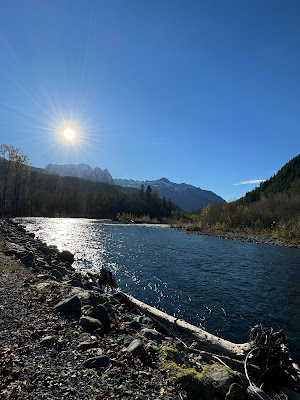
On the return trip toward Index, we pulled over and took a picture into bright sun over the North Fork Skykomish River.


Looking over the roof tops of Index was this view of the peaks in the Wild Sky Wilderness.


All in all, a wonderful day of solitude and peace, cool but not too cold, sunny and bright, no traffic noise, and beautiful nature surrounding us.


Count for the day:

No people, no dogs

.8 mile loop, a couple of small hills, no perceptible elevation gain

65 miles from home


Wednesday, November 13, 2024

Erinswood Trail, Index, 2024


Sign pointing the way to the Erinwood trail, Index


This past week we planned to hike to Heybrook Ridge near Index.  We had been on this trail before and were looking forward to waterfall views.  However, we had not counted on high water from previous rainy days, nor the broken rail on the two-log crossing, or the slippery rocks, mostly submerged in quick running water.  Bob tested out both the log “bridge” and the stepping stones and pronounced both too slippery.  The risk of one of us falling was too great to chance it.  A short off-shoot loop on the Heybrook trail is a newer trail that is still being worked on.  It is the short Erinwood trail.  We decided to try it.  This is a free county park with land purchased by the county and the community to preserve the forest. 


Rain forest, moss everywhere


Nurse logs with new trees growing in the old stumps


Erinwood is an extremely nice, wooded area trail.  It has the feel of a rain forest with moss growing on all sides of the trees and fuzzy mossy branches making strange shapes.  At this time of the year the leaves on the deciduous trees are mostly down, the flowers are gone, but there are mushrooms aplenty nearly everywhere.   


Licorice ferns growing on the tree trunk


Licorice ferns grow in profusion on the trees. It is quiet, and solitary.  The area was logged and interesting nurse logs now playing host to another tree can be spotted all along the route.


Mushrooms


More interesting mushrooms


Mushrooms growing in the moss


Tree almost covered in mushrooms


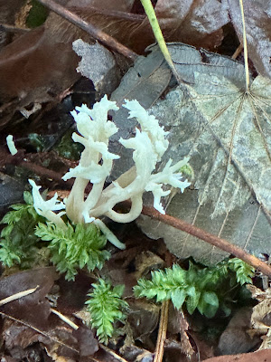
 White coral mushroom


Trail surface is dirt and gravel covered in damp decaying fallen leaves


The trail surface is mostly packed dirt with gravel on some parts.  Probably the entire trail will have gravel when it is completed.  We enjoyed this walk in the woods.


The Heybrook Ridge trailhead parking area is fairly large.  There is a public restroom with flush toilets and running water a short distance away in the Index city park and a port-a-potty at the trailhead.  The trail winds and twists around until it finally meets up near the paper sign and rejoins the main trail back to the parking area.  The sign says the loop is .6 miles RT; however, we added a little by walking as far as the creek crossing to Heybrook Ridge, making it about .8 miles RT.  This seemed like not quite enough, so we drove another approximately 15 miles, on a road that had been previously closed but is now open, to the Troublesome Creek camp ground where there is a slightly longer loop trail.  There will be a separate post about the Troublesome Creek trail.


Count for the day, .8 miles RT

No people, no dogs

About 50 miles from home