Showing posts with label California. Show all posts

Thursday, June 15, 2017

If this is Thursday it must be postcards, 303


Fountain of Ceres at the Pan Pac Expo San Francisco 1915
Edward H. Mitchell

The Panama-Pacific International Exposition held in San Francisco in 1915 served a two-fold purpose as it provided an opportunity for the city to show how it had recovered from the 1906 earthquake and also to celebrate the completion of the Panama Canal.  Both of the postcards shared this week were found in a local antique mall. 

There were at least two publishers of postcards for this Fair.  The card above features a postcard published by Edward H. Mitchell of San Francisco.  Mitchell was one of the earliest publishers of postcards in the United States with over 3,000 cards identified so far and updates to this list still occurring.  His cards have been collected and studied since the end of the 19th century.  He began publishing undivided postcards in San Francisco before the earthquake and fire in 1906 destroyed his printing operation and then continued to work out of his home until he built a plant and warehouse on Army Street. Many of Mitchell’s cards feature views of San Francisco and the West as well as a series on the Philippines and the Hawaiian Islands.  His cards had high quality real photo views, comics, artistic designs and California fruits and vegetables.  The Mitchell card shared this week has a message written on the reverse but does not have a stamp and was either never mailed or mailed in an envelope.  At the lower right corner there is what looks like a partial identification number but not enough of the printing is visible to make a determination.


Just like the 1909 Alaska-Yukon-Pacific Exposition, held in Seattle, the Panama Pacific International Exposition in San Francisco had a designated official photographer.  In the case of the P.P.I.E. it was the Cardinell-Vincent Company which published the unused card below.  Cardinell-Vincent employed over 150 people for the P.P.I.E. and had photographic galleries on the grounds.  The postcards published by this company had “Official Postcard” and a Fair logo printed on the reverse; however, several logos were used for this exposition so it is hard to tell if the company selected one from the several or designed their own logo.  At the lower right corner there is a code C30.  


 Niche in Court of Four Seasons, showing Autumn in Place
Pan-Pac. Int Exposition, San Francisco, 1915
Cardinell-Vincent Co. Pub.


Reverse


Also like the Alaska-Yukon-Pacific Expo the buildings constructed for the Panama Pacific International Expo were made of temporary materials called “staff” composed of plaster and burlap fiber.  Almost all the buildings and attractions were taken down in late 1915 after the fair closed.  One of the surviving buildings is the Palace of Fine Arts designed by architect Bernard Maybeck.  The Palace was completely reconstructed in the 1960s and retrofitted for earthquakes in 2009.  The Exloratorium, an interactive science museum, called part of the Palace of Fine Arts home from 1969 to 2013 before re-locating to newer facilities at piers 15 and 17.

The fair grounds covered approximately 300 acres along the Bayside Marina district of San Francisco.  There were palaces, towers, gardens, fountains and other attractions creating what was known as a city of domes.  The amusement park was called The Zone.   Other things surviving things include a Japanese Tea House that was moved by barge down to Belmont, California and now houses a restaurant.  Some 1/3 scale steam locomotives from the Overfair Railroad that operated during the expo and later became the property of the Swanton Pacific Railroad Society and were moved the Swanton Ranch as part of Cal Poly San Luis Obispo.  The expo opened on 4 February 1915 and closed 4 December of the same year.   A set of four postage stamps commemorating the exposition was first on sale in 1913 and then reissued in 1914 and 1915.  The San Francisco Mint was authorized to issue a series of five commemorative coins.  The 100th anniversary of the fair was held at the Palace of Fine Arts on 20 June 2015. 

For additional information, see:

http://www.thepostcard.com/walt/pub/ehm/chklst/mitbio2.htm
http://socialarchive.iath.virginia.edu/ark:/99166/w6811pf4
https://en.wikipedia.org/wiki/Panama%E2%80%93Pacific_International_Exposition
https://en.wikipedia.org/wiki/Exploratorium

Thursday, September 15, 2016

If this is Thursday it must be postcards, 264


 Winchester Mystery House, San Jose, California

These two postcards show view of the Winchester Mystery House in San Jose, California.  Both cards are unused from 1990.  The photograph on the card above was taken by Ken Glaser, Jr. and is numbered C-234 on the reverse.  The picture on the card below shows an aerial panorama of the estate and was taken by Mike Roberts of Oakland, California.  The number CSF-231 is found on the reverse.  Smith Novelty Company of San Francisco, California, distributed both cards.


Aerial view of the Winchester Mystery House, San Jose, California

The Winchester Mystery House estate was on six acres, which was reduced to 4.5 acres, has 160 rooms and was said in some accounts to have kept carpenters busy 24 hours a day for 38 years but another account stated that there were some periods of time when workers were dismissed and then rehired to continue on the project.  Sarah Winchester the widow of gun manufacturer William Wirt Winchester began construction on the mansion in 1884 without the benefit of an architect adding here and there in a haphazard fashion and creating oddities such as stairs that go nowhere and windows overlooking other rooms.   Mrs. Winchester inherited a large sum of money and had earnings from the Winchester Repeating Arms Company after her husband died.  The odd configuration of the house and her belief in ghosts led to it being referred to as the Winchester Mystery House.  She consulted a spiritual medium that told her in order to appease the spirits of those who had died from wounds inflicted by Winchester rifles she needed to build the house. 

Trivia:  It takes 20,500 gallons of paint to paint the house.  The house is on a floating foundation that allows it to shift freely during earthquakes.  It is this type of foundation that is believed to have prevented total collapse during the large quakes in 1906 and 1989.  The house has 40 bedrooms, 2 ballrooms, 47 fireplaces, 17 chimneys, two basements, three elevators and over 10,000 panes of glass.  There are gold and silver chandeliers, hand in-laid parquet floors and trim.  Mrs. Winchester had easy riser stairways installed so she could move about freely even though she could only lift her feet a few inches due to debilitating arthritis.  Only one restroom had a working toilet all the others were decoys to confuse spirits.  Mrs. Winchester slept in a different bedroom each night also to confuse the ghosts.  For its time the home had very modern conveniences such as indoor toilets and plumbing, push-button gas lights, and a hot water shower.  The Tiffany Company created many of the windows.  The designs included spider webs and the number 13.  The drain covers in the sinks had 13 holes, wall clothes hooks are in multiples of 13, there is even a topiary tree shaped like the numeral 13.  Every Friday the 13th a large bell is rung 13 times at 1300 hours or 1 pm as a tribute to Mrs. Winchester. 

At the time of her death in 1923 the house was still unfinished and deemed more or less worthless due to some earthquake damage and the impractical design.  The house was not included in her will and was eventually sold at auction to a private investor for $134,000 and subsequently opened to the public about 6 months later.  All her other possessions passed to her niece who took what she wanted and sold the rest at auction.

For additional information about the house and also about it in popular culture, see:

https://en.wikipedia.org/wiki/Winchester_Mystery_House

Thursday, August 25, 2016

If this is Thursday it must be postcards, 261


Death Valley, California, ca 1941

The Longshaw Card Company of Los Angeles, California manufactured the 1941 Linen-Type postcard of Death Valley shared this week.   The title and the number 893 are printed in the upper left of the card margin.  No photographer is identified.  Henry Lowe Longshaw was a former card salesman for the E.F. Clement Company.  He mostly produced view cards and cards with the pictures of the homes of movie stars and some pinup cards.  In business from the 1930s to 1957 many of his cards are known to have orange borders such as this one above.  It is hard to tell if this is the original coloration or if time has caused some fading and distorting of the colors.  Many of the earlier cards produced by Longshaw are known to have retouching and coloring problems.   Most of the cards were printed by Mission Engraving Company with whom Longshaw shared a building.  Longshaw did go on to produce higher quality images but was unable to compete with lower priced cards and closed in 1957. 

Like many cards of this era there is an informational blurb at the upper left corner on the reverse side of the card.

Death Valley, located in Eastern California near the border of California and Nevada, got its name from a party of emigrants known as the Jayhawkers who became lost and died in the valley en route to the gold fields in 1849.   It is thought that the term Jayhawker stems from a group associated with the American patriot John Jay of the Revolutionary War era.  It is uncertain how this group of gold seekers took the nickname.  Other uses of the word refer to militant free-state bands along the Missouri-Kansas border around the time of the Civil War and to native-born Kansans or students, fans, or alumni of the University of Kansas.  At one time the slang term “Jayhawking” was used as a synonym for stealing. 

The blurb on the card states that Death Valley boasts the greatest contrasts in the country with elevations from 280 feet below sea level to 11,045 feet above.  The scenery shifts from mountains to flaming desert.  The highest recorded and disputed temperature in Furnace Creek was 134 degrees F on 10 July 1913.  The longest period of temperatures over 100 degrees F in the valley was 154 days in 2001.  The average rainfall in this desert is about 1.5 to 2.3 inches a year.  There have been accounts of scattered snow but no accumulation.   Despite this harsh environment there are wildflowers in the spring, Bighorn sheep, red-tailed hawks, wild burros, and roadrunners.  Here and there in the desert are also springs and ponds and Darwin Falls, a 100-foot waterfall and pond surrounded by willows and cottonwood trees.  Over 80 different kinds of birds have been spotted around the pond.

Borax was found in Death Valley in the 1880s and extracted, then transported by 20-mule team wagons.  In 1933 President Herbert Hoover placed Death Valley National Monument under federal protection and in 1994 the monument was named Death Valley National Park and enlarged to include Saline and Eureka Valleys.


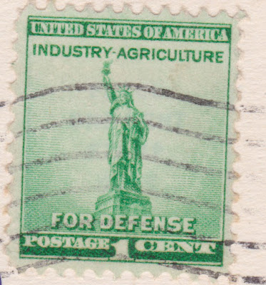
The stamp is a National Defense Issue stamp, one of three denominations, 1 cent, 2, and 3.  It was issued in October 1940 a month after President Franklin D. Roosevelt signed the first peacetime draft.  The stamp shows Lady Liberty on a green background. 

For additional information, please see:

https://en.wikipedia.org/wiki/Death_Valley
https://en.wikipedia.org/wiki/Death_Valley_National_Park
https://en.wikipedia.org/wiki/Jayhawker
http://www.metropostcard.com/publishersl.html
http://arago.si.edu/category_2028698.html

Thursday, April 21, 2016

If this is Thursday it must be postcards, 243


 Quincy, California, ca 1880s

Several years ago on one of the trips we took to visit Bopa’s sister and brother in Quincy, California we stopped at the Plumas county Museum and picked up these postcards.  The cards have drawings of the way Quincy and surrounding areas looked in the late 1800s.  Only one of the drawings had the artist’s name, C. L. Smith of San Francisco.    I thought it might be interesting to see what sort of historical information could be attached to the places depicted on the cards.  Perhaps my nieces and nephews who live/lived in Quincy have other things to add?

Quincy, the Plumas County seat, is a mountain town in northern California.  The Mountain Maidu were the early primary inhabitants and lived in small settlements along the edges of the valleys.  In 1820 the Spanish explorer, Captain Luis Arguello, named the river that runs through the canyon Rio de las Plumas (Feather River) after being impressed by the many floating feathers on the water.  Life changed for the native people beginning with the Gold Rush era.   Miners were attracted to the area during after the discovery of gold in 1849.  There were stories of a lake of gold but although many prospectors searched such a lake was never found.  However, a few miners had success in the rivers and creeks and non-native settlements were established.  Even today some small nuggets and flakes can be found in the river or in the streambeds. 

I can remember in addition to the traditional crawdad feed, rubber duck races, swimming in the creek, the tree swing, and camp singing around the fire on the beach that gold panning or dredging was a favorite vacation activity when we visited the cabin on Spanish Creek.  Usually a there were few little flakes or nuggets of gold that could be put in a tiny vial as a souvenir.  On very rare occasions a larger piece might be found by someone but never enough to cause a real frenzy of gold fever.  After the gold rush years in the mid 1800s cattle ranching and timber production were introduced.  The Western Pacific Railroad, built in 1910, allowed timber to be exported beyond the local region and also in brought tourists.   Today visitors can enjoy a variety of outdoor activities, hiking, kayaking, swimming, mountain biking, hunting, and fishing.  Quincy has art shows and musicals such as the High Sierra Music Festival held in July that draws about 10,000 people each year.  There are bed and breakfast inns, motels and campgrounds.  


Spanish Ranch, Plumas County, California

Spanish Ranch is a community in Plumas County begun in 1850 by two Mexicans who developed a distribution center for the many nearby mining camps.  It is now registered as a California Historical Landmark.


L.W. Bunnell's Hotel, Big Meadows, Plumas County, California

L.W. Bunnell was one of many who came from the eastern United States to California and Nevada to mine gold in 1851.  He mined the middle fork of the Feather river until 1853 then went to north fork where he mined until 1855 that same year he moved to Butt valley in Plumas County and began raising stock and farming until 1867.  From there he came to Big Meadows where he acquired about 940 acres and built a hotel along the banks of the north fork of Feather river amid pine trees and with views of Lassen’s peak in the distance.  The hotel resort offered excursions to Lassen’s peak, the Hot Springs and Mud Springs as well as other places of interest.  


Plumas House, Quincy, California

Plumas House was the center of Quincy’s social scene for many years beginning in the Gold Rush days.  James Bradley one of the first to settle in area named the town for his hometown of Quincy, Illinois.  Elizabethtown, an adjacent mining camp, was later absorbed into what is now Quincy. 

For additional information, see:

http://files.usgwarchives.net/ca/plumas/bios/bunnell196gbs.txt
http://www.icollector.com/Big-Meadows-CA-Plumas-County-c1885-L-W-Bunnels-Hotel-Photograph_i9798926
https://en.wikipedia.org/wiki/Quincy,_California
https://en.wikipedia.org/wiki/Plumas_County,_California
https://en.wikipedia.org/wiki/Spanish_Ranch,_California
http://files.usgwarchives.net/ca/plumas/bios/kellogg298nbs.txt

Thursday, February 19, 2015

If this is Thursday it must be postcards, 182


 The Ford Building, Balboa Park, San Diego, California 1935


The two postcards, day and night views, above have photos of the Ford Building from the California Pacific International Exposition that was held in San Diego, California in 1935 and 1936.  The Expo was held in Balboa Park to promote and support economy in San Diego.  When the first year proved to be a financial success the decision was made to hold it over for a second year. 

There were buildings left from the 1915-16 exposition also held in Balboa Park even though originally they had been designed as temporary structures.  By adding a few new buildings and moving some exhibits from the Chicago “Century of Progress” fair that was just ending the San Diego fair ended up with hundreds of exhibits on history, the arts, horticulture, ethnic cultures, science and industry.  The fair was profitable bringing in $37 million dollars.  Admission was 50 centers for adults and 25 cents for children 2-11.  There were four restaurants, an amusement area, and 21 nations participating with exhibitions.

The Ford Building, by architect and industrial designer Walter Dorwin Teague, is described as “Streamline Moderne.”   It was styled to resemble a V8 engine with two different sized circles in the shape of n “8” and a fountain shaped like the Ford V8 logo in a courtyard that was lit by valve shaped lights.  A mural depicting the history of transportation from the beginning of time through 1935 was along an interior wall of the outer ring.  Today the building houses the San Diego Air & Space Museum and is also used for weddings and other occasions.

Some of the fair buildings were rebuilt or replaced in the 1960s which caused a protest by local citizens and resulted in the preservation of remaining buildings and a condition that any new buildings would have to be designed in the Spanish Colonial Revival Style.  In 1978 the remaining original buildings were declared a National Historic Landmark. 

For additional information, please see:

http://en.wikipedia.org/wiki/California_Pacific_International_Exposition
http://en.wikipedia.org/wiki/Ford_Building_%28San_Diego,_California%29

Thursday, June 13, 2013

If this is Thursday it must be postcards, 95


Bath House, Santa Monica, California, 1903

A little space was left at the right side of this card for the message and Harry Larson, who mailed the card to I.C. Lee, carefully wrote only in the open spaces so that the picture would be unmarred.  The message on the reverse of the card says, “This side is exclusively for the address.”  M. Rieder, of Los Angeles, California, published postcards from 1901 to 1915 and had the postcards printed in Germany.  He made a number of cards featuring western states and several of the Los Angeles area.  Later he sold some of his photographs to E. H. Mitchell who published additional postcards. This is one of the bathhouses along the beach in Santa Monica, California.  

Santa Monica was founded in 1875.  It is only 14 miles away from Los Angeles and it was hoped that the railroad would make the town the closest port to the larger city.  Due to several unexpected economic setbacks this did not happen.  However, Santa Monica is close to the beach and tourists and campers began going there.  Real estate values increased and people began moving to the area.  In 1887 a 125 room hotel opened becoming the finest seaside hotel in California.  By 1895 North Beach had a bathhouse, restaurant and bowling alley.  In 1896 the trolley line was extended to connect to Los Angeles.  During the summers carnival rides and booths were available on the beach.  These included things like merry-go-rounds, Ferris wheels, and a shooting gallery.

Today’s postcard was mailed less than ten years after the bathhouse was built and must have been near to the time of its most popular period.   By 1905 the beach had begun to lose popularity due in part to the newer facility at Venice of America. 

For more information see

http://www.metropostcard.com/publishersr1.html
http://www.westland.net/venicehistory/articles/sm-northbeach.htm

Thursday, September 20, 2012

If this is Thursday it must be postcards, 57

California Building, Alaska Yukon Pacific Exposition, 1909

 Many of the buildings on the grounds of the Alaska Yukon Pacific Exposition of 1909 reflected cultural heritage.  For instance, the buildings for both Japan and China were designed to look very much like they stepped out of those countries.  The Hoo Hoo House and the Arctic Brotherhood buildings were built of timber from the northwestern United States.  Live exhibits such as the Igorrote and Eskimo Villages were built to allow the visitors to feel as if they were in actual native villages.  The California building shown on the postcard above has a decidedly Spanish appearance, as did many places in California at that time and still do.  This building is quite different looking than other buildings on the fair grounds. 

Among the exhibits the interior housed displays of fruits, nuts and vegetables that were grown in California.  We are fortunate that a couple of photos of the interior views are still available that show the often creative and spectacular displays.  Oddly the interior does not appear to reflect the Spanish theme of the building exterior.  It is hard to imagine why a model of an animal like an elephant made of fruit or nuts would seem appropriate but perhaps it was just for the artistic novelty and to attract visitors to the display with a sort of awe factor.  The glass jars and round bowls filled with produce look like penny gumball or candy machines.  Gumball machines were first introduced in 1907 so it is possible that in 1909 it would have seemed a fashionable or novel way to display items such as these in that manner.


Interior display, California building
[photo:  Frank H. Nowell, photographer]

Interior display, California building
[photo:  Frank H. Nowell, photographer]

The official photographer for the Alaska Yukon Pacific Exposition of 1909 was Frank H. Nowell (1864-1950).  Many of his pictures, like these above, were on display during the Fair and also used in official publications.  Born in New Hampshire he moved to Alaska at age 22 to join his father who was involved in mining near Juneau.  He took up photography as a hobby taking pictures of the native Alaskan people, businessmen, city officials, railroads, hydraulic mining, waterways, ports, and creating a visual record of Alaska around the turn of the century.  He traveled between Nome, Alaska and Seattle and around 1908 J. E. Chilberg, the president of the Exposition, appointed him as the official photographer.  After the Fair he operated a commercial photography studio in Seattle for 25 years. 

For more information about Frank H. Nowell and his AYPE collection see:
http://nwda-db.wsulibs.wsu.edu/findaid/ark:/80444/xv75935/

Thursday, July 26, 2012

If this is Thursday it must be postcards, 49

 Soldiers Home, Santa Monica, California, 1908

One of the last official things President Abraham Lincoln did in 1865 was sign legislation for the care and provision of volunteer (temporary) soldiers versus career military.  Up until this time volunteers had not been eligible for such care.  There were several of these “Old Soldiers Homes” in the United States this one shown on the postcard above in Santa Monica, California was established in 1887 with a 300 acre donation of land that later grew until it reached approximately 700 acres, 20 of those set aside for use as a veterans’ cemetery.  Originally these homes were for veterans of the Civil War but later it included “all honorably discharged officers, soldiers and sailors who served in regular or volunteer forces of the US in any war and were disabled or who had no adequate means of support and were incapable of earning a living.“ The rules were adjusted in 1908 to also accommodate those who had served in undeclared Indian wars.  In the 1920s rehabilitation as well as hospitalization was available. 

It was almost like a small town and included barracks, a chapel, a theater, a streetcar and a hospital.  Pine trees, palms, and eucalyptus groves were planted to transform the site from its natural barren state.  This particular Soldiers Home was called the Sawtelle Veterans Home and was also a tourist attraction.  In 1904 it became a hot air balloon stop.  There were escorted streetcar tours too.  By 1905 real estate developers had opened residential lots and larger tracts in the Westgate Subdivision, which joined the “beautiful Soldier’s Home.”  As a result the new community of Sawtelle grew up around the area and veterans and their families who were drawing relief settled there.

The hospital, first called Barry Hospital, was later replaced by Wadsworth Hospital, which opened in 1927.  Most of the 1890s era buildings were demolished in the 1960s and the Veterans Affairs (VA Wadsworth Medical Center) was opened in 1977.  It is the largest of the VA’s health care campuses and is part of the VA Desert Pacific Network. 


 Reverse side, Soldiers Home postcard

The card took a penny stamp to mail, was published by Newman Postcard Co. of Los Angeles, California but made in Germany, and is numbered F 5.  The handwritten message is cute too—“Long Beach-Cal July 16th, 08   Mr. & Mrs. Lee  Dear Friends.  I have a fine time.  Long Beach, Venice and Santa Monica are the finest Beach I ever saw 30 miles from Los Angeles.  The finest Bath House, Dance Halls, Hotels I ever see.  People from all over the U.S. come here and spent their time of leisure.  It looks like Sunday every day.  It is the place for the Rich.  Soldiers Home are 3000 veterans—300 acres.  Your O.F. Rier Hotel Leondie”


For additional pictures and more information see: http://en.wikipedia.org/wiki/Sawtelle_Veterans_Home