Thursday, May 30, 2019

If this is Thursday it must be postcards, 402


Juneau, Alaska, ca 1939


 View of Juneau from the dock, 2019

The black and white postcard is from 1939 and shows the city from further out in the bay.  The card is numbered 328 and titled “Juneau, Alaska in Winter” at the lower left, the photographers are identified as a Winter & Pond.  Lloyd V. Winter and Edwin P. Pond were photographers who documented the Klondike Gold Rush, mining operations in the Juneau district and also traditional Tlingit culture from about 1893 to 1940.  Pond was one of the special agents for collecting exhibits and photographs from Southeastern Alaska for the 1909 Alaska-Yukon-Pacific Exposition held in Seattle,Washington.

Lloyd Valentine Winter (1866-1945) and Edwin Percy Pond (1872-1943) landed in Juneau in 1893.  By 1896 they had published a catalog of their photographs that could be mail ordered through their own store.  A scrapbook of pictures called “Trail of 98” had pictures of the journey up the Dyea Trail and over Chilkoot Pass in 1897-1898.  They sold copies of this book to tourists for many years.  Their most popular images featured native villages, people, scenic views, and the Klondike Gold Rush.  


Although both my mother's and father's families had many connections to Alaska and Juneau in particular, I had never been there before, hence this was a much anticipated trip.  Just getting off the ship one of the first things we saw was this sign welcoming us to Juneau.


The second thing was an eagle sitting on a roof.  


From the ship looking at the cables for the tram car


The Mt. Roberts tram car


Looking down from the platform at the top of the Mt. Roberts tram

Southeast Alaska get about 151 inches or 383.5 cm of rain a year so we were not too surprised to be greeted by clouds and rain the day we were there.  My friend and her husband met us at the terminal and were our guides for the day.  I had not seen this friend for many years and the chance to visit with her and reminisce about our childhood days was a wonderful treat.  We went up the Mt. Roberts tram and took pictures looking down on the city far below.  As I have mentioned before, heights are not my favorite thing but the tram holds a lot of people and it felt more like a funicular, attached to the ground, than suspended on cables hanging in the air so it wasn’t too scary after all.  


In front of the fireplace

One of the highlights of the day was a visit to the house my father, her father, and my brother built along the beach of the Gastineau Channel.  The new owners had significantly remodeled and changed much of the original dwelling but the magnificent fireplace that Dad built is still a centerpiece in the house.  Some of the fireplace stones contain iron pyrite cube crystals that are sometimes called Fool’s Gold.  All the stone for the fireplace was found locally, some came from the beach by the house.  I spotted several of the crystals looking like unexpected gold nuggets in the stone sticking out in random places. 


This is Mark Kelley Images of Alaska postcard with the number PC157 on the reverse shows Juneau the capital city of Alaska and part of the rugged surrounding terrain as it looks today.  Juneau is the only US capital city that has no roads leading into it and can only be reached by plane or boat.  It was the first port on the Alaska cruise we took recently and as can be seen on this card, Juneau is a popular destination for the cruise ships.  The day we visited our ship was one of three.  My friend told me that they have had as many as seven ships on one day.  Since each ship can hold between 2,000 and 4,000 tourists one can see the kind of impact the tourist industry has on the city.

Many thanks to M & B for a wonderful day and a true Alaskan experience.

For more information, see:

https://en.wikipedia.org/wiki/Juneau,_Alaska
http://archiveswest.oribiscascade.org/ark:/80444/xv24096
https://en.wikipedia.org/wiki/Winter_and_Pond

Wednesday, May 29, 2019

Iron Goat, 2019


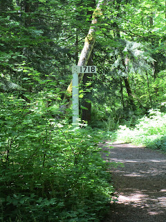
Iron Goat Trail markers

We have hiked the Iron Goat Interpretive trail before, both the upper trail and the lower grade.  The trail is at Stevens Pass where the old railway line used to be and has since been replaced by the 8 mile tunnel.  Because my Achilles tendon is still not completely healed we went on the lower grade beginning at the Caboose trailhead and using the Martin Creek trailhead as our turn around point.  


 Informational sign telling about the old railroad line at the trailhead


The old Caboose at the trailhead parking lot
 
There are outhouses at both trailheads and at Martin Creek there is a long bench to sit on in the shade.  That is where we had our lunch break before heading back to the Caboose.  There is a place near the starting point where it goes uphill to the Windy Point Crossover trail and two trail junctions past the tunnels to the Martin Creek Crossover trails.


 Paved section at the beginning of the trail


 Most of the lower grade trail was like this, packed dirt and gravel


Mile post signs left from the railroad days

Our total distance on the lower grade trail was 5.5 miles with an elevation gain of approximately 300 feet.  This is a very nice wide trail that starts out paved, turns into dirt but remains wide throughout.  The trail is slightly uphill but wide enough to accommodate a wheelchair.  There are a couple of bridges over water and/or a ravine.  We saw one young family with a baby in a stroller and a child riding a small bike with training wheels.  There are informational placards about the old railroad and remains of old railroading relics, abandoned tunnels, and a couple of places with benches with views.


In several places there are remains of snowshed walls 


 A new view spot with a bench and informational placard.  It is possible to see the new railway line across the way below from this view point.


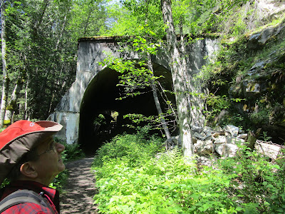
 Old abandoned railroad tunnel


Bridge crossing a ravine with a stream below

We hoped for wildflowers and were not to be disappointed.  A large party of people had started out just before we did.  When asked we were informed it was a garden club looking at plants.  Bob designed a sheet that lists the flowers we usually see and he adds new ones when we find them.   On this day we saw 28 different kinds of flowers in bloom.  Big bonuses for the day were chocolate lilies and calypso orchids!


Salmonberry blossom above mixes with Miner's lettuce


Salmonberry already set and ready to ripen


Aven


 Fringecup


Baneberry


 Bleeding heart


 Mertensia


Columbine

   
Alum root


 Spotted coralroot


Close up, Spotted coralroot


 Chocolate Lily


We counted about 20 lily plants, many with multiple flowers on one stem


Calypso orchid


 Trillium, almost finished blooming


Meadow rue

The count for the day:  32 hikers including one baby in a stroller, 6 dogs—3 running free and 3 leashed and well behaved.

Friday, May 24, 2019

Pratt River Trail, 2019


Once across the bridge the trail splits. The sign identifying the two trails.

Previous times we have hiked the Middle Fork Snoqualmie trail heading upstream but that trail had a slide last year and is closed.  The newer Pratt River Trail, which we had not tried before, was open and proved to be especially nice.  The trail was built under the direction of the Forest Service with help from the Washington Trails Association and other volunteer groups.  It took 3 years to complete and replaced the old riverside trail that was partially destroyed by flooding. The new trail has only been open for a couple of years.  The first section has had gravel added, otherwise it is packed dirt, a little mud in places, but not many rocks or roots and a slide area has a rock path through it.  The trail crew is still working on the stairs.


Bridge crossing Middle Fork Snoqualmie


The trail crosses and then follows along the Middle Fork Snoqualmie River for a way and then goes into the forest with occasional views of the river and if one goes far enough the trail connects with the Pratt River.  From there it goes up to into the mountains where there are some small lakes.   


 Middle Fork seen from trail


 More river view and mountains in the distance


Open view of mountains and trees

I have been nursing tendonitis in my right Achilles so this was to be a 2 ½ mile round trip trial run hike for us and we did not go as far as the Pratt River junction.   There is some up and down, and a couple sets of stairs.   Bob estimated that we had about a total 300 ft elevation gain.  My foot did okay with the compression brace and the Superfeet insoles in the boots, so we will try something a little more challenging next time.


 Thimbleberry


Elderberry


 Maidenhair fern


Bleeding Heart


 Whole meadows of these Lily of the Valley


 Lily of the Valley mixed with Sword fern


Twisted Stalk
We don't see these as often as other flowers


Bunchberry also known as Canadian Dogwood


 Even Dandelions gone to seed can be pretty

Since we are retired we have the luxury of picking and choosing days with nice weather.  It was sunny, but not too warm, no mosquitoes yet, flowers in bloom along the trail, and views of the surrounding mountains.  The most predominant flowers we saw were the Lily of the Valley and Bleeding Heart.  The Twisted Stalk was fun to find as we don't see it as often as some of the other flowers.  Trillium had been in bloom here earlier.  In all we counted 19 different kinds of flowers in bloom. 


 New bridge over Rainy Creek


Rainy Creek falls

There is a newer wooden bridge that crosses Rainy Creek.  The creek waterfall tumbles down the hillside and under the bridge.  If we had taken one of the side trails we could have hiked to the upper falls on Rainy Creek. 

Count for the day:  20 hikers and one very excited, perhaps not totally controlled, but leashed dog.