Thursday, August 25, 2016

If this is Thursday it must be postcards, 261


Death Valley, California, ca 1941

The Longshaw Card Company of Los Angeles, California manufactured the 1941 Linen-Type postcard of Death Valley shared this week.   The title and the number 893 are printed in the upper left of the card margin.  No photographer is identified.  Henry Lowe Longshaw was a former card salesman for the E.F. Clement Company.  He mostly produced view cards and cards with the pictures of the homes of movie stars and some pinup cards.  In business from the 1930s to 1957 many of his cards are known to have orange borders such as this one above.  It is hard to tell if this is the original coloration or if time has caused some fading and distorting of the colors.  Many of the earlier cards produced by Longshaw are known to have retouching and coloring problems.   Most of the cards were printed by Mission Engraving Company with whom Longshaw shared a building.  Longshaw did go on to produce higher quality images but was unable to compete with lower priced cards and closed in 1957. 

Like many cards of this era there is an informational blurb at the upper left corner on the reverse side of the card.

Death Valley, located in Eastern California near the border of California and Nevada, got its name from a party of emigrants known as the Jayhawkers who became lost and died in the valley en route to the gold fields in 1849.   It is thought that the term Jayhawker stems from a group associated with the American patriot John Jay of the Revolutionary War era.  It is uncertain how this group of gold seekers took the nickname.  Other uses of the word refer to militant free-state bands along the Missouri-Kansas border around the time of the Civil War and to native-born Kansans or students, fans, or alumni of the University of Kansas.  At one time the slang term “Jayhawking” was used as a synonym for stealing. 

The blurb on the card states that Death Valley boasts the greatest contrasts in the country with elevations from 280 feet below sea level to 11,045 feet above.  The scenery shifts from mountains to flaming desert.  The highest recorded and disputed temperature in Furnace Creek was 134 degrees F on 10 July 1913.  The longest period of temperatures over 100 degrees F in the valley was 154 days in 2001.  The average rainfall in this desert is about 1.5 to 2.3 inches a year.  There have been accounts of scattered snow but no accumulation.   Despite this harsh environment there are wildflowers in the spring, Bighorn sheep, red-tailed hawks, wild burros, and roadrunners.  Here and there in the desert are also springs and ponds and Darwin Falls, a 100-foot waterfall and pond surrounded by willows and cottonwood trees.  Over 80 different kinds of birds have been spotted around the pond.

Borax was found in Death Valley in the 1880s and extracted, then transported by 20-mule team wagons.  In 1933 President Herbert Hoover placed Death Valley National Monument under federal protection and in 1994 the monument was named Death Valley National Park and enlarged to include Saline and Eureka Valleys.


The stamp is a National Defense Issue stamp, one of three denominations, 1 cent, 2, and 3.  It was issued in October 1940 a month after President Franklin D. Roosevelt signed the first peacetime draft.  The stamp shows Lady Liberty on a green background. 

For additional information, please see:

https://en.wikipedia.org/wiki/Death_Valley
https://en.wikipedia.org/wiki/Death_Valley_National_Park
https://en.wikipedia.org/wiki/Jayhawker
http://www.metropostcard.com/publishersl.html
http://arago.si.edu/category_2028698.html

Thursday, August 18, 2016

If this is Thursday it must be postcards, 260


 Date Palm Grove, Coachella Valley, California


 Desert Cactus, California

Tichnor Art Company of Los Angeles published these two used Linen Type postcards from the late 1930s.  The top card shows Date Palm Grove in the Coachella Valley of Southern California.  It is numbered at the upper right as T147 and the lower right as 63619.  The lower card is of desert cacti with snow-clad mountains in the background, also from California.  It is numbered at the upper right as T288 and the lower right as 61093.  Although Curt Teich, based in Chicago, Illinois, was the largest printer and publisher of Linen Type postcards in the eastern United States and Stanley Piltz was one of the most prominent publishers on the West Coast there were other smaller companies that also produced Linen Type cards.  Tichnor Art Company was one of those smaller companies and used the logo seen below as an identifier on the reserve of their cards.

Dates are native to the Middle East and have been cultivated for thousands of years.  The Spanish missionaries introduced dates to northern Mexico and California in the late 1700s but it wasn’t until much later that they were cultivated as a crop.  Date Palms were first planted in the desert of the Coachella Valley of California beginning in 1890 and eventually covered over 6,500 acres producing over 40 million pounds of four different varieties of dates, Deglet-Noor, Medjool, Barhi and Zahidi. The growing of dates was made possible through irrigation and the dates were sold commercially.  The best-known variety is probably Medjool that has a high quality is large and soft and ships well.  About 15% of the world’s dates are grown in California and Arizona.

Unlike the dates that were imported from other countries, the cacti shown on the postcard are native to the Americas.  Most of the cacti shown in the picture on the card are the smaller ball-shaped columnar type.  They grow in harsh, arid conditions like a desert.  Almost any fleshy cactus fruit is edible and can be preserved by drying or boiling to make syrup.  The ball-shape of these smaller and some larger plants allows for more water retention when water is available.  People have been known to extract some liquid from cacti when in the desert and in need of fluids.  Catci are ribbed succulents that swell or shrink depending on how much water is stored inside the plant.  They do not have leaves but do have spines instead.  When we visited the Lady Bird Johnson Wildflower Preserve near Austin, Texas last year we saw many cacti in bloom.  The flowers are colorful and beautiful while the plant is more interesting than pretty.  Below are some examples of cacti in bloom from the Lady Bird Johnson Wildflower Preserve.


For additional information, see:

http://www.seecalifornia.com/farms/california-dates.html
https://en.wikipedia.org/wiki/Cactus

Thursday, August 11, 2016

If this is Thursday it must be postcards, 259


 John Knox's House, Edinburgh, Scotland

Traditionally associated with John Knox (1513-1572), he reportedly may have only lived in it for a few months during the siege of Edinburgh Castle; nevertheless, this postcard photograph is of what is called “John Knox’s House” in Edinburgh, Scotland.  The first mention of Knox living in this house started around 1800 and was repeated by Victorian writers until the tradition was established and even appears in a visitor's pamphlet. Although the house would have been a familiar feature in the city during his lifetime, a Catholic owned it at the time of Knox and it is unlikely he visited or stayed here since he was a Protestant religious reformer.  It is believed that he maintained a residence in Warriston Close instead where there is a small plaque with the years he lived there. The postcard is unused with the number 1024 on the reverse lower left.  The publisher/printer is identified as Braemar Films Ltd., of Edinburgh.

The house was built beginning in 1490 with some restorations and repairs in later years.  It passed through several hands via inheritance and forfeiture.  James Mossman, husband of Mariota Arres who had inherited the home in 1556, was a goldsmith.  He worked in Edinburgh Castle making coins for supporters of Mary Queen of Scots who were holding the castle during the siege when she was exiled in England.   Mossman was subsequently charged with counterfeiting following the surrender of the Castle in 1573 and was hanged, quartered, and beheaded.  The house was forfeited and given in the name of James VI of Scotland to James Carmichael. 

In 1850 the building was restored.  Alexander Handyside did carvings made for that restoration.  Another restoration occurred in 1984.  Many decorations and paintings have been added and the house and contents are now a museum.  Today the Church of Scotland owns it as part of a new Socttish Storytelling Center.

John Knox a clergyman, theologian, writer and for a time a private tutor to young boys was born around 1513 in Scotland.  He is known as the leader of the Protestant Reformation, a founder of the Presbyterian denomination in Scotland.  It is not known when or how Knox became converted to the Protestant faith but he was a close friend of the reformer George Wishart, even acting as Wishart’s armed bodyguard at times.  Because of his religious beliefs he was arrested by the French and spent 19 months as a galley slave.  Later he spent 5 years exiled in England where he was licensed to work for the Church of England and preached Protestant doctrines.  Following this period he spent several years in Continental Europe preaching and working for the reformation.  He was married and widowed then married a second time when he was 50 and his bride was 17.  He died 14 November 1572, survived by five children, two sons with his first wife, Margery Bowes Knox who died in 1560, and three daughters with his second wife, Margaret Stewart Knox, survived Knox. 

For more information about John Knox and the house, see:

https://en.wikipedia.org/wiki/John_Knox_House
https://en.wikipedia.org/wiki/John_Knox

Thursday, August 4, 2016

If this is Thursday it must be postcards, 258


 Austin, Nevada

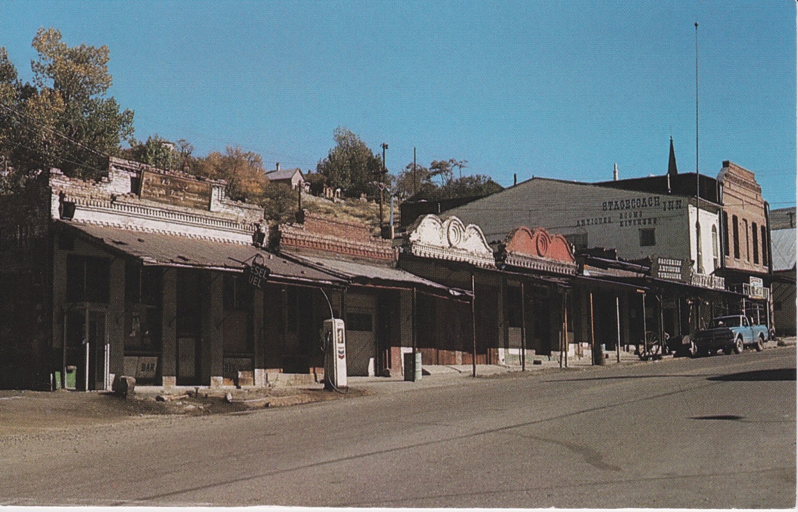
A section of the main street in Austin, Nevada, is shown on the above postcard identified by a number at the lower left on the reverse as 4852-E.  The publisher/printer is noted as Postcards, Goldfield, Nevada.  A note on the reverse of the card states that the last two building at the left of the photo are no longer standing the result of heavy snow on their roofs and years of old age taking a toll.  

Austin is a small, unincorporated community of about 200 people located on the western slopes of the Toiyabe Range, elevation 6,605 ft or 2,013 meters.  U.S. Highway 50, also called the Loneliest Road in America, passes through the town.  There is a small café in this town that makes a good stopping place for a hamburger and milkshake and is where I picked up this postcard about 20 years ago. 

David Buell and his partner Alvah Austin mapped out the town in 1862 during a silver rush.  The discovery of silver here is attributed to a Pony Express horse kicking over a rock that exposed the ore.  A year after Buell and Austin (for whom the town is named) had mapped it out the population of the town and surrounding Reese River Mining District had jumped to 10,000.  During the boom years Austin became the Lander County seat that was later moved to Battle Mountain in 1979. 

It was hoped that the Nevada Central Railroad would connect Austin with the transcontinental railroad at Battle Mountain in 1880; however, by then the silver boom was almost over with major silver production ending in 1887.  Although there was interest in uranium mining during the 1950s the ore proved to be of low quality.  A small amount of gold and silver mining has continued off and on and small quantities of high quality turquoise are still mined in this area.  

Because Austin has numerous historical buildings in various states of repair it has been dubbed a “living ghost town,” and is an example of an early Nevada mining town.  Some of the nearby local attractions include a three-story structure called Stokes Castle built in 1897 by wealthy Anson Phelps Stokes who had interests in more than one of the local mines.  The castle was only occupied for one month before being abandoned and allowed to fall into disrepair.  It is listed on the National Register of Historic Places as is the Austin Cemetery, the old city hall, the Austin Masonic and Odd Fellows Hall, Gridley Store, and the former Lander County Courthouse together with a few others.  Austin is the recognized headquarters for the Yomba Shoshone Tribe.  Also near the town is a cluster of natural hot springs and the Hickson Petroglyph Recreation Area with an interpretive trail featuring ancient drawings carved into the rocks. 

For additional information, see:

https://en.wikipedia.org/wiki/Austin,_Nevada

Friday, July 29, 2016

Naches Loop, 2016


Tipsoo Lakes

I have been on this trail three times now, first with a Mountaineers naturalist class, second with our friends R&D, and this time just Bob and I.  We parked in the same lot to hike to Sourdough Gap three weeks ago where at that time there was a substantial snow bank.  The snow was still there but had shrunk in size and there were also a few small snow patches but nothing that really covered the trail.  Six very pretty lakes can be seen from along the way, also several views of Mt. Rainier and a peek-a-boo view of Mt. Adams in the distance.


Looking back at where we were three weeks ago, Sourdough Gap from the Naches Loop


Sourdough Gap is the V point by the big rocks at the top right on the ridge line

The first time I went on the trail we were caught in the middle of a thunder storm with short episodes of drenching rain, the second time it was almost unbearably hot, this time it started out cool with nice cool breezes and by the time we got back to the car it was about 65 degrees F.  It was a very nice, sunny, pleasant day.  The two previous times I waited at the lower parking area for Bob to retrieve the car and come get me, this time I was able to climb the last steep hill back to the upper lot.  Thus after three tries I can now say that I have done the entire loop.  It is one of those popular easier hikes that have a paved road to the trail head, nice parking, restrooms, and beautiful views so we expected to encounter many other hikers.  Even though we counted 114 people it was far less crowded mid week than it must be on the weekends.  There were bugs and bug spray is definitely needed.

The first half of the loop trail is part of the Pacific Crest Trail that crosses into the Rainier National Park where there are many signs stating no pets are allowed in the park.  Although we counted 4 dogs, one pooch, with a rakish red polka-dot bandana tied around his neck, turned out to be a “felon” being escorted out of the park together with his owner by a Ranger.   Bob said he thought at the very least the owner would get a ticket and probably have to pay a rather hefty fine. 


We have been on other sections of the Pacific Crest Trail and occasionally run into hikers who are going the entire distance from Mexico to Canada.  This time we met two girls in their early twenties; one had started from the Washington/Canadian border and the other from Rainy Pass.  Most through hikers we’ve met are going the opposite direction, Mexico to Canada.  It is a foot journey of 2659 miles and usually takes 3 to 4 months.  In contrast, our modest hike was about 4 miles round trip with a total gain of 700 ft that included some ups and downs. 


PTC through hikers
We had beautiful views of Mt. Rainier and plenty of flowers to enjoy. 


 The east tarn, the first small lake or pond we came upon


 Lupine


 Avalanche Lily


Magenta Paintbrush


 Looking down on Dewey Lake


 Penstemon


One of my favorites, Beargrass


 West tarn with Mt. Rainier


 Butterfly posing


 Moon over Mt. Rainier


 Pink Monkey Flower


 Mock Orange


Looking back at Tipsoo Lakes from the trail

Thursday, July 28, 2016

If this is Thursday it must be postcards, 257


City Hall, Toronto, Canada, ca 1920s

Like some of the other cards produced by different companies this one is titled and numbered.  The title for this card is at the lower left corner “City Hall, Toronto, Canada,” and the number is handwritten in the lower right corner  “113483 (V).”


Reverse

Although this postcard was never stamped nor mailed someone has inked in the date of Aug. 6, 1931 on the reverse shown above.  The logo in the center identifies the company as
Valentine & Sons, or alternately as Valentine-Black Co., Ltd. of Toronto with the publishing information along the left side indicating that the card was printed in Great Britain.   

The Valentine Company was a lithographic printing firm established in 1825 in Dundee, Scotland by John Valentine.  By 1860 Valentine’s son, James, was reproducing photographic images as prints and stereo-views.  After James died in 1879 his two sons took over the business and began producing Christmas cards in 1880 then printing postcards beginning in 1896.  As the company expanded branch offices were opened in several other countries including Canada. 

From 1890 to 1902 most of the Valentine cards were printed in black & white collotype.  Later between 1907 and 1923 a variety of different reproduction methods were used.  This card appears to be produced using the Photo-Brown method that implemented two half-tone screens to achieve the look of toned real photos.  Valentine’s closed their Canadian branch office in 1923 therefore it is possible to date this card to the 1920s or earlier despite the inked in date on the reverse.  Postcards and greeting cards continued to be produced by the company into the 1950s.  The company was sold first to John Waddington & Co. in 1963 then in 1980 it was passed on to Hallmark Cards. 

The photograph is of the Old City Hall, as it has been called since a newer replacement building was constructed in the 1960s, was built in 1899 and designated as a National Heritage Site of Canada in 1984.  The largest civic building in North America at that time it was home to the Toronto City Council from 1899 to 1966. 

Three different types of stone were used in the construction, sandstone, grey stone and brown stone.  It took ten years to build and due to cost overruns and construction delays the angry city councilors refused to put a plaque on the building naming the architect, Edward James Lennox and the completion year of 1899.  Lennox then had the stonemasons put his name and the date in the decorative molding called corbels beneath the upper floor eaves around the entire building.  Lennox also designed an annex to the building, Manning Chambers, built in 1900 which was later demolished to make way for the current city hall.

One of the most distinctive features of the Old City Hall is the clock tower at 340 feet or 103.6 meters it was the tallest structure in Toronto from 1899 to 1917.  The clock has three bells the largest weighing 5-½ tons or 5,443 kilograms.  Originally there were carved sandstone gargoyles at the upper corners of the clock tower but they were removed due to erosion in 1938.  In 2002 bronze casts of the gargoyles were reinstalled.  The four clock faces are each 20 feet in diameter with the mechanism sitting in a glass box enclosed by the timepiece.  The manually functioning clock was automated in the 1950s.  The clock was stopped for the first time in 1992 after more than 100 years of operation for repairs and maintenance.  The room housing the clockworks is accessible only by climbing 280 stairs as the original elevator was taken out in the 1920s. 

The Old City Hall has been described as a massive square quad with a courtyard in the middle.  The originally planned large public square to be called Victoria Square never was developed instead a smaller space was allocated in front of the building.  Currently the building is being used as a courthouse with future plans perhaps including a museum for the city.  There is also a memorial to those who died in World Wars I and II as well as the Korean War and Canadian peacekeeping operations at the foot of the front stairs on Queen Street where ceremonies are held on November 11th. 

For more information, see:

http://www.metropostcard.com/publishersv.html
https://en.wikipedia.org/wiki/Old_City_Hall_(Toronto)

Thursday, July 21, 2016

If this is Thursday it must be postcards, 256


Yucca

This C. T. American Art Colored postcard was sent from Palm Springs, California and is dated 1940.  There are two numbers in the lower margin, 237 at the left and 1671-29 on the right.  It has the Curt Teich logo on the reverse.

This evergreen plant is a Yucca, sometimes also identified as small soapweed, Spanish bayonet, Great Plains Yucca and beargrass.  The flower stalk grows to about 39 inches (100 cm) with the blossoms that hang downward a white or pale green color and long, narrow leaves.  The Yucca fruit is in the form of seeds found in capsules after the flowers have finished.  The plant is native to North America and is found from the Canadian Prairies south to Texas and New Mexico.  It has adapted to dry growing conditions.  


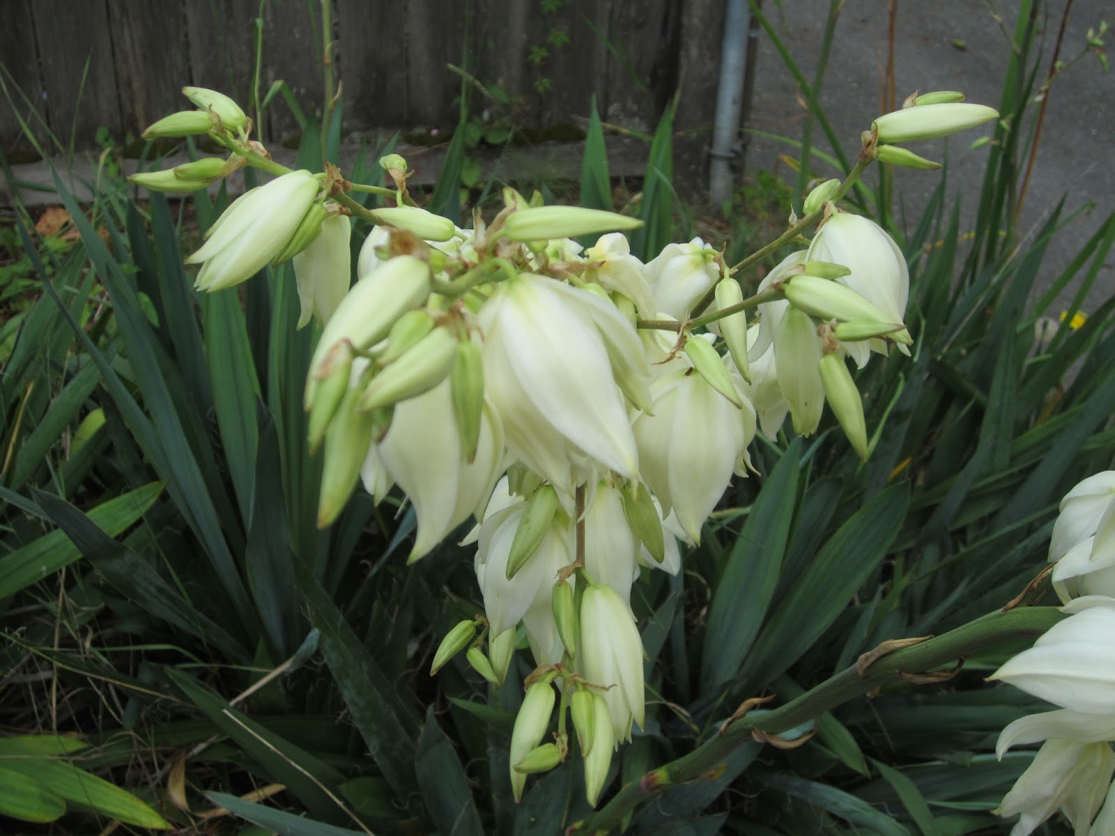
It is quite an interesting and attractive looking plant.  Although this is hardly a desert climate the Yucca seems to grow well in the Pacific Northwest as I have seen many in various parts of the city.  The picture on the card does not really do it justice.  Below are some of photographs of a local Yucca plant in bloom.  The flowers are large so it is not uncommon to find the heavy flower head leaning or drooping unless the stalk is staked up.


Native Americans such as the Blackfoot, Cheyenne, Lakota and other tribes have used this plant for medicinal purposes.  All parts of the plant are used in various ways
including the sharp, tough pointy leaves that can scratch exposed skin and hurt .  For example, the seedpods are boiled and used for food by the Zuni people.  The leaves have been made into brushes to use in the making or decorating of pottery and ceremonial masks.  They are also soaked and softened to aid in the making of mats, rope and other articles.  Dried leaves are split and woven to make water carrying head pads.  Peeled roots pounded make suds to use for washing hair, wool garments and blankets. 

Warren G. Harding, 1930 stamp

I found the stamp on this postcard to be interesting as I had never seen a United States stamp with a value of 1-½  cents before.  It is part of the Presidential stamp series this one featuring Warren G. Harding, who was the 29th President of the United States.  A two-cent stamp in his honor was issued in 1923 shortly after Harding died suddenly from a heart attack in 1923.  Two years later in 1925 1-½ profile stamp in a different color was issued.  In 1930 at the request of President Harding’s widow, Florence, who provided a photograph of her late husband for the design of this new 1-½  stamp, this full face version replaced the 1925 profile version. 

For more information, see:

https://en.wikipedia.org/wiki/Yucca_glauca
https://en.wikipedia.org/wiki/U.S._presidents_on_U.S._postage_stamps