Thursday, July 14, 2016

If this is Thursday it must be postcards, 255


 Anemone coronaria or poppy anemone

This time of year I am looking at flowers, planting things, and hiking to see wildflowers hence when I saw this card I thought it would be a good one to share today.  Anemone coronaria or poppy anemone is featured on this lightly textured postcard printed in Switzerland.  The card is numbered 355 and has the ST Z.F. logo on the reverse.  It was sent to my mother from Bergen, Norway in 1939 as a Christmas greeting and carried well wishes on her recent marriage earlier that year.  It falls into the category of an art or novelty card.


ST Z. F. logo on reverse

These poppies that are native to the Mediterranean region have different common names in different countries.  They are referred to as Spanish marigolds, dağ lalesi in Turkey, kalanit in Hebrew, and shaqa’iq An-Nu’man in Arabic.  I thought is was interesting that the Hebrew name Kalanit metzuya has reference to a bride on her wedding day because of its beauty and majesty.  Anemone coronaria was elected in 2013 as the national flower of Israel in a poll by the Society for the Protection of Nature in Israel. 

These flowers grow wild all over Israel, Palestine and Jordan.  The British soldiers during the British Mandate for Palestine were nicknamed “kalaniyot” for their red berets.  Although they can be different colors, the vast red carpets of anemones have become a major tourist attraction in the northern Negev region of Israel.


The stamp is the 20 øre rampant lion on a red background

For additional information, see:

https://en.wikipedia.org/wiki/Anemone_coronaria

Sunday, July 10, 2016

Sheep Lake & Sourdough Gap


Looking down on Sheep Lake


Sheep Lake

There are a large parking area and two outhouses at Chinook Pass (5400 ft elevation) where there was on this occasion also a big snow bank.  Two trails take off from the parking lot, one to the south, Naches Loop, and one to the north, Sourdough Gap which is a on a section of the Pacific Crest Trail.  There was still snow on the Naches Loop but the north trail to Sheep Lake and from there on up to Sourdough Gap was snow free except for a couple tiny patches.  We could have gone a little further than the Gap but there was larger snow patch on the steep hillside and people we met coming down said if we decided to go onward to see the view of Upper Crystal Lake and Mount Rainier we should be careful, as it was very slippery and one young woman had fallen but fortunately not been hurt.  Although we would be able to see Upper Crystal Lake, Mt. Rainier was shrouded in clouds so it was a risk without much benefit of a mountain view.  We chose to stop at the Gap.


Snow in the parking lot

It was a nice comfortable day for hiking, some clouds but lots of sun and not too warm.  As in the past we continue to keep track of how many folks we meet on the trail and how many dogs.  This was a 30 people 7 dog hike, 7 miles round trip with a total elevation gain of 1200 ft.  Most of the people and dogs we encountered were on the lower part of the trail.  Once up on top at the Gap we had perfect solitude.  It was so quiet the only sound was the wind. 


We are in our mid 70s and not speed demons, the actual time up was 2 hours and 40 minutes.    The return down to the parking area was 2 hours and 7 minutes.  We spent 20 minutes at the lake on the way up and on the way down and another 30 minutes at the top where we had sandwiches, vegetables and fruit for lunch and were buzzed by hummingbirds.  In addition to water we also carry nuts and chocolate for snacks.  Too much speed cheats us of all the beautiful things in nature that we can see and enjoy.  We stop often to take pictures and admire the scenery and the flowers and to rest now and then if necessary.  Digital cameras and large capacity memory cards allow us to take as many photos as we want and the computer allows us to edit the pictures once we get back home.  

As the trail starts it drops down 100 ft. and then most of the rest of the way is a gradual incline with the steep part the last ¼ mile that includes a sharper drop off to one side and ends at 6400 ft. This is highest we have hiked this year so far.  We saw chipmunks, fish jumping in the lake, gray jays, other smaller birds and we heard marmot whistles.  The most surprising was several humming birds that passed by fast enough to be a blur of wings but close enough to hear the buzz.


Hello little chipmunk

It is approaching peak flowering time in the mountains and we were not disappointed.  Many of these flowers are small and white.  Sometimes I think people walk right by them and don’t even take the time to see all these little beauties.  Other flowers are more colorful and showy.  Bob has a chart that allows us to keep track and check off the different flowers we see each time we go out.  We take a field guide, bird book and flower book in the car or one in a pack.  Below are a few pictures of what we saw.


 Yellow Lousewort

Close up of Yellow Lousewort


Mertensia


 Beargrass


Beargrass close up


Wallflower


Larkspur


Showy Jacob's-ladder


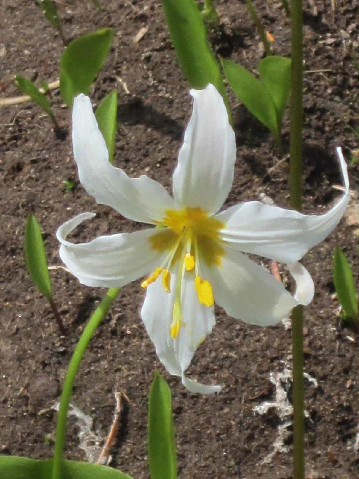
 Avalanche lilies


Glacier lilies


Tiger lily with a cobweb


Penstemon


Lupine


Fendler's Waterleaf


Cinquefoil (?)

And some views looking out and down from Sourdough Gap . . .


 The snowfield we chose not to cross


Sheep Lake

Thursday, July 7, 2016

If this is Thursday it must be postcards, 254


 Devils Punch Bowl and Gull Island, Oregon, 1939

This Linen Type postcard is another printed by the Wesley Andrews Co., of Portland, Oregon and was mailed from Eureka, California postmarked 1939.  As mentioned in an earlier postcard Thursday Wesley Andrews Co. was famous for postcards featuring nature scenes, especially areas along the Oregon coast.  This photo is attributed to Home Studio, Toledo, Ohio.  The card has two numbers on the front, 967 by the title at the top margin and 2A181 in the right hand side margin.  


 Wesley Andrews logo


 Curt Teich, Colortone logo

The reverse side has the Wesley Andrews logo at the top center and the logo for Curt Teich and Colortone of Chicago, Illinois at the bottom center.  Many of the Colortone cards were printed as Linen Type since that format allowed for the best color reproduction.

Devils Punch Bowl is a State Natural Area in central Oregon.  The large bowl shape was carved in a rocky headland that is partly open to the Pacific Ocean.  It is thought that the bowl was created by ocean water when two caves collapsed.

Devils Punch Bowl is about 8 miles north of the resort town of Newport, Oregon.  The park includes picnic grounds, has a trail access to the beach.  Also to be found in the park are tide pools.  Off shore about ½ mile is Gull Rock where the waves are attractive to surfers.   Whale watching is another activity in this area.

The land was acquired in three parcels between 1929 and 1952 with the Civilian Conservation Corps doing the work to install fresh water systems, sanitary works, picnic tables, stoves, trails and safety fences.  It is a popular park and receives more than 200,000 visitors during the busiest season of June through October.  


Green, 1938 George Washington profile stamp

The stamp is a green 1938 George Washington profile stamp.  President Franklin Roosevelt, who was an avid stamp collector, suggested this set of stamps to honor past American presidents.  A national contest was held and out of over 1200 entries this design by Elaine Rawlinson, a New York art student, was chosen for the Washington stamp.  This stamp was used on postcards and letters from 1938 through the late 1950s.   

For more information, see:

https://en.wikipedia.org/wiki/Devils_Punch_Bowl_State_Natural_Area
https://en.wikipedia.org/wiki/U.S._presidents_on_U.S._postage_stamps
https://en.wikipedia.org/wiki/Stanley_Piltz
http://www.pdxhistory.com/html/post_card_history.html

Sunday, July 3, 2016

Lower Lena Lake, Olympics


Old trail sign for Lena Lakes tacked on a tree

 Here’s another new trail for us, Lower Lena Lake in the Olympics.  The trail divides near the lower lake and goes up another 4 miles to Upper Lena Lake but we were stopping for lunch at the lower lake, walking around it a bit and then returning to the trailhead.  It is a 6 mile round trip the extra walk to the campground plus around part of the lake adding another ½ mile or so.   The trailhead is at 700 ft, there are 18 switchbacks with an elevation gain of about 1300 ft to end at 2000 ft at the lake.   For us the walk down to the lake and back up to rejoin the main trail added another 200 feet for a total of 1500 ft.  


 Wonderful large trees and peek-a-boo views


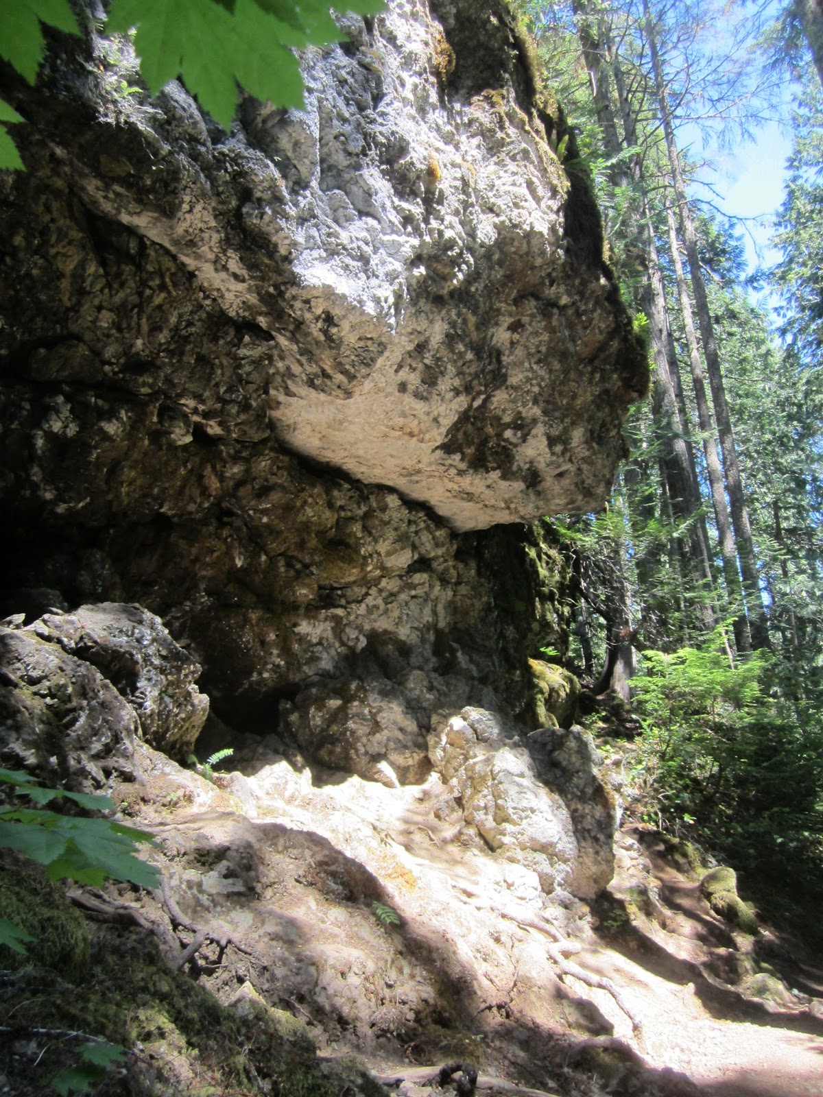
Dramatic stone outcropping, suitable for Trolls


 Nice wooden bridges

The weather was perfect for the hike up, cloudy and cool, 55 degrees F; about 65 degrees F at the top; the temperature did hit over 70 degrees F by the end of the day.  There were no bugs!   It is an extremely popular trail.  We saw 66 people and 5 dogs even though this was a weekday.  Because it gets used so much parts of the trail are very rocky and full of roots due to erosion.  


First view of Lower Lena Lake from the trail


 Lower Lena Lake from our lunch spot


Lower Lena Lake beach in the campground

Lots of flowers with some surprises like the first Indian pipe of this year and native rhododendrons still in bloom.  There were coral roots, wintergreens and hundreds of the delicate twinflowers.  Closer to the lakeshore we also found tiger lilies and roses right on the beach.  We saw chipmunks, gray jays, an interesting snail, and a small red spotted garter snake.


Indian Pipe


 Pink Wintergreen


 Twinflower


 Tiger Lily


 Nootka Rose


White veined wintergreen

Despite signs instructing campers to be sure their fires were out before leaving the campsite we came across an abandoned fire pit that still held partially burnt logs with hot smoldering coals and was definitely not out.  We didn’t want to use all of our drinking water since we had a hot hike down to the car and would need the water but felt compelled to put out the fire out if we could.  We did end up dumping one of our canteens on it and Bob went down to the lake a few times to refill the canteen with lake water to dump on the logs and coals.  We were not sure it was completely out and alerted campers in the neighboring spots to watch for smoke and if they had a pot or bucket to use lake water to dowse the fire pit again, please.  


I’m not sure if I’m ready to backpack up 18 switchbacks to sleep on hard ground and cook over a camp fire but Lower Lena Lake is gorgeous, the campsites are nice and relatively private with vegetation separating each site.  There is a plaque in memory of scouts and leaders 1927-1941, Boy Scouts of America Tumwater Council, "Where youth learned to appreciate our outdoor heritage."


Typical campsite


There are newer solar composting toilets at the campground; however, they are currently under repair so there are no facilities at the present time.


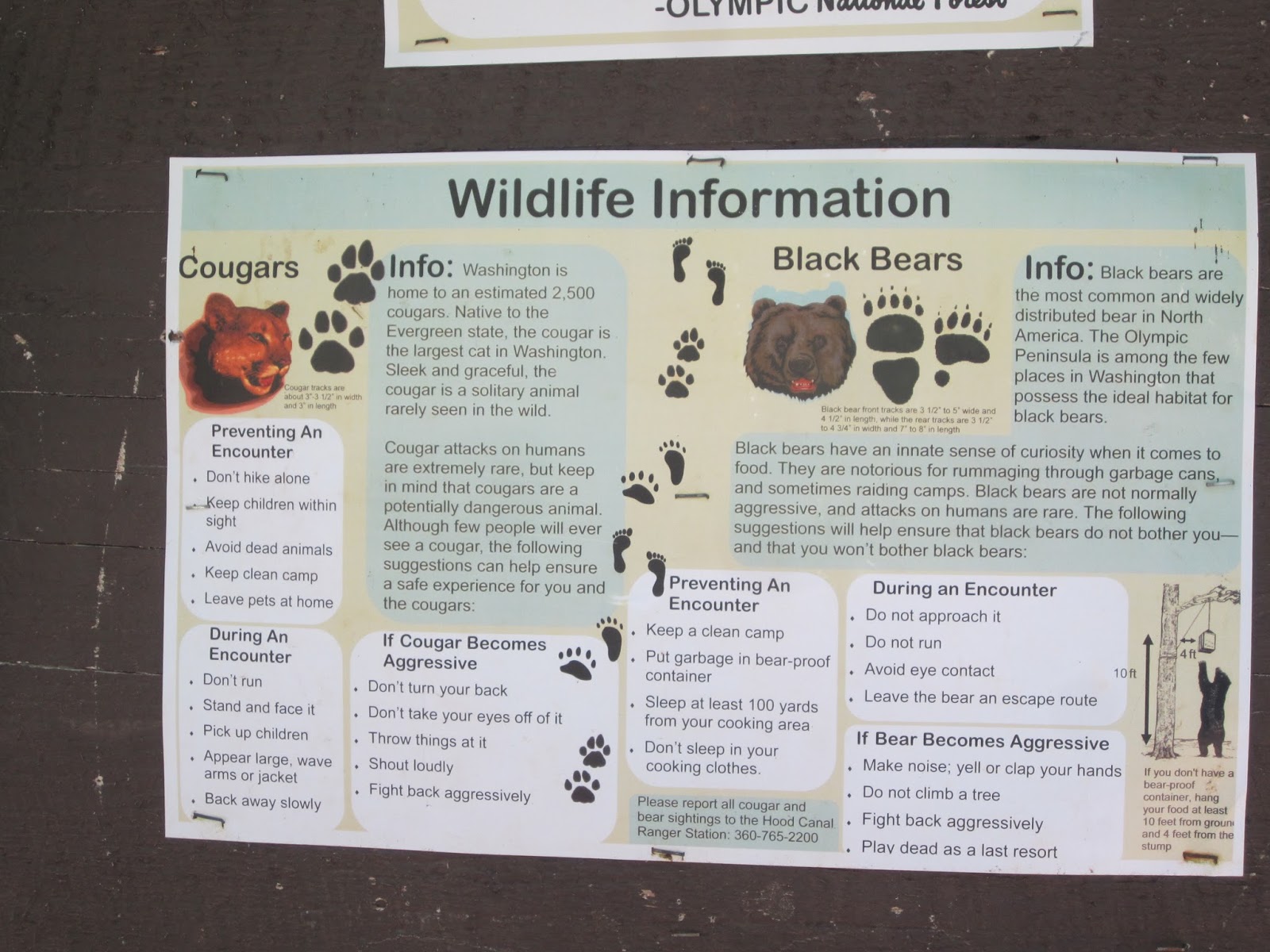
This poster provides information on what to do if one encounters a cougar or bear.  On another hike awhile back we did see a bear from a distance once but I don't care to come face to face with one.  This did little to alleviate fears as it served to remind me that we were sharing the woods with them even if we didn't see them.  Bob laughs.


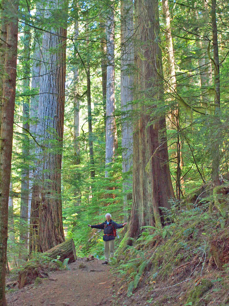
Amid tall Douglas Fir trees along the trail at 1500 ft. and bigger trees to be found at the campground at 2000 ft.