Thursday, October 16, 2014

If this is Thursday it must be postcards, 164


Totem Bight State Historical Park near Ketchikan, Alaska, ca 1960

Originally there was a Native village or fish camp near Ketchikan, Alaska called Mud Bight but the buildings and totem poles fell into disrepair in the early 1900s as the people left to find work in other communities.  In 1938 the Civilian Conservation Corps (CCC) began reconstruction of the site under the direction of Alaskan architect, Linn Forrest.  Skilled Native carvers were hired with the older members teaching the younger ones the art of carving totem poles. 

The plan was for the U.S. Forest Service to salvage and reconstruct as many of these large cedar monuments as possible.  Rotting totem poles were repaired or duplicated.  Every attempt was made to copy the originals in a traditional manner right down to using handmade carving tools.  Samples of the dye colors made from natural materials like clamshells, lichen, graphite, copper pebbles and salmon eggs were then duplicated with modern paints. 

The project slowed down with the advent of World War II but by then 15 totem poles and the community house were in place.  The name of the site was then officially changed to Totem Bight.  Before statehood in 1959 the 33-acre park was under the management of the federal government after statehood it transferred to the Sate of Alaska.  Then in 1970 it was added to the National Register of Historic Places.

There may not have been a community house, such as the one seen in the center of the postcard, when it was called Mud Bight but such houses, large enough to house 30 to 50 people, were typical in many early 19th century Indian villages.  The interior is described as being one large room with a central fireplace.  The floor was smooth wood with removable boards so house wares, blankets and treasured items could be stored below.  Food was hung from the beams and rafters.  Several related families would have lived in such a dwelling with a house chief as the leader.  The totem poles reflected the nature that surrounded the people and told stories since there was no written language.  Totem Bight is generally thought to be Tlingit but there is also evidence of Haida myths and legends in the carvings. 


The postcard was a product of Pacific Northern Airlines which later became Western Airlines in 1967 and then merged with Delta Airlines in 1987.  The stamp is a 7 cent airmail stamp.  Airmail stamps were used within the United States from 1918 to 1975 and internationally until 1995. 

For more information, please see:
http://en.wikipedia.org/wiki/Totem_Bight_State_Historical_Park
http://dnr.alaska.gov/parks/units/totembgh.htm
http://en.wikipedia.org/wiki/List_of_United_States_airmail_stamps

Thursday, October 9, 2014

If this is Thursday it must be postcards, 163


During our stay in Salzburg, Austria we walked from the hotel to the Mirabel Gardens several times and even attended a concert in the palace one evening.  The gardens are lovely with new things opening up daily so there were surprises and delights with each visit.  The photo on the card was taken from the gardens looking toward the castle that was featured in a previous postcard Thursday.  Hans-Jörg Murenwald, Edition Murenwald bei Colorama, took the picture. 

The palace and gardens are listed as a UNESCO World Heritage Site and are part of the historic central area of Salzburg.  The Prince-Archbishop Wolf Dietrich Raitenau had the palace built in 1606.   The name Mirabel was attached in 1612 and comes from the Italian mirabile, bella meaning amazing or wonderful.  The palace has undergone several changes, for example in 1710 it was rebuilt in a Baroque style and in 1818 it was restored to a Neoclassical style following a fire.  The gardens are arranged in geometric patterns with statues from mythology, some dating as early as 1690.  The rose garden is shown in the foreground of the postcard photo.

Salzburg is known for being the birthplace of Mozart and also as the “Sound of Music” city with parts of the movie filmed at Mirabel.  The palace and gardens are also popular locations for weddings.


Looking toward the palace from the entry into the gardens


Garden flowers


Looking the opposite direction toward the castle fortress on the hill


Tree lined pathway with convenient benches


Mimes or living statues stood at this corner in the garden.  They did move and pose with visitors but for extremely long periods of time they simply stood like a statue. 


Musicians like this man playing the harp were here everyday near a small outdoor café.  Each day someone is playing a different instrument. 


The fountain seen in the movie “Sound of Music”


Rose Garden


Trees trained to grow on the trellis form a covered shady arbor to walk through on a warm sunny day


From a outdoor balcony looking toward the hill and the castle


Inside the palace . . .


The evening concerts at the palace are held in this room


The grand staircase


By evening light . . .

For more about Mirabel see: 
http://en.wikipedia.org/wiki/Mirabell_Palace

Wednesday, October 8, 2014

Urban water walk


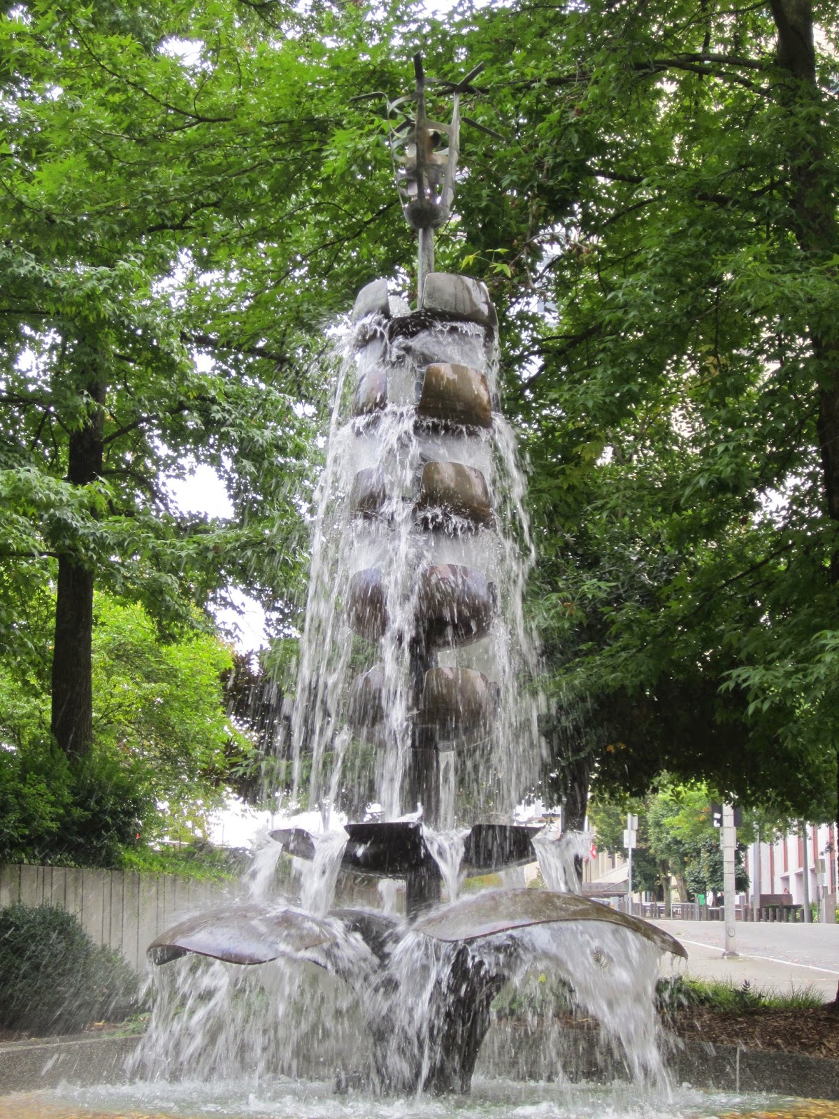
It is perhaps not news that it rains in Seattle therefore when the forecast looked like rain we planned a rainy day city hike.  The household downsizing-cleaning project has complicated the hiking schedule so a destination in the downtown business section of the city instead of driving an hour or two to the mountains or beaches seemed like a good choice.  The adventure began with the Freeway Park.  I have driven under the park many times but had never visited it.  We parked the car in the Convention Center garage and headed out to find as many water sculptures as we had energy and time to do.  This meant going up and down some very steep inclines and walking about 3 miles round trip.   It also involved a stop for lunch and a browse through the Mystery Book Store where all the books for sale are mysteries.

Here is a sampling of what we saw . . .


This walkway greets the visitor as he or she exits the Convention Center.


Then the park opens up and it is amazing to see plants and trees growing on top of the freeway.


One section is called “The Canyon” and has several waterfalls.  A sign explains that water is employed in the park to deaden the sound of traffic and it is very effective.  The soothing sound of the water is more pleasant than the bustle and noise of cars and buses.


There were still a number of beautiful flowers in bloom.


Across the street from Freeway Park is a George Tsutakawa water sculpture.  Tsutakawa was a well-known painter and sculptor in Seattle.  In the 1970s he built approximately 75 fountains of which several are found in the Seattle area and others can be found throughout the world but not all of them still have flowing water.


Naramore Fountain by George Tsutakawa, 1967 made of bronze and concrete it is located at the corner of Sixth Avenue and Seneca Street.
 Another Tsutakawa fountain, shown below, is placed in front of the main branch of the public library.  Unfortunately the day we visited it the water was not flowing through the sculpture so we did not get the full effect.  We later learned that the water in some fountains is turned off during the fall and winter months.


One fountain was a simple configuration of nozzles or spouts in the sidewalk.  The water rushed up and then ran off the side to a running channel, was recycled and shot up again and again.  We saw something very similar to this in Salzburg, Austria.  There on a hot summer day little children played with the water as it spouted up out of the sidewalk.


The Waterfall Park is found near Pioneer Square and is a lovely courtyard of trees, flowers, and water.  The park was donated to the city by the Annie B. Casey foundation in 1977 to honor United Parcel employees.  A small welcome plaque states that this site is the birthplace of United Parcel.  


Across from the Seattle Art Museum is the long stairway, the top two sections have small falls. 


Two Union Square has a secluded courtyard with a beautiful waterfall, tables and chairs and two balconies that afford views looking down onto the falls.


The Mystery Bookshop was a fun side stop and a good place to pick up a couple of books.


We stopped at the Juicy Café in the Convention center for a “bowl” lunch that was served in a paper box—Ginger Peanut Chicken Salad in one bowl and Italian Chicken Pesto Salad in the other.


Yum, yum
Looking down from the café level we noticed yet another fountain inside the Convention Center

Thursday, October 2, 2014

If this is Thursday it must be postcards, 162


 Dutch Wedding Rocks, Colorado

The Dutch Wedding Rocks postcard above was one found at the Marietta, Ohio Antique Mall last March when we were visiting.  I thought these natural rock formations were very interesting and wanted to learn a bit more about them.  Sanborn Souvenir Co., of Denver Colorado, produced the card.  It has a cancellation date of 22 July 1944 and a one-cent George Washington profile stamp.  On the reverse side there is a brief description stating that these rock formations are located in the valley east of the Woodmen Sanatorium.  The rocks acquired their name because some of them are standing close together like a bride and groom might.

These strange formations are variously called tent rocks, fairy chimneys, earth pyramids, and hoodoos.  They are products of erosion.  The tall thin spires are composed of a softer rock while a harder, less easily eroded rock, forms the top.  The top makes an umbrella for the “stems” protecting them from the elements.  They generally form within sedimentary and volcanic rock formations.  Although the ones on the card are from near Colorado Springs, Colorado, a good example of this type of erosion on a larger scale can be found in Bryce Canyon National Park in Utah.   Hoodoos are commonly found in the Colorado Plateau, in the Badlands of the United States and in Canada; however, they can also be found in places such as Turkey, France, Serbia, and Taiwan.   The French sometimes call them “ladies with hairdos” (demoiselle coiffées) while in Serbia they are referred to as “towers.”  Some effort is being made to slow down the erosion of unusual or iconic examples. 

Hoodoos can be as tall as a person or as high as a ten-story building.  Erosion is caused by a combination of wind, heating and cooling, and acidic rain.  The softer rock is often mudstone, sandstone, or something called tuff a consolidated volcanic ash.  A harder magnesium-rich limestone called dolomite forms the most durable cap on hoodoos.

The rocks shown on the card are now on private property so it is no longer possible to visit them. 

A notation at the upper right of the card margin states that these formations are located near the Woodmen Sanatorium.  Today this fraternal benefit society is called the Modern Woodmen of America and provides life insurances plus annuity and banking products to its members.  Joseph Cullen Root founded it in 1883 in Lyons, Iowa.  The name came from a sermon he heard describing the good that was derived from woodmen clearing the forest to build homes, communities and security for their families.  The words “modern” and “of America” were added later to stay current and to symbolize patriotism. 

In the early 1900s there was an epidemic of tuberculosis (TB) and the Woodmen opened the sanatorium to provide free treatment to more than 12,000 members.  The care included board, lodging, treatment, medicine, dental work and laundry at no expense to the patient.  The sanatorium is on 1,000 acres and cost $1.5 million to build. 

Please see the following for more information about the hoodoos and the Woodmen

http://dougniedermillerphotography.com/2009/12/28/the-hoodoos-of-colorado-springs/
http://www.route40.net/page.asp?n=6482
http://en.wikipedia.org/wiki/Hoodoo_%28geology%29
http://en.wikipedia.org/wiki/Modern_Woodmen_of_America

Monday, September 29, 2014

Dege Peak


Last week the weather was supposed to be nice with temperatures around 70 degrees F and we decided to do one last summer hike.  We will still do hikes in the fall but as the season moves into autumn and the weather deteriorates some places will not be as accessible as they are in the summer months.  Dege Peak in Mt. Rainier National Park at slightly more than 7,000 ft elevation is one of those places.


We parked in the lot by the Sunrise lodge and started up the Sourdough Ridge trail.  It would be approximately a 4 mile round trip hike with about 700 feet of elevation gain from the parking area.  On a previous trip we had turned to the left toward Frozen Lake and the Mt. Fremont lookout, this time we headed right toward Dege Peak.  The trail is sandy and quite broad at the beginning but it narrows and gets rocky as it goes up.  The last section is steep and very rocky.  When we got to the top I was surprised to find out that the two men who had passed us on the way up were professional photographers and had been carrying about 100 lbs of camera equipment.  They were setting up a tripod and taking pictures of Mt. Rainier and the surrounding area.  Three young women also reached the summit while we were having a snack.  They had had to take rests about as often as I had so I didn’t feel to bad about the slow pace after that. 


It was a beautiful day with the mountain visible at all times.  There was a lenticular or cap cloud hovering over the summit that changed throughout the day.  Clouds below us were creeping in between the other mountains and foothills.  Rain was forecast for late afternoon and I thought we might get wet before we got back to the car but although we felt a couple of drops the rain did not start until we were safely on the way back to town inside the car. 


Not many flowers were still in bloom, most had gone to seed but only a few were decked out in bright fall colors like the Mountain Ash.


Mop head


Blue bell of Scotland


Lupine


Aster


Mountain Ash


Pine White butterfly on Pearly everlasting


Looking east from the top of Dege Peak toward Sunrise Point


Dege Peak from the trail


Craggy views along the trail


The cap cloud had worked its way down the mountain to form a ring and left the top free of clouds for just a little while.


Almost back to the trail head and the parking lot with only a couple of rain drops . . .