Thursday, November 28, 2024

if this is Thursday it must be postcards, 687


Thanksgiving, ca early 1900s


This card is a reproduction by the small local printing company, Laughing Elephant.  They specialize in printing vintage cards, books, and posters.  It may not be the traditional cornucopia usually seen on Thanksgiving Day cards but it contains most of the ingredients from cornstalks with ears of corn, pumpkins, apples, grapes, and fall leaves. 


My wishes to all of you, Happy Thanksgiving!  I hope you all can spend time with loved ones, enjoy good food and conversation, lots of laughter, love, and share thanks for times past as well as look forward to things to come.


If you want to see other items printed by Laughing Elephant, here is a link:


https://laughingelephant.com/


Thursday, November 21, 2024

If this is Thursday it must be postcards, 686


Edgartown Light House and The Harbor View Hotel, Martha’s Vineyard, Massachusetts


This unused postcard was probably originally available at the Harbor View Hotel, seen at the right.  It is a tourist card produced by McGrew Graphics and printed in Kansas City, Missouri with has the number 531180 at the bottom of the center line on the reverse.  At the upper left is a blurb:  “The Harbor View Hotel Edgartown, Martha’s Vineyard Island, Mass. 02539.  Telephone (617) 627-4333.  Overlooking our picturesque harbor is the famous Edgartown Light House.  The Harbor View at the right, is equally famous.”


In the late 1700s and early 1800s there were a large number of vessels, mostly whalers, frequenting the harbor necessitating a lighthouse at the harbor entrance.  The original Edgartown Lighthouse was a Cape Cod style two-story Keeper’s house, built of wood on wooden spiles, similar to piling, on an artificial island ¼ mile from shore in 1828.  It was the first lighthouse at the entrance to Edgartown Harbor and also served as the lighthouse keeper’s home.  In 1830 a wooden causeway, known locally as the “Bridge of Sighs,” was approved and built.  People would gather on the causeway bridge to watch the whaling ships depart on voyages that could last up to 5 years, hence the nickname for the bridge.  The old lighthouse structure, which had had several rebuilds and repairs, was demolished and replaced by the current cast-iron tower in 1939.  Today it is surrounded by a beach made of accumulated sand around a stone causeway that connects to the mainland.  


For additional information, see:


https://en.wikipedia,org/wiki/Edgertown_Harbor_Light


Friday, November 15, 2024

PepperWool knives


My son, Beren, has just launched his new pocket knife, the Merino MM. It is elegantly beautiful as well as useful and carefully engineered. Check it out on the website: https://pepperwool.com/ or to order one use this shortcut link: https://pepperwool.com/merino-mm/

Thursday, November 14, 2024

Troublesome Creek Trail, Index, 2024


Troublesome Creek


 The day we hiked the Erinwood trail we also hiked the Troublesome Creek trail.  There are several tributaries that feed into the North Fork Skykomish River and Troublesome Creek is one of them.  The campground is about 15 miles from Index on the Index-Galena Road that has been closed for about 7 or 8 years due to river washout.  Open now, the new road is paved, up higher on the hill, with crews installing erosion control terraces and plantings going in on the day we visited.  


One of the other tributaries to the North Fork Skykomish River, Trout Creek 


Named Troublesome Creek for the difficulty the railroad had in getting around it, the camp ground is closed for the season but the trail can still be accessed.  We passed one small outhouse that was part of the camping area but it looked like it was locked, hence prepare for no facilities if you want to hike here in late fall or early winter. 


Most of the trail looks like this


With just a few stairs


The trail we took is a loop with a lower path following along the creek and an upper mini loop that joins the lower loop again before returning to the campground proper.  We chose to do the lower loop since it was right along the creek which is really a small mountain river with a torrent of fast, powerful water running down the day we were there.  We followed the upper loop for a short distance to see where it went, but preferred being along the water so turned around and kept to the lower trail.  It is a short loop even adding the extra part of the upper loop.  Bob estimated that it ended up being about the same as the Erinwood trail, .8 miles for the loop. 


Metal bridge


 Wooden bridge


There are two sturdy foot bridges crossing the creek that offer opportunities to take pictures of the rapids, falls, and rushing water in the creek. 


 Pools


 and rapids


with water that is incredibly clear and a blue-green color.  There are pools, rapids, waterfalls and wonderful water music all along the lower loop trail.


 Our only animal sighting for the day was this busy, busy, woolly bear caterpillar hurrying to somewhere ...


 Little yellowish mushrooms


Medium sized flat topped brown mushrooms


Larger pink-purple cup shaped top mushroom


Cream colored concave mushrooms


There were mushrooms growing in this forest too, but perhaps not quite as many as we encountered in Erinwood.  


Only one place with an almost obstacle--Watch your head


 North Fork Skykomish


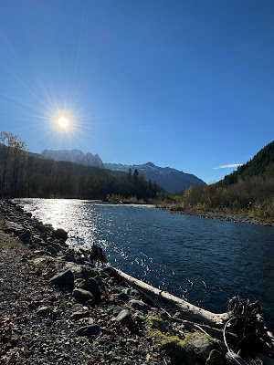
On the return trip toward Index, we pulled over and took a picture into bright sun over the North Fork Skykomish River.


Looking over the roof tops of Index was this view of the peaks in the Wild Sky Wilderness.


All in all, a wonderful day of solitude and peace, cool but not too cold, sunny and bright, no traffic noise, and beautiful nature surrounding us.


Count for the day:

No people, no dogs

.8 mile loop, a couple of small hills, no perceptible elevation gain

65 miles from home


If this is Thursday it must be postcards, 685


Chapel by the Lake, Auke Bay, Alaska, ca 1960

[photo by Howard C. Robinson]


The unused postcard shared this week features a photo by Howard C. Robinson of the Chapel by the Lake.  At the bottom left on the reverse there is C8716 and credit to Robinson.  At the upper left on the reverse is a short blurb:  “World famous Chapel by the Lake, Auke Bay, Alaska, with Mendenhall Glacier in the background.”  The card was published by C.P. Johnston Company of Seattle, Washington using color by Mike Roberts.  This card was one of several found in a jumble box at a local antique mall. 


Architects Howard Foss and Linn A. Forrest designed this Presbyterian church located in Auke Bay, Alaska.  Construction began in 1954 and was completed in 1958.  There is no date or postmark on the card but the date of the card can be estimated based on the new-like appearance of the interior shown on the card.  The style is an example of Rustic architecture.  There are large windows behind the altar that look out across Auke Lake to the famous Mendenhall Glacier.  The scenic, suburban location makes this chapel a popular venue for weddings. 


Auke Lake is found in Auke Bay, Juneau, Alaska.  In addition to Dolly Varden, cutthroat, and steelhead there are four other varieties of salmon live in the lake.  The views from the Glacier Hwy side of Auke Lake are often photographed. 


Mendenhall Glacier has been significantly receding.  When my parents visited in the early 1960s the glacier was close to the visitor center and the lake was much smaller with almost no beach.  When Bob and I were there in 2019, Mendenhall Lake had increased and the visitor center was at the beginning of a trail down to the large lake beach.


 Mendenhall Glacier, 2019


As can be seen in these photos from 2019, Mendenhall Lake has grown in size between the edge of the glacier and the pathway down from the visitor center.  The glacier is still massive but is continuing to shrink. 


Mendenhall Glacier and beach with people standing by the lake, 2019 


Mendenhall Glacier is about 13.6 miles or 21.9 km long and is located about 12 miles or 19 km from downtown Juneau.  The glacier and the surrounding areas are protected as the Mendenhall Glacier Recreation Area within the Tongass National Forest.  Since 1942 the Juneau Icefield Research Program has monitored the outlet glaciers.  Since 1929 when the lake was created, the glacier has receded 1.75 miles or 2.82 km.  It has receded a total of 2.5 miles or 4 km since 1500.  A statement from the U.S. Forest Service, which manages the Mendenhall Glacier, says: “because glaciers are a product of climate, they respond to climate change.”  The glacier is expected to continue receding in the foreseeable future due to a generally warming climate in Southeast Alaska. 


Nugget falls, the beach, lake, and Mendenhall Glacier, 2019 


Nugget Falls


Mendenhall Glacier Visitor Center, 2019


https://en.wikipedia.org/wiki/Chapel_by_the_Lake

https://en.wikipedia.org/wiki/Mendenhall_Glacier

https://en.wikipedia.org/wiki/Auke_Bay,_Juneau

https://en.wikipedia.org/wiki/Auke_Lake


Wednesday, November 13, 2024

Erinswood Trail, Index, 2024


Sign pointing the way to the Erinwood trail, Index


This past week we planned to hike to Heybrook Ridge near Index.  We had been on this trail before and were looking forward to waterfall views.  However, we had not counted on high water from previous rainy days, nor the broken rail on the two-log crossing, or the slippery rocks, mostly submerged in quick running water.  Bob tested out both the log “bridge” and the stepping stones and pronounced both too slippery.  The risk of one of us falling was too great to chance it.  A short off-shoot loop on the Heybrook trail is a newer trail that is still being worked on.  It is the short Erinwood trail.  We decided to try it.  This is a free county park with land purchased by the county and the community to preserve the forest. 


Rain forest, moss everywhere


Nurse logs with new trees growing in the old stumps


Erinwood is an extremely nice, wooded area trail.  It has the feel of a rain forest with moss growing on all sides of the trees and fuzzy mossy branches making strange shapes.  At this time of the year the leaves on the deciduous trees are mostly down, the flowers are gone, but there are mushrooms aplenty nearly everywhere.   


Licorice ferns growing on the tree trunk


Licorice ferns grow in profusion on the trees. It is quiet, and solitary.  The area was logged and interesting nurse logs now playing host to another tree can be spotted all along the route.


Mushrooms


More interesting mushrooms


Mushrooms growing in the moss


Tree almost covered in mushrooms


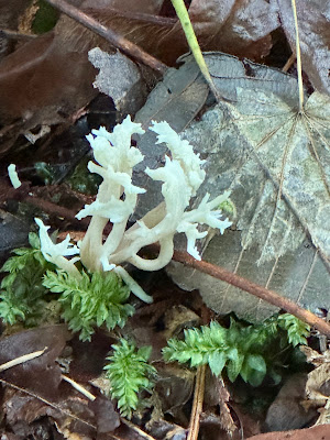
 White coral mushroom


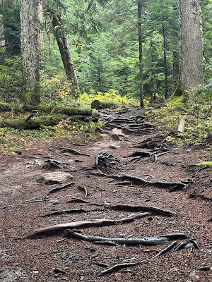
Trail surface is dirt and gravel covered in damp decaying fallen leaves


The trail surface is mostly packed dirt with gravel on some parts.  Probably the entire trail will have gravel when it is completed.  We enjoyed this walk in the woods.


The Heybrook Ridge trailhead parking area is fairly large.  There is a public restroom with flush toilets and running water a short distance away in the Index city park and a port-a-potty at the trailhead.  The trail winds and twists around until it finally meets up near the paper sign and rejoins the main trail back to the parking area.  The sign says the loop is .6 miles RT; however, we added a little by walking as far as the creek crossing to Heybrook Ridge, making it about .8 miles RT.  This seemed like not quite enough, so we drove another approximately 15 miles, on a road that had been previously closed but is now open, to the Troublesome Creek camp ground where there is a slightly longer loop trail.  There will be a separate post about the Troublesome Creek trail.


Count for the day, .8 miles RT

No people, no dogs

About 50 miles from home


Thursday, November 7, 2024

If this is Thursday it must be postcards, 684


Saint Mary Lake, Glacier National Park, Montana, ca 1998

[photo by Diana Stratton]


This used postcard features a photograph by Diana Stratton of Saint Mary Lake and Goose Island located in Glacier National Park, Montana.  Goose Island is the small island in the center.  The card was produced by Billings News, Inc., Billings, Montana.  At the upper left corner on the reverse is #10822 and a blurb:  “St. Mary Lake and Goose Island one of the most photogenic views in beautiful Glacier National Park.”  Some damage on the card from the postal machine has been photo-shopped out.


Saint Mary Lake is the second largest lake in Glacier National Park.  It is located on the east side of the park along the north shore.  The lake is 9.9 miles or 15 km long, 300 ft or 91 m deep.  Because the lake is at an altitude of 4,484 ft or 1,367 m the waters stay cold and rarely rise above 50 degrees F (10 degrees C).  Wild Goose island’s high point is only 14 ft or 4.3 m above the lake.  The lake freezes over in the winter with ice sometimes up to 4 ft or 1.2 m thick. 


There are 130 names lakes in the park, 1000s different species of plants and hundreds of species of animals including grizzly bears, moose, mountain goats, wolverines, Canadian lynxes birds, and fish.  The mountain goat is the park symbol. 


Glacier National Park in northwestern Montana on the U.S. Canada border was established in 1910.  This park borders the Canadian Waterton Lakes National Park.  In 1932 these two parks became the first park designated as an International Peace Park and the joint parks with the name the Waterton-Glacier International Peace Park.  Both parks are United Nations Biosphere Reserves (1976) and World Heritage Sites (1995).  Additionally in 2017 “the joint park received a provisional Gold Tier designation as Waterton-Glacier International Dark Sky Park through the International Dark Sky Association.” [from Wikipedia.org].  It is the first trans-boundary dark sky park.
 

For additional information, see:


https://en.wikipedia.org/wiki/Glacier_National_Park_(U.S.)

https://en.wikipedia.org/wiki/Saint_Mary_Lake


Sunday, November 3, 2024

Denny Creek Trail, Snoqualmie Pass, 2024


Sign at the Denny Creek trailhead


Our most recent hike was a short one to the water slide on Denny Creek.  It was a cold, drizzly day but the best weather day for the week.  Puffy jackets and long johns, gloves and hats helped keep us warm and dry.  The newer main parking area serves three trails, Denny Creek, Franklin Falls, and Wagon Road.  There are newer outhouses at the main upper parking area and also at the handicapped parking area below the main lot.  The old Denny Creek parking trailhead is closed to cars.  The small outhouse there was closed for the season.  The Wagon Road is another way to get to Franklin Falls.  Since it is only 55 miles from Seattle, it is a very heavily visited hiking area.  However, on a cold, rainy day there were not many people.


Roots, slippery when wet


Stairs


more stairs


and still more stairs

Part way up to the slide is this newer bridge over the creek


We have hiked this trail before but this time we found it full of rocks, roots, and stairs.  Lots of stairs.  Trail crews sometimes think that stairs are an improvement on trails but uneven stairs are very hard on older legs, both going up and coming down.  We will take a walk-around slope in lieu of stairs, if there is one available, almost every time.   


Stairs down to the water slide and the log bridge crossing the creek


There was mud and standing water on the trail in a few places and one small creek we walked through.  Our boots are waterproof, so no problem.  There has been some erosion since we were last here also, but we are now a little older too and that makes a difference.  For instance, we did not attempt to use the log bridge, that does not have a railing, over the rushing water in the creek.  We might have considered doing that a few years ago but not now.  Also, our turn around destination this time was just getting to the slide.  Continuing up across the creek about another ¾ mile are the spectacular Keekwulee Falls. Denny Creek lower falls are a view through trees, while the upper Denny Creek falls are at the top of the water slide.


Denny Creek lower falls


Denny Creek upper falls


It is too late in the season now for flowers but fall colors are still out and there are various shapes, sizes, and colors of mushrooms all along the trail.   I do not know mushrooms, but used a field guide to guess the common names. 


Shrimp mushroom


Brown coral fungus


Yellow coral fungus


Tiny witch's butter


Tiny tan mushrooms growing on log


Angel Wings


Clump of white mushrooms


Someone had turned part of the clump over and I thought the underside was pretty


Violet Cort


Most of the trail is quiet and woodsy.  However, one section goes directly under the I-90 freeway and there is audible traffic noise.   


 Denny Creek


More pleasant are the burbling sounds of the water in Denny Creek and peek-a-boo views of rushing water here and there. 


Count for the day:

13 hikers, 2 dogs

540 ft elevation gain

3 miles RT

55 miles from home