Thursday, May 25, 2023

If this is Thursday it must be postcards, 608


Schloẞ Hellbrunn [Hellbrunn Palace], near Salzburg, Austria, 1916


It is always delightful to find a vintage postcard showing a place I have visited.  This used card is dated 23 November 1916.  It has a black and white photograph of one of the Hellbrunn trick fountains with part of the palace in the background.  A section of the Royal Table and two of the stools are visible in the foreground.  The back of the card is divided but aside from the title at the upper left on the front of the card there is no other information about the photographer or the publisher.


 The front view of Hellbrunn Palace, 2014


Markus Sittikus von Hohenems developed this resort for recreation.  He was the owner of Hellbrunn and the Prince Archbishop of Salzburg from 1612 to 1619.  His design used the natural conditions of the property rather than the strict geometry of that era.  Wherever there were springs and streams on the 60 hectares, or 148 acres, property he created fountains and creeks.  Helbrunn was named for the clear spring water.  It was meant to be a place to calm the spirit and enliven the senses, much like a modern spa. 


Helbrunn was used as a day residence in the summer, with the Archbishop returning to Salzburg in the evening.  Hence there are no bedrooms in the palace.  The grounds are famous for water-games and it is a popular tourist attraction in the summer. 


Guided tours are required with tickets purchased at the entrance to the park.  There is also a zoo on the grounds which we did not visit.  The day we were there it was overcast and rainy; however, even if it were sunny most people would opt for an umbrella and rain gear.  We never knew when the guide would turn on a sprinkler.  The only way into one grotto was by running through a sprinkler.  The stools around the Royal Table sent out sprays of water on the guests with the only dry stool the one for the host (the Archbishop).  All the trick fountains, the moving figures, and statues spouting water are run by gravity-water power.  The grounds are beautiful with lots of green trees, grass, statues, ponds with fish and ducks.


Here are few photos from when Bob and I visited in 2014.


View similar to that on the postcard, this shows the sprinklers that surround the table


The stools had sprinklers too

The trench in the center of the table was filled with cold water to chill the wine bottles when the Archbishop entertained.  On warm to hot summer days guests might be amused or not to find a spray of water on their backsides.  Since the spout holes on the stools and around the table were very obvious, I do not think the modern guides were successful in tricking any of the tourists to take a chance and sit on them.


Looking toward the table from the opposite end of the pool

 
The cabinet has doors that can be closed when not in use

Miniature figures depict everyday work and activities 


There are several attractions on the grounds including this cabinet with miniature figures performing everyday activities.  When turned on the figures move about all powered by unseen running water.


These tiny peek-a-boo houses can be found all along the small stream that runs through the park 


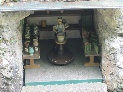
Inside the peek-a-boo niches are miniature figures working at various tasks like this potter

There are statues placed here and there all over the grounds


some spouting water into pools,


and in other places amusing animals, like this little goat, that rolls in and out of a small opening, spitting water as it goes.

There is a photographer, of course, who takes a group picture of all those who took the tour.  One need not purchase the photo but we did and it is a fun reminder of a day in an amusing and interesting park.


For more information, see:


https://en.wikipedia.org/wiki/Hellbrun_Palace


Hellbrunn Palace & The Trick Fountains, text by Micky Kaltenstein, graphic design by Christian Salic, 2011


Thursday, May 18, 2023

If this is Thursday it must be postcards, 607, part 2


Mont Saint-Michel, Hôtel Poulard atné, Grande-Rue, ca early 1900s


Last week the Thursday postcard had a view of the Abbey of Mont-Saint-Michel as seen through a rocky outcropping.  However, as can be seen in this postcard street scene, there is more to the tidal island than just the church.  There is also village that is situated at the base of the hill upon which the abbey sits.  I found two additional cards from the same collection that have notes typed on the reverse.  Both cards have divided backs, putting the date from the early 1900s to the 1920s.  The typed note:  “The Main Street and the only street in the City.”  The card above was photographed and published by Neurdein et cie.  The number 26 is found at the lower left corner.  This French firm was founded in 1864 by Etienne Neurdein (1832-1918).  His brother, Antonin Neurdein (1846-1914), joined the firm around 1885.   


The company used the monogram, ND, found at the lower right corner on the card.  In 1920 the company was traded as Lévy (of Léon & Lévy or L.L.) et Neurdein.  


Le Mont Saint-Michel. – Le Chȃtelet et la Merveille, ca 1920s


This second card has the L.L. monogram at the lower right corner. The number 45 is found to the left of the title at the bottom of the card.  Typed on the reverse:  “A view of the Grand Cathedral [Abbey].”  Ground was broken for the building of the abbey in the 10th century and not completed until 1523.  There are two parts to the Mont-Saint-Michel abbey, the church-abbey and where the monks lived, called the Merveille.  It is located to the north of the church abbey.  The east side of the Merveille dates from 1218 and has three rooms:  chaplaincy, hosts room and the dining hall.  The west side, built 7 years later, houses the wine cellar, the Knights room and the cloister.  There were also an infirmary, hostelry, and the Saint Etienne chapel.  At times the abbey also served as a jail or prison which was finally closed in 1863.  The entrance to the main church was modified to limit contact between pilgrims and monks. The caption on the card tells us we are looking at the Merveille not the entire abbey.


Pilgrims would walk from Italy, Germany, England and other parts of France in medieval times to visit the abbey.  Today there are hiking trails created to enable modern pilgrims to retrace the paths their ancestors took.  Tourism is the main source of income for the community living the island.  There are about 50 shops in the town and approximately 3 million tourists annually.  The island also has museums, restaurants and some hotels.  Only about 25 people including monks can stay overnight at the abbey living quarters.  Mont-Saint-Michel has been a UNESCO world heritage site since 1979.


Since this inked stamp is found on the reverse side of the cards, it suggests that the cards were purchased at a gift shop on the island.


For additional information, see:


https://en.wikipedia.org/wiki/Mont-Saint-Michel

https://en.wikipedia.org/wiki/Mont-Saint-Michel_Abbey

https://commons.wikimedia.org/wiki/Category:Neurdein

https://www.britishmuseum.org/collection/term/BIOG215364

https://artsandculture.google.com/story/5QVxL6fbiWgAJw


Friday, May 12, 2023

Cranberry Lake, 2023


Cranberry Lake trail head


Cranberry Lake is part of the Anacortes Forest Lands system.  We had not hiked this trail before but stopped here a few weeks ago to check it out.  That day we walked just a little way and made a plan to return and walk all around the lake.  It is about a 2 mile RT loop.  There is a port-a-potty in the parking area.  A short way in, the trail branches off with one branch going up and the other staying low right next to to the lake edge.  


Our first mistake was thinking that the low trail would be even and level all the way around.  We left the trekking poles in the car by accident and were not far from the car when we noticed we didn't have them.  Okay, this should be short, mostly level and no problem without poles, so we opted not to go back and get them.  We made it all the way around but we will not do this again!  


Not far from the start of the trail, the northeast corner of the lake


Canada geese


The trail was about this close to the edge of the lake for most of the loop


Reflections in the lake, about half-way around


At the southern end of the lake


Huge lily pads, not in Cranberry Lake but in Big Beaver Pond along the detour route 


Yes, the views of the lake, the wildflowers and birds are wonderful.  Yes, the lower trail does follow the edge of the lake mostly all the way around.  There was a slide or trees down in one section and a detour rerouted us up and around the bad place before returning to the normal lakeside trail.  The worst part; however, is the trail condition.  Bob described it as a scramble without vertical gain.  About 80% of the trail is full of roots and rocks, narrow, steep ups and downs, almost impassible without poles.  Bob had to provide his hand to help me in many of these places.  We were slow going, it took us about an hour and a half to go half way around.  This is not a trail that I would recommend for senior citizens, especially without poles.  

 Where the upper trail rejoins the lower lake trail there is a great improvement in the majority of the remaining trail condition.  Although in one place we had to hang onto three trees to get down a particularly rough section most of the return trail was much better than the other side. 


We saw at least a dozen calypso orchids at Cranberry Lake and another dozen at Heart Lake


Sedge going to seed


Chickweed Monkeyflower

We were not sure what this was until we checked it out in Wildflowers of the Pacific Northwest by Mark Turner & Phyllis Gustafsson.  This is our go-to reference book when we cannot find plants in any other book or online. 


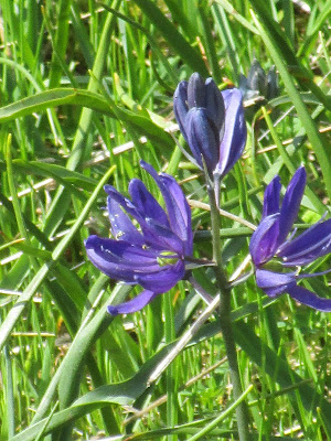
Camas

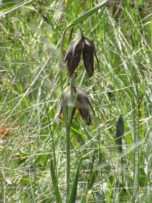
On the return portion of the loop we came upon a hillside meadow filled with blue camas and sea blush with one chocolate lily way up at the top.  The rocky ground was similar to Goose Rock where these same flowers are also found. 


Sea Blush


Wildlife for the day, small garter snake swimming in the lake


We also saw a Great Blue Heron very close by but it was flying, stopping briefly, and flying too fast to get a good picture. 


Count for the day:  2 people, no dogs


Heart Lake


Twinberry


After leaving Cranberry Lake we drove over to Heart Lake and walked along a much nicer trail for a little way.  The Heart Lake trail is an out and back not a loop.  There is a large parking area and a boat launch.  A few people had set up folding camp chairs and were fishing at the launch area.  The outhouse was roped off and looked as if it was getting a cleaning before opening for the season.


Thursday, May 11, 2023

If this is Thursday it must be postcards, 607, part 1


5. Mont-Saint-Michel (Manche) “The Mount Saint-Michel,” France


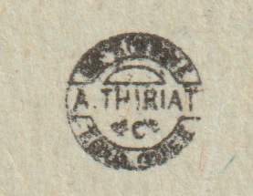
This is a completely different view of Mount-Saint-Michel than is normally photographed.  The Vintage postcard is damaged, a corner is missing, but the picture is interesting, so I chose to add it to my collection.  The left edge of the card is perforated, which suggests that it was originally in a booklet of several “tear out” cards.  Along the upper left side is the name of the editor:  J. Sorrel. The printer-publisher logo was printed at the center line on the reverse.


Logo found on the center line, reverse side


The famous abbey of Mont-Saint-Michel is located on a tidal island in Normandy, France.  The first monastic establishment was constructed here during the 8th century.  Once the Mont was on dry land but as sea levels rose, erosion occurred over.  Several outcroppings of granite were left in the bay and produced the tidal island.  It was accessible at low tide allowing pilgrims to cross on dry land.  At high tide those on the island would be stranded. 


 Modern aerial view

By User:Fabos~commonswiki - Own work, Public Domain, 

https://commons.wikimedia.org/w/index.php?curid=604843


During the reign of Louis XI the island was used as a prison.  The tides also provided defense during wars as enemies were driven away by incoming water or drowned.  As an example, during the 100 years ward an attack by the English in 1433 was repelled by a small garrison.  The original tidal causeway was raised in 1879 to help prevent erosion around the mount.  Dikes on the coastal flats created pastureland and decreased the distance between the shore and the island.  


The new bridge

 By Mathias Neveling - Own work, CC BY-SA 4.0, 

https://commons.wikimedia.org/w/index.php?curid=34173554   


 As silt accumulation threatened the island the French government began a project starting in 2006 to build a hydraulic dam, remove the causeway and a visitor car park.  Since 2012 a new car park on the mainland has been built about 1.5 miles or 2.5 km from the island.  In 2014 a new bridge opened to the public.  The new bridge improves the water flow around the island and the efficiency of the dam.  Visitors can walk or use shuttles to cross the causeway.


For additional information, see:


https://en.wikipedia.org/wiki/Mont-Saint-Michel

Modern pictures from Wikipedia.

Friday, May 5, 2023

Price Sculpture Forest, Whidbey Island, 2023


Sign at the parking area


This was a new place for us to visit near Coupeville on Whidbey Island. The sign is by the entrance and the parking area.  This is a non-profit outdoor gallery, no fee to park or walk through.  Donations are welcome.  There is a port-a-potty in the parking area.  


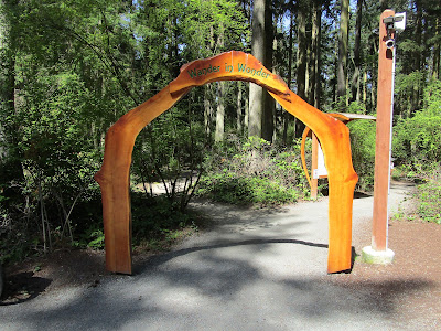
The entry to the loop trail is through this archway 

[Entry arch and kiosks by Michael Hauser and Ken Price]


The trail is two loops, Nature Nurtured and Whimsy Way, linked together to form a figure 8.  The sculptures are placed within the forest along the .6 mile trail that winds up and down and around.  It is open from 8 am to 7 pm (or sunset) everyday year round.  No bikes or dogs permitted on the trails.

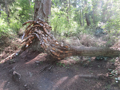
Here is a sampling of what the visitor will encounter while walking on the trail through the forest.


Attacking Eagle by Greg Neal


There are two eagle sculptures in the forest by the same artist.  This one titled Attacking Eagle and the other is called Soaring Eagle. 


Playa Flowers by Jeff Tangen


Tyrannosaurus Rex by Joe Treat


Wind Shear by Jeff Kahn


Nature's Keystone by Anthony Heinz May


Lichen Series:  Spore Patterns by Jenni Ward


Pentillium by Gary Gunderson


Life Tree by Andrew Woodard


We Are Water by Sue Taves


Count for the day:  2 people, 9 deer


For more information, see:

https://sculptureforest.org/


Thursday, May 4, 2023

Goose Rock, 2023


Goose Rock, Deception State Park


Goose Rock is a place we like to hike this time of year for the views from the top and to see the wonderful wildflowers.  We were not disappointed.  The day was perfect, cool but sunny.  This is a 2 mile RT loop.  The Discover Pass or a day use fee is required.  We parked in the lot just across the Deception Pass bridge where there are about 20 parking spaces and public restrooms.  There are stairs that lead down to the trails from the parking area.  One trail heads farther down to the beach and another trail that goes under the bridge and forms a junction with two trails branching off to head up the Goose Rock Loop.  We prefer to take the shorter right-hand trail and head up steeply to the top, enjoy the view from the top, then head back down the longer route that ends up back at the junction left-hand trail.  The elevation gain is about 500 feet with some ups and downs.  There are some very sharp, steep switch backs on the way down.  Hiking poles are extremely helpful in those spots.  There is one place on the way down that has a grove of native rhododendrons but it is still too early for them to be in bloom. 


Blue Camas


White Death Camas


Broomrape


Broomrape is a shy little flower that likes to hide in the grass and in between other flowers.  It is an annual; therefore, it is found near where it bloomed the year before but not usually in exactly the same place.  


Chocolate Lilies


Close up of Sea Blush


Close up of part of a Lomatium

Indian Paintbrush

Madrona tree blossoms


Larkspur

 
Star flower

 
Wild Morel mushroom


Looking down on the boats in Cornet Bay from the trail

 
Count for the day:  20 people including one baby being carried, 1 dog
2 miles RT, 500 ft EG