Tipsoo Lakes
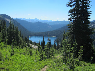
I have been on this trail three times now, first with a Mountaineers naturalist class, second with our friends R&D, and this time just Bob and I. We parked in the same lot to hike to Sourdough Gap three weeks ago where at that time there was a substantial snow bank. The snow was still there but had shrunk in size and there were also a few small snow patches but nothing that really covered the trail. Six very pretty lakes can be seen from along the way, also several views of Mt. Rainier and a peek-a-boo view of Mt. Adams in the distance.
Looking back at where we were three weeks ago, Sourdough Gap from the Naches Loop
Sourdough Gap is the V point by the big rocks at the top right on the ridge line
The first time I went on the trail we were caught in the middle of a thunder storm with short episodes of drenching rain, the second time it was almost unbearably hot, this time it started out cool with nice cool breezes and by the time we got back to the car it was about 65 degrees F. It was a very nice, sunny, pleasant day. The two previous times I waited at the lower parking area for Bob to retrieve the car and come get me, this time I was able to climb the last steep hill back to the upper lot. Thus after three tries I can now say that I have done the entire loop. It is one of those popular easier hikes that have a paved road to the trail head, nice parking, restrooms, and beautiful views so we expected to encounter many other hikers. Even though we counted 114 people it was far less crowded mid week than it must be on the weekends. There were bugs and bug spray is definitely needed.
The
first half of the loop trail is part of the Pacific Crest Trail that
crosses into the Rainier National Park where there are many signs
stating no pets are allowed in the park. Although we counted 4 dogs,
one pooch, with a rakish red polka-dot bandana tied around his neck,
turned out to be a “felon” being escorted out of the park together with
his owner by a Ranger. Bob said he thought at the very least the owner
would get a ticket and probably have to pay a rather hefty fine.
We have been on other sections of the Pacific Crest Trail and
occasionally run into hikers who are going the entire distance from
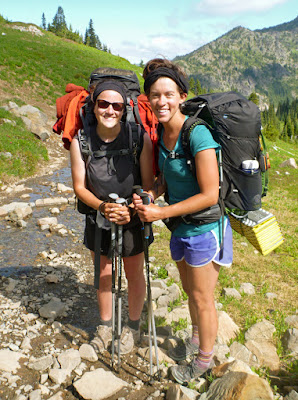
Mexico to Canada. This time we met two girls in their early twenties;
one had started from the Washington/Canadian border and the other from
Rainy Pass. Most through hikers we’ve met are going the opposite
direction, Mexico to Canada. It is a foot journey of 2659 miles and
usually takes 3 to 4 months. In contrast, our modest hike was about 4
miles round trip with a total gain of 700 ft that included some ups and
downs.
PTC through hikers
The east tarn, the first small lake or pond we came upon
Lupine
Avalanche Lily
Magenta Paintbrush
Looking down on Dewey Lake
Penstemon
One of my favorites, Beargrass
West tarn with Mt. Rainier
Butterfly posing
Moon over Mt. Rainier
Pink Monkey Flower
Mock Orange
Looking back at Tipsoo Lakes from the trail


No comments:
Post a Comment