Thursday, June 30, 2022

If this is Thursday it must be postcards, 562


Tromsø, Troms and Finnmark, Norway 


This picture of a postcard was sent by a Norwegian cousin who had visited here recently.  The photograph shows the city of Tromsø located in northern Norway. 


Tromsø is a city north of the Arctic Circle in Troms and Finmark county.  The city center is on the island of Tromsøya but the urban area is also found on the mainland.  Connections between the island and the mainland are by the Tromsø Bridge, seen in the photo, and the Tromsøysund Tunnel.  It is also connected to the island of Kvaløya by the Sandnessund Bridge.  The westerlies and a branch of the Gulf Stream, the North Atlantic Drift, make the climate milder here than most other settlements this far north.   Because it is so far north it experiences the midnight sun and the polar night depending on the season.


This area of Norway has been inhabited since the end of the Ice Age.  Some archeological excavations have turned up remains of buildings and artifacts 9,000 to 10,000 years old.  In the 890s the Norse chieftain Ohthere, who lived near the southernmost part of Tromsø, described himself as living furthest to the “North of all Norwegians.”  Places north of this are populated by the Sámi.  The first church on the island was built in 1252.  King Christian VII issued the Tromsø city charter in 1794.  With Bergen no longer holding a monopoly in the fishing of cod, this far northern city quickly rose in importance.  By 1900 it had become a major Arctic trade center.  Explorers Roald Amundsen, Umberto Nobile and Fridtjof Nansen recruited their crews and started their expeditions from here.


One of the largest groups of historic wooden houses dating from 1789 to 1904 north of Trondheim co-exist with modern architecture.  Wooden houses were banned in the early 1900s from the city center in several Norwegian cities, most likely due to fire danger.  Several festivals are held in the city during the summer.  Today tourism has exploded as an economic resource.


The Sámi are among the prominent minorities in this area of Norway.  There is a Sámi People’s Day and signs at the university are bilingual.  There has been a controversial attempt to get all public signage in both Norwegian and Sámi.  However, in 2013 the city agreed with the Sámi Parliament to strengthen Sámi language and culture in Tromsø.


For additional information, see:


https://en.wikipedia.org/wiki/Troms%C3%B8


Wednesday, June 29, 2022

Stan's Overlook, 2022


We have been to Stan's Overlook, Rattlesnake Mountain, several times since it is close to home, gives us elevation gain, some miles, and some flowers.  The trail goes on up to two more summits past Stan's and eventually down to Rattlesnake Lake.  There are trails open to hikers, horses, and bikes.  By the way, there are no rattlesnakes here.  Trailhead facilities include a newer style double outhouse and a large parking lot.  A nearby park has flush toilets and running water. 


This sign shows the bike routes, the difficulty levels, and other information.


Separate bike trails have been created and this time the parking lot at the trailhead was predominantly filled with cars that had bike racks.  In a few places the bike trails cross the hiking trail and Stan's is a popular place for hikers as well as bikers to rest before the bikes start down the Popping Tops. Hikers can continue on up or turn around and back to the trailhead.  


The hiking trail was once an old logging road and is wide in some places, narrow in places where the vegetation is starting to overgrow.  The walking surface for the most part is good, free of roots and rocks.  There was plenty of mud the day we went.  


Mud


In one place there is an arch of tree branches.  Here Bob hides under the bridge of branches by an old stump.


The trail crosses a logging road that is still in use, as can be seen by this logging truck.  The logging is being done on the south side of the mountain while all the trails are on the north side.


The view from Stan's Overlook.  Not terrific on the cloudy, cool day we were there.  On a clear day the view is obviously better.  It is a steady climb up to Stan's gaining 1050 ft in elevation.  The round trip for us was 5 miles.


There were 4 or 5 of these little guys foraging for leftovers.  Since lots of people stop at Stan's it has a picnic table and benches.  Although it is not a good idea to feed them people food, the chipmunks know where to look and how close to get to people.  They were pretty bold even when a biker arrived with a dog.


 There are two sets of stairs like these


There was a better selection of native plants and flowers this day:

Aven

Bald head waterleaf


 Bleeding heart


Trailing or Creeping Blackberry
 
 
Foam flower


Fringe cup and Aven
 

 Goat's beard


Nootka Rose

 
Yellow Scotch broom  (Scotch broom is invasive and weeded out, but the flowers are pretty.) 

Red and Yellow Scotch broom


Queen's Cup


Thimble berry


Vanilla leaf

Count for the day:  22 hikers, 7 dogs, 4 bikers
5 miles RT with 1050 elevation gain


Monday, June 27, 2022

Greenwater Trail, 2022


Trail sign


When we were here about the same time last year, we thought the water was high and running fast.  This year there was more snow, late snow, and cool days stretching into summer.  The result was even higher water, lots of river roar, and the partly broken bridge was really broken.  A sign at the trailhead said the trail was closed at the bridge, 2.5 miles out.  We had already decided that the bridge would be our turn around due to the broken railing from the year before so it wasn’t going to be a problem.  This year there were little creeks to ford, more mud, and the flower selection was different because of the late Spring weather. 


 There are 3 or 4 bridges across the river on this trail.  The first bridge with a torrent of water rushing under.


This creek crossing had rocks to hop and keep feet dry


The running water at this creek crossing was not deep and we just walked across


The water under this board walk was overflow from the river and is not always this high.


Lots of mud


Bonus in the form of a small waterfall


Water creeping up on trail
 

 First of two Greenwater lakes.  We were unable to reach the second lake due to the broken bridge.


High water had pushed these downed logs into a jam near where the lake empties into the river.


Our turn around point, the broken bridge.  
 
One more recent trail report said crews had started the work of replacing this bridge.  It used to be a level log bridge with a sturdy railing and steps on each end.  This time the near end had rotten, broken wood.  The far end had tipped up making the stairs on that side more or less useless and would require a huge jump down or stretch up on the return.  The river was running too high and too fast for most people to even attempt crossing.  The trail was officially closed at this point.  Farther along there is another bridge that has been closed for at least a year.
 
We did not see as many flowers as hoped.  
 
 
Calypso Orchid


 Fairy bells


Tiny sandwort
 

 Trillum with friendly bug


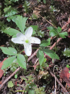
Oregon anemone

Count for the day:  28 hikers, 8 dogs
5.5 miles RT* with 500 ft elevation gain.  

*From trailhead to bridge and back is 5 miles but we did a double back at the beginning of the trail and added 1/2 mile.


Thursday, June 23, 2022

If this is Thursday it must be postcards, 561


Southern Pacific Railroad Depot, Columbus, New Mexico


This unused postcard was published by Warren D. Yell, of Las Cruces, New Mexico and has the number 93319-D printed at the lower left corner on the reverse.  There is a blurb at the upper left corner on the reverse:  “Southern Pacific Railroad Depot, Columbus, New Mexico.  Formerly El Paso and Southwestern, built in 1902.  Now The Columbus Historical Museume.  Designated a National Historic Site, 1975.  Columbus is where Pancho Villa raided the United States Territory March, 1916.”


The village of Columbus was established in 1891 and was located just across the Mexican border from Palomas, Chihuahua.  It was named after the explorer Christopher Columbus.  When the El Paso and Southwestern Railroad was built in 1902, the village was moved 3 miles where this station shown on the card was built.  The station has now been converted to a museum that is run by the Columbus Historical Society.


In March 1916 a group of 500 men led by the revolutionary leader Pancho Villa, Colonel Francisco Beltrán, Colonel Candelario Cervantes, General Nicolás Frenáandez, General Pablo López, and others attacked the town where a detachment of the 13th U.S. Calvary Regiment was garrisoned.  Part of the town was burned.  Seven or eight soldiers and 10 civilians were killed before Villa retreated back to Mexico.  President Woodrow Wilson sent 10,000 troops to Columbus to pursue Villa.  This action was known as the Pancho Villa Expedition or the Punitive Mexican Expedition.  However, Villa managed to escape and the expedition to find him was called off. 


During the years between 1926 and the 1990s the town changed and decayed as the army closed its camp, and the El Paso and Southwestern Railroad stopped service to Columbus.  In the 1990s a revitalization started that included building city and state parks, museums, and RV parks.  Columbus today has about 1,800 residents, a library, an elementary school, and the museum that occupies the old railroad depot.  About 90% of the students attending the school come from homes where Spanish is the main language.  The school works with parents and the community to promote a bicultural and bilingual environment. 


For additional information, see:


https://en.wikipedia.org/wiki/Columbus_New_Mexico

Thursday, June 16, 2022

If this is Thursday it must be postcards, 560


Bishop’s Palace, Galveston, Texas


Printed by Texas Guides this unused postcard has a photograph of the Bishop’s Palace, also known as Gresham’s Castle, located in Galveston, Texas.  No photographer is credited but there is a blurb at the upper left corner on the reverse:  “Elegant Victorian home completed in 1893 after seven years of hand-crafted construction.  Built by Col. & Mrs. Walter Gresham, designed by prominent Galveston architect Nicholas J. Clayton, estimated cost $250,000.  Purchased by Archdiocese of Galveston in 1923 for the late Bishop Christopher E. Byrne’s residence.”


It is hard to think of this 19,082 square feet mansion being a private residence.  Today it is valued at about $5.5 million.  Made of stone this castle withstood the huge Galvestone hurricane of 1900.  The Greshams’s welcomed hundreds of storm survivors into their home.  Walter Greshman was a lawyer and politician and lived here with his wife and nine children. 


The handcrafted interior of some of the rooms in the home is shown in the pictures on these other postcards below.


Main staircase


The unused H.K. Barnett card above shows a pictures of the ornate man staircase.  It is a focal point of the entrance hallway.  The card is dated 1977 with BP-2 101014 at the bottom of the center line on the reverse.  It took 3 years to build and 61 craftsmen worked on it.  The Coat of Arms for the State of Texas is displayed above the gas-burning fireplace.  Near the newel post is the Gresham’s hand-carved calling card basket.


  The dome


Dated 1977 and a H.K. Barnett unused postcard it has BP-5, 101017 at the bottom of the center line on the reverse.  This dome rises 55 ft from the main hallway. 


The mantel  

Also a H.K. Barnett unused postcard this one has BP-7, 151157 at the bottom center line on the reverse.  Santo Domingo mahogany was used for the carved mantel.  The mantel was awarded the first prize in the Philadelphia World’s Fair of 1883.  It is one of 14 fireplaces in the home.


The Roman Catholic Diocese of Galveston purchased the property in 1923 and it was the residence of Bishop Christopher E. Byrne and was situated across the street from the Sacred Heart Church.  When the diocese was moved from Galveston to Houston the house was opened to the public in 1963.  Proceeds from the tours help fund the University of Texas medical school’s Newman Center located in the basement of the building. 


 The dining room

The dining room is shown on this unused H.K. Barnett postcard with BP-9, 151159 at the bottom center line on the reverse.  Above the table is a French chandelier of gilded bronze and Baccarat crystal.  A massive, ornate sideboard is a prominent feature.  Floor-length windows flank the fireplace and serve as doorways into an adjacent Solarium.


The Bishop’s Palace was placed on the National Register of Historic Places in 1970.  Today the house is owned by the Galveston Historical Foundation.  Self-guided tours are available daily.  Restoration and preservation of the property is supported by a portion of the admission fee.


 For additional information, see:


https://en.wikipedia.org/wiki/Bishop%27s_Palace,_Galveston


Wednesday, June 15, 2022

Iron Goat, Lower Grade & Deception Falls, 2022


Sign at the Iron Goat Trailhead


Also at the trailhead is an old red caboose from the Great Northern Railway


The trip report said that the trail crews had cleaned up the lower grade trail, no snow there but still some snow on the upper grade trail in places.  An earlier report mentioned an avalanche that had blocked part of the lower trail.  It was unclear if the entire lower grade was open from the Iron Goat Interpretive trailhead to the Martin Creek trailhead.  As it turned out it was not.  It is 2.75 miles from Iron Goat to Martin Creek or a 5.5 mile RT.  About 1.5 miles in we hit an 8 ft high wall of snow and debris from the avalanche.  Bob told me to stay below while he climbed up the snow to see what the other side looked like. 


There was ice and snow under this pile of avalanche debris.  Climbing up to the top was not too difficult but the other side was extremely steep going down.  For us, what was needed was an ice axe to chop in some steps.   There are tunnels, railroad history, snow sheds, flowers, and views along this trail and two young men had been stopping here and there to see the sights, passing us a couple of times.  They had just gone over the snow and offered to help Bob get down the steeper back side, he thanked them and said no, he did not think that his wife (me) could manage it.  Also, it wasn’t known if we would have help coming back the other way.  That is a lot of snow and unless the crews dig through, it might be late summer before it is cleared off.  


Salmon berry


Trail sign


Coltsfoot


Fairy bells


Yellow Stream Violets


Concrete snow shed remains


Elderberry


Mertensia


Baneberry


Trillium


 The end result was a 3 mile RT and a drive down to Deception Falls.  We had planned to do that anyway, so just a shorter day than expected.   There is a loop trail just below the main falls that we tried this time.  The water was high and running fast and furious.  There are a couple of wooden bridges across the river.  We crossed one but could see no safe way to get to the second bridge because the water was covering part of the trail in that direction.  When we finished the short loop we crossed another stronger steel bridge closest to the falls and climbed up the steps to the observation platform. 


One of the wooden bridges that cross the river on the loop trail.  Notice the far end had been broken probably by snow load but is still okay to walk across.


Taking pictures of the falls in the misty spray


 Views of the river and the falls


Count for the day 2 hikers, no dogs on the Iron Goat Trail

                                8 hikers, 3 dogs on the Deception Falls trail